Illinois–Indiana–Kentucky Tri-State Area, Geographic confluence region at Illinois, Indiana, and Kentucky borders, United States.
The tri-state area spans approximately thirty counties across the borders of Illinois, Indiana, and Kentucky, with Evansville serving as its main economic center. The region contains several significant cities including Harrisburg, Henderson, and Vincennes, connected by river systems and road networks.
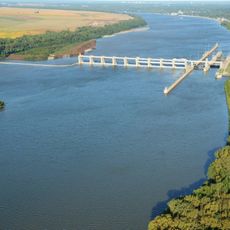
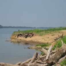
This border region was defined by the natural courses of the Ohio and Wabash Rivers, which have marked state boundaries since 1792. These waterways served as natural dividing lines during the early expansion and settlement of the American Midwest.
Local broadcast stations connect communities across the state boundaries, shaping a shared sense of regional belonging among residents. This media presence helps people identify with their tri-state neighbors despite living in different states.
The area is best explored by car, as towns spread across considerable distances and public transportation between states is limited. Evansville makes a good starting point from which to visit smaller cities and natural areas in the region.
The exact meeting point where the three state boundaries converge is located at the intersection of Gallatin, Posey, and Union Counties, making it an interesting geographic landmark for boundary enthusiasts. This spot can be visited with some planning and offers insight into how the region's borders were drawn.
The community of curious travelers
AroundUs brings together thousands of curated places, local tips, and hidden gems, enriched daily by 60,000 contributors worldwide.