Chest opened
+${chestReward.xp} XP
Explorer
NOUVEAU ×${chestReward.collectible.quantity}
tapez pour fermer
Chest locked

Open chests in the app

Around Us is built for your phone — chests unlock when you walk, explore and capture nearby places.

Enable Location

We need your location to show you interesting places around you

Discover nearby places

Find interesting locations and hidden gems around you

Precise directions

Get accurate directions and distances to places

Your location is never shared with other users. It's only used when you tap the location button.

Log in to your account

Start exploring — it's free

Trusted by 72,991 travelers worldwide

Continue with Google
Continue with Apple
or

We will send you a code to connect

By continuing, you accept our Terms and Conditions and our Privacy Policy

Check your inbox

We've sent a pincode in your inbox. Please enter the code below.

Land O'Lakes State Forest
Discussion Reviews Photo
1.5k Popularity

Land O'Lakes State Forest, State forest across Cass and Aitkin Counties, Minnesota.

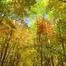
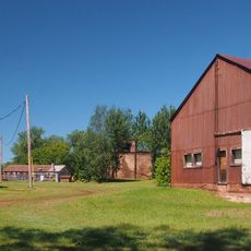
Land O'Lakes State Forest is a wooded area spanning over 51,000 acres across multiple counties, containing lakes, wetlands, and stands of aspen, paper birch, and pine. The terrain alternates between open water, boggy ground, and dense forest patches.

Heavy logging occurred between 1800 and 1890, when operations removed vast quantities of Eastern White and Red Pine from the area, particularly through the Simpson Logging Company. The forest recovered through natural regrowth and eventually came under state management.

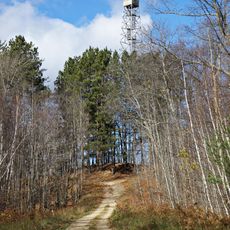
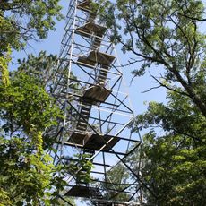
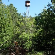
The forest serves as a gathering place for outdoor recreation, where locals and visitors experience seasonal rhythms through activities like fishing, hunting, and hiking. The woodland landscape shapes how people in the region connect with nature throughout the year.

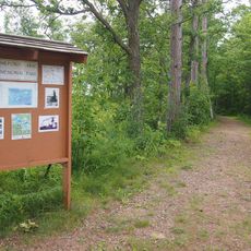
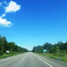
Visitors can enjoy about 14 miles (22 kilometers) of cross-country skiing paths in winter and around 27 miles (43 kilometers) of marked trails for off-road vehicles year-round. Bringing water and a map is wise, as the terrain is extensive and can feel disorienting.

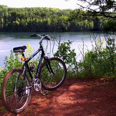
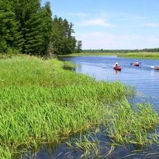
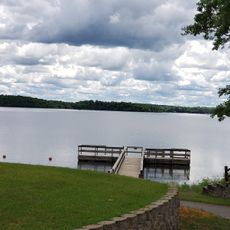
The forest contains over 50 lakes of various sizes, with Washburn Lake as the largest at around 1,590 acres (640 hectares), offering boating, paddling, and swimming opportunities. This abundance of water makes the area a focal point for water-based recreation in the region.

The community of curious travelers

AroundUs brings together thousands of curated places, local tips, and hidden gems, enriched daily by 60,000 contributors worldwide.

Start exploring
Location
Location
Location
GPS coordinates
46.93410,-93.94410
Latest update
December 14, 2025 14:41
Around this place
Milford Mine
United States of America

Milford Mine

44.5 km
Cuyuna Country State Recreation Area
United States of America

Cuyuna Country State Recreation Area

49.6 km
Minnesota State Sanatorium for Consumptives
United States of America

Minnesota State Sanatorium for Consumptives

50 km
United States of America

The Big Fish

52.5 km
Forest History Center
United States of America

Forest History Center

43.7 km
Schoolcraft State Park
United States of America

Schoolcraft State Park

34.2 km
Bowstring State Forest
United States of America

Bowstring State Forest

55.1 km
Aitkin County Courthouse and Jail
United States of America

Aitkin County Courthouse and Jail

48.1 km
Wilford H. Fawcett House
United States of America

Wilford H. Fawcett House

43.3 km
Deerwood Auditorium
United States of America

Deerwood Auditorium

51.2 km
Patrick Casey House
United States of America

Patrick Casey House

48.9 km
Cuyuna Iron Range Municipally-Owned Elevated Metal Water Tanks
United States of America

Cuyuna Iron Range Municipally-Owned Elevated Metal Water Tanks

50.1 km
Aitkin Carnegie Library
United States of America

Aitkin Carnegie Library

48.1 km
Cole Memorial Building
United States of America

Cole Memorial Building

46.4 km
Coleraine Methodist Episcopal Church
United States of America

Coleraine Methodist Episcopal Church

55.4 km
Church of the Good Shepherd
United States of America

Church of the Good Shepherd

55.4 km
Potter/Casey Company Building
United States of America

Potter/Casey Company Building

48.2 km
Ironton Sintering Plant Complex
United States of America

Ironton Sintering Plant Complex

49.6 km
Remer State Forest
United States of America

Remer State Forest

23.9 km
Pequot Fire Lookout Tower
United States of America

Pequot Fire Lookout Tower

45.6 km
Rialto Theatre
United States of America

Rialto Theatre

48.1 km
Tioga Pit Beach
United States of America

Tioga Pit Beach

40.9 km
Draper Lookout Tower
United States of America

Draper Lookout Tower

1.8 km
Leisure Suites
United States of America

Leisure Suites

43.6 km
Quadna Fire Tower
United States of America

Quadna Fire Tower

27.3 km
Sandy Lake Lookout Tower
United States of America

Sandy Lake Lookout Tower

56.1 km
Emily Lookout Tower
United States of America

Emily Lookout Tower

28.3 km
Ball Bluff Lookout Tower
United States of America

Ball Bluff Lookout Tower

53.2 km
Show the full map
Reviews
Share your experience

No review yet

Discussions
Start a discussion...

No discussion yet

« Land O'Lakes State Forest - State forest across Cass and Aitkin Counties, Minnesota » is provided by Around Us (aroundus.com). Images and texts are derived from Wikimedia project under a Creative Commons license. You are allowed to copy, distribute, and modify copies of this page, under the conditions set by the license, as long as this note is clearly visible.

Discover hidden gems everywhere you go!

From secret cafés to breathtaking viewpoints, skip the crowded tourist spots and find places that match your style. Our app makes it easy with voice search, smart filtering, route optimization, and insider tips from travelers worldwide. Download now for the complete mobile experience.

Around Us App Screenshot

A unique approach to discovering new places

Le Figaro

All the places worth exploring

France Info

A tailor-made excursion in just a few clicks

20 Minutes

Around Us
Travel Guide & Maps
Download

Send to your phone

QR Code
1

Open the camera app on your mobile.

2

Point at the QR code with your camera. A notification will appear.

3

Tap the notification to open the link.