Monterey Historic District

Log in to your account

AroundUs is a community-driven map of interesting places, built by curious explorers like you. It grows with every review, story, and photo you share.
Connect to save your favorite spots, contribute locations, and create personalized routes.
Continue with Google
Continue with Apple
Continue with X
Continue with Facebook
Continue with email
By continuing, you accept our Terms and Conditions and our Privacy Policy
Create an account
Add to collection
Map
Suggest a change
Share

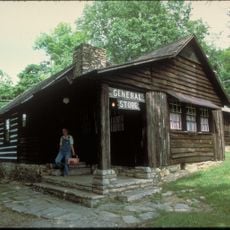
Monterey Historic District, Historic district in Franklin County, Pennsylvania.

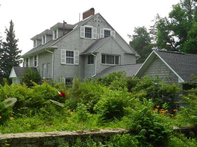
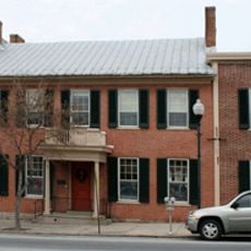
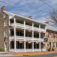
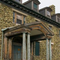
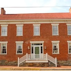
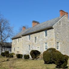
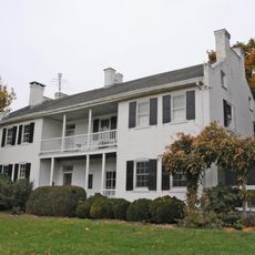
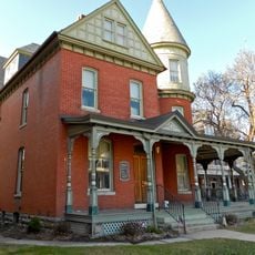
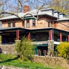
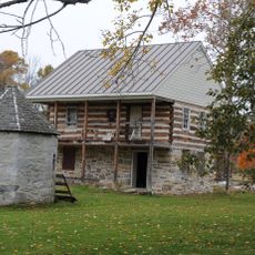
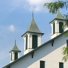
Monterey Historic District is a neighborhood in Franklin County featuring buildings constructed between 1875 and 1899, which display Georgian architectural style with symmetrical designs and brick facades. The structures remain well-preserved and show construction techniques typical of late 19th century Pennsylvania.

The district emerged during a period of growth in late 19th century Pennsylvania, when agricultural expansion drove local development. Recognition came in 1976 when it was added to the National Register of Historic Places, acknowledging its importance to understanding this growth period.

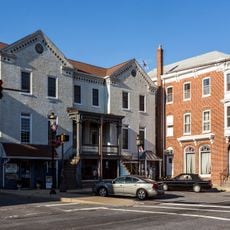
The homes and businesses in this district reflect how people lived in late 19th century Pennsylvania, with architectural choices that reveal local building traditions and community values. Walking through, you notice how these structures shaped daily life and social patterns of that era.

You can walk through the streets and observe the facades and details of the historic buildings, many retaining their original architectural features. Tours and educational programs are available to learn more about specific structures and their role in local history.

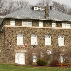
Many buildings were designed by unidentified architects, offering insight into the practical construction methods of an entire region. These structures show how ordinary builders and craftspeople shaped community development rather than just prominent architectural figures.

Location: Pennsylvania

Architectural style: Georgian architecture

GPS coordinates: 39.73610,-77.46920

Latest update: December 14, 2025 18:02

Photos
Around this place
Catoctin Mountain
United States of America

Catoctin Mountain

9.8 km
National Shrine of St. Elizabeth Ann Seton
United States of America

National Shrine of St. Elizabeth Ann Seton

12.6 km
Quirauk Mountain
United States of America

Quirauk Mountain

5.8 km
Camp Misty Mount Historic District
United States of America

Camp Misty Mount Historic District

10.6 km
Alexander Hamilton House
United States of America

Alexander Hamilton House

9.4 km
Camp Greentop Historic District
United States of America

Camp Greentop Historic District

10.3 km
Fairfield Inn
United States of America

Fairfield Inn

10.4 km
Roddy Road Covered Bridge
United States of America

Roddy Road Covered Bridge

12.4 km
Victor Cullen Center, Old Administration Building
United States of America

Victor Cullen Center, Old Administration Building

3 km
Jacks Mountain Covered Bridge
United States of America

Jacks Mountain Covered Bridge

7.8 km
Welty's Mill Bridge
United States of America

Welty's Mill Bridge

8.8 km
Borough Hall of the Borough of Waynesboro
United States of America

Borough Hall of the Borough of Waynesboro

9.4 km
Fairfield Historic District
United States of America

Fairfield Historic District

10.7 km
Royer-Nicodemus House and Farm
United States of America

Royer-Nicodemus House and Farm

8 km
Emmitsburg Historic District
United States of America

Emmitsburg Historic District

12.6 km
Victor Cullen School Power House
United States of America

Victor Cullen School Power House

2.5 km
Jeremiah Burns Farm
United States of America

Jeremiah Burns Farm

6.2 km
Joseph J. Oller House
United States of America

Joseph J. Oller House

9.9 km
Tipahato
United States of America

Tipahato

4 km
Handycraft Farmstead
United States of America

Handycraft Farmstead

6.4 km
Renfrew Museum and Park
United States of America

Renfrew Museum and Park

7.8 km
Catoctin Mountain Park Visitor Center
United States of America

Catoctin Mountain Park Visitor Center

11.5 km
Mont Alto State Park
United States of America

Mont Alto State Park

12.4 km
Chimney Rock
United States of America

Chimney Rock

12.3 km
South Beach
United States of America

South Beach

12.1 km
Mt. Moriah Lutheran Church
United States of America

Mt. Moriah Lutheran Church

10.1 km
Catoctin Mountain Park Resource Management Office
United States of America

Catoctin Mountain Park Resource Management Office

10.2 km
Raven Rock Shelter
United States of America

Raven Rock Shelter

8.7 km
Show the full map
Reviews

Visited this place? Tap the stars to rate it and share your experience / photos with the community! Try now! You can cancel it anytime.

« Monterey Historic District - Historic district in Franklin County, Pennsylvania » is provided by Around Us (aroundus.com). Images and texts are derived from Wikimedia project under a Creative Commons license. You are allowed to copy, distribute, and modify copies of this page, under the conditions set by the license, as long as this note is clearly visible.

Discover hidden gems everywhere you go!

From secret cafés to breathtaking viewpoints, skip the crowded tourist spots and find places that match your style. Our app makes it easy with voice search, smart filtering, route optimization, and insider tips from travelers worldwide. Download now for the complete mobile experience.

Around Us App Screenshot

A unique approach to discovering new places

Le Figaro

All the places worth exploring

France Info

A tailor-made excursion in just a few clicks

20 Minutes