Chest opened
+${chestReward.xp} XP
Explorer
NOUVEAU ×${chestReward.collectible.quantity}
tapez pour fermer
Chest locked

Open chests in the app

Around Us is built for your phone — chests unlock when you walk, explore and capture nearby places.

Enable Location

We need your location to show you interesting places around you

Discover nearby places

Find interesting locations and hidden gems around you

Precise directions

Get accurate directions and distances to places

Your location is never shared with other users. It's only used when you tap the location button.

Negro Mountain

Log in to your account

Start exploring — it's free

Trusted by 72,961 travelers worldwide

Continue with Google
Continue with Apple
or

We will send you a code to connect

By continuing, you accept our Terms and Conditions and our Privacy Policy

Check your inbox

We've sent a pincode in your inbox. Please enter the code below.

Negro Mountain
Discussion Reviews 1 Photos
23.2k Popularity

Negro Mountain, Mountain ridge in southwestern Pennsylvania, United States

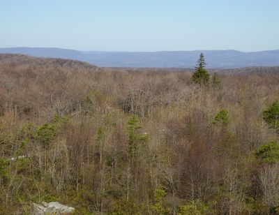
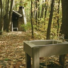
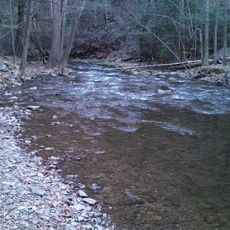
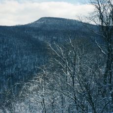
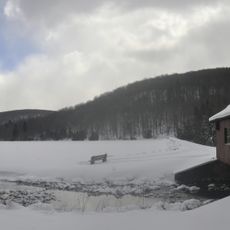
Negro Mountain is a ridge in southwestern Pennsylvania's Allegheny range that stretches across the landscape with its highest point at Mount Davis. The terrain features multiple trails through forested areas and open ridgetop sections with changing views along the way.

The mountain received its name in 1756 following an event involving a free African American named Nemisis during a frontier expedition. This naming origin shaped how the place became known in the region.

The Maryland Department of Transportation removed directional signs on Negro Mountain in 2019 following discussions about racial sensitivity and naming conventions.

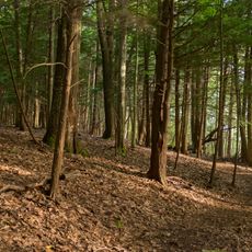
The Mount Davis Natural Area provides access with multiple marked trails through the forested terrain at varying difficulty levels. Visitors should prepare for changing weather conditions, especially during colder months when the ground may be wet or frozen.

Pennsylvania State Representative Rosita Youngblood proposed renaming the mountain to Black Hero Mountain, but the suggestion faced opposition from local authorities.

The community of curious travelers

AroundUs brings together thousands of curated places, local tips, and hidden gems, enriched daily by 60,000 contributors worldwide.

Start exploring
Location
GPS coordinates
39.78611,-79.17500
Latest update
December 20, 2025 14:40
Around this place
Mount Davis
United States of America

Mount Davis

151 m
Ohiopyle State Park
United States of America

Ohiopyle State Park

23 km
Laurel Hill State Park
United States of America

Laurel Hill State Park

26.3 km
Laurel Ridge State Park
United States of America

Laurel Ridge State Park

25.1 km
Pennsylvania Railroad 3750
United States of America

Pennsylvania Railroad 3750

21.9 km
Casselman Bridge
United States of America

Casselman Bridge

10.3 km
Salisbury Viaduct
United States of America

Salisbury Viaduct

12.3 km
Big Run State Park
United States of America

Big Run State Park

27 km
Somerset County Courthouse
United States of America

Somerset County Courthouse

26.2 km
Wills Creek Bollman Bridge
United States of America

Wills Creek Bollman Bridge

15.8 km
Petersburg Tollhouse
United States of America

Petersburg Tollhouse

14.4 km
Sugarloaf Knob
United States of America

Sugarloaf Knob

25.3 km
Lower Humbert Covered Bridge
United States of America

Lower Humbert Covered Bridge

14 km
Beechdale Bridge
United States of America

Beechdale Bridge

16 km
Barronvale Bridge
United States of America

Barronvale Bridge

20.3 km
Uptown Somerset Historic District
United States of America

Uptown Somerset Historic District

26.2 km
King's Bridge
United States of America

King's Bridge

18.8 km
Fuller-Baker Log House
United States of America

Fuller-Baker Log House

10.1 km
Stanton's Mill
United States of America

Stanton's Mill

10.5 km
Second National Bank of Meyersdale
United States of America

Second National Bank of Meyersdale

13.1 km
Penrose Wolf Building
United States of America

Penrose Wolf Building

14.3 km
New Germany State Park
United States of America

New Germany State Park

17.6 km
Mercy Chapel at Mill Run
United States of America

Mercy Chapel at Mill Run

18 km
Kaese Mill
United States of America

Kaese Mill

18.3 km
James Drane House
United States of America

James Drane House

21.1 km
Laurel Hill RDA
United States of America

Laurel Hill RDA

24.4 km
Deer Valley Kissing Bridge
United States of America

Deer Valley Kissing Bridge

2.6 km
Youghiogheny River Lake
United States of America

Youghiogheny River Lake

16.7 km
Show the full map
Reviews
Share your experience

No review yet

Discussions
Start a discussion...

No discussion yet

« Negro Mountain - Mountain ridge in southwestern Pennsylvania, United States » is provided by Around Us (aroundus.com). Images and texts are derived from Wikimedia project under a Creative Commons license. You are allowed to copy, distribute, and modify copies of this page, under the conditions set by the license, as long as this note is clearly visible.

Discover hidden gems everywhere you go!

From secret cafés to breathtaking viewpoints, skip the crowded tourist spots and find places that match your style. Our app makes it easy with voice search, smart filtering, route optimization, and insider tips from travelers worldwide. Download now for the complete mobile experience.

Around Us App Screenshot

A unique approach to discovering new places

Le Figaro

All the places worth exploring

France Info

A tailor-made excursion in just a few clicks

20 Minutes

Around Us
Travel Guide & Maps
Download

Send to your phone

QR Code
1

Open the camera app on your mobile.

2

Point at the QR code with your camera. A notification will appear.

3

Tap the notification to open the link.