Chest opened
+${chestReward.xp} XP
Explorer
NOUVEAU ×${chestReward.collectible.quantity}
tapez pour fermer
Chest locked

Open chests in the app

Around Us is built for your phone — chests unlock when you walk, explore and capture nearby places.

Enable Location

We need your location to show you interesting places around you

Discover nearby places

Find interesting locations and hidden gems around you

Precise directions

Get accurate directions and distances to places

Your location is never shared with other users. It's only used when you tap the location button.

Log in to your account

Start exploring — it's free

Trusted by 72,939 travelers worldwide

Continue with Google
Continue with Apple
or

We will send you a code to connect

By continuing, you accept our Terms and Conditions and our Privacy Policy

Check your inbox

We've sent a pincode in your inbox. Please enter the code below.

Orange Grove Flour Mill
Discussion Reviews Photo
1.6k Popularity

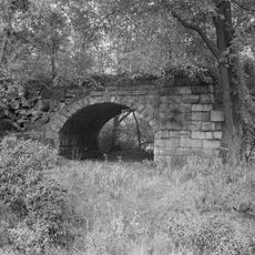
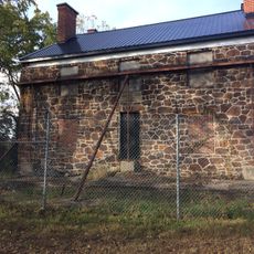
Orange Grove Flour Mill, Industrial flour mill ruins in Patapsco Valley State Park, Maryland

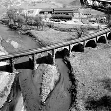
The Orange Grove Flour Mill was a six-story structure in Patapsco Valley State Park, standing between CSX Railroad tracks and the Patapsco River. The mill operated from 1856 to 1905, processing grain into flour for distribution across the region.

The mill was established in 1856 and became one of the region's major industrial operations under the C.A. Gambrill Manufacturing Company. Production ceased in 1905 as new technologies and changing market demands shifted the flour industry elsewhere.

The mill was central to life in this river valley, with workers crossing a swinging bridge daily from their homes in Howard County. The brand name Patapsco Superlative Patent flour became known throughout the region, reflecting the pride locals took in their workplace.

Visitors can reach the ruins by walking about 1.3 miles from the Lost Lake entrance or about 1 mile from Ilchester Road along the Grist Mill Trail. The path follows the river, so comfortable walking shoes are recommended and the area can be muddy in wet weather.

The mill's name comes from osage-orange trees that once grew near the site, not from citrus groves which never existed in this region. These trees are native to the American South and were planted locally for their fruit and hardy wood.

The community of curious travelers

AroundUs brings together thousands of curated places, local tips, and hidden gems, enriched daily by 60,000 contributors worldwide.

Start exploring
Location
GPS coordinates
39.24120,-76.74970
Latest update
December 14, 2025 14:24
Around this place
Thomas Viaduct
United States of America

Thomas Viaduct

3.8 km
Belmont Estate
United States of America

Belmont Estate

2.8 km
Ellicott City Historic District
United States of America

Ellicott City Historic District

5 km
Relay, Maryland
United States of America

Relay, Maryland

3.9 km
Patterson Viaduct
United States of America

Patterson Viaduct

1.6 km
Ellicott City Station
United States of America

Ellicott City Station

4.9 km
Elkridge Furnace Complex
United States of America

Elkridge Furnace Complex

5.1 km
Hilton
United States of America

Hilton

1.9 km
Arbutus Oak
United States of America

Arbutus Oak

5.9 km
Troy
United States of America

Troy

5.2 km
Center for Art, Design and Visual Culture
United States of America

Center for Art, Design and Visual Culture

3.5 km
UMBC Stadium
United States of America

UMBC Stadium

3.8 km
Ellicott's Mills Historic District
United States of America

Ellicott's Mills Historic District

4.7 km
Lilburn
United States of America

Lilburn

4.7 km
Hockley Forge and Mill
United States of America

Hockley Forge and Mill

3.9 km
Earl and Darielle Linehan Concert Hall
United States of America

Earl and Darielle Linehan Concert Hall

3.4 km
Howard County Courthouse
United States of America

Howard County Courthouse

5.2 km
Old Catonsville Historic District
United States of America

Old Catonsville Historic District

3.5 km
Summit
United States of America

Summit

3.1 km
Castle Thunder
United States of America

Castle Thunder

3.4 km
Mount Gilboa Chapel
United States of America

Mount Gilboa Chapel

4.5 km
Curtis-Shipley Farmstead
United States of America

Curtis-Shipley Farmstead

5.3 km
Bethesda
United States of America

Bethesda

980 m
Winters Lane Historic District
United States of America

Winters Lane Historic District

4.3 km
Central Catonsville and Summit Park Historic District
United States of America

Central Catonsville and Summit Park Historic District

3 km
The Wilderness
United States of America

The Wilderness

2.4 km
St. Luke's African Methodist Episcopal Church
United States of America

St. Luke's African Methodist Episcopal Church

5.4 km
Howard County Circuit Courthouse
United States of America

Howard County Circuit Courthouse

5.2 km
Show the full map
Reviews
Share your experience

No review yet

Discussions
Start a discussion...

No discussion yet

« Orange Grove Flour Mill - Industrial flour mill ruins in Patapsco Valley State Park, Maryland » is provided by Around Us (aroundus.com). Images and texts are derived from Wikimedia project under a Creative Commons license. You are allowed to copy, distribute, and modify copies of this page, under the conditions set by the license, as long as this note is clearly visible.

Discover hidden gems everywhere you go!

From secret cafés to breathtaking viewpoints, skip the crowded tourist spots and find places that match your style. Our app makes it easy with voice search, smart filtering, route optimization, and insider tips from travelers worldwide. Download now for the complete mobile experience.

Around Us App Screenshot

A unique approach to discovering new places

Le Figaro

All the places worth exploring

France Info

A tailor-made excursion in just a few clicks

20 Minutes

Around Us
Travel Guide & Maps
Download

Send to your phone

QR Code
1

Open the camera app on your mobile.

2

Point at the QR code with your camera. A notification will appear.

3

Tap the notification to open the link.