Enable Location

We need your location to show you interesting places around you

Discover nearby places

Find interesting locations and hidden gems around you

Precise directions

Get accurate directions and distances to places

Your location is never shared with other users. It's only used when you tap the location button.

Log in to your account

Start exploring — it's free

Trusted by 67,595 travelers worldwide

Continue with Google
Continue with Apple
or

We will send you a code to connect

By continuing, you accept our Terms and Conditions and our Privacy Policy

Check your inbox

We've sent a pincode in your inbox. Please enter the code below.

Pequest Fill
Discussion Reviews Photo
1.4k Popularity

Pequest Fill, Railroad embankment in Huntsville, New Jersey

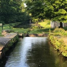
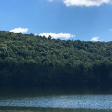
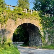
Pequest Fill is a massive railroad embankment stretching across the Pequest Valley, rising about 105 feet (32 meters) above the river level. The structure incorporates underground tunnels for a state highway and river passage, making it function as both barrier and connector rather than a simple raised track.

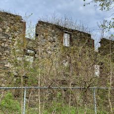
The Delaware, Lackawanna and Western Railroad completed this massive earthwork in 1911 using material sourced from nearby farmland. The project represented an important engineering solution for railroad expansion during the early industrial era.

The site stands as a quiet testament to early 20th-century engineering that shaped how people moved through the valley. Walking along or near it shows how the railroad became woven into the natural landscape rather than merely crossing over it.

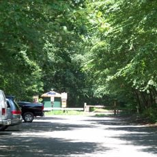
The best views come from nearby roads and walking paths that allow you to see the full scale of the embankment. The site is accessible but sits in a rural area, so plan accordingly for getting there.

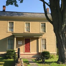
Local schoolchildren witnessed the burial of the Huntsville Schoolhouse during construction, as tons of rock and earth covered the old building. This event captures how dramatically the railroad project transformed the area.

The community of curious travelers

AroundUs brings together thousands of curated places, local tips, and hidden gems, enriched daily by 60,000 contributors worldwide.

Start exploring
Location
GPS coordinates
40.97900,-74.76300
Latest update
December 14, 2025 16:43
Around this place
Morris Canal
United States of America

Morris Canal

7.7 km
Waterloo Village
United States of America

Waterloo Village

7.1 km
Swartswood State Park
United States of America

Swartswood State Park

11.5 km
Hopatcong State Park
United States of America

Hopatcong State Park

10.9 km
Rutherfurd Hall
United States of America

Rutherfurd Hall

8.3 km
Allamuchy Mountain State Park
United States of America

Allamuchy Mountain State Park

6.6 km
Lake Musconetcong
United States of America

Lake Musconetcong

9.9 km
Kittatinny Valley State Park
United States of America

Kittatinny Valley State Park

4.5 km
United States of America

St. Paul's Abbey

6.1 km
Christ Church, Newton
United States of America

Christ Church, Newton

8.7 km
Sussex County Courthouse
United States of America

Sussex County Courthouse

8.9 km
Henry W. Merriam House
United States of America

Henry W. Merriam House

8.2 km
Allamuchy Mountain
United States of America

Allamuchy Mountain

4.9 km
Plaster Mill
United States of America

Plaster Mill

9.7 km
Allamuchy Freight House
United States of America

Allamuchy Freight House

7.1 km
First Presbyterian Church
United States of America

First Presbyterian Church

8.8 km
Lubber Run Fill
United States of America

Lubber Run Fill

6.7 km
Casper and Abraham Shafer Grist Mill Complex
United States of America

Casper and Abraham Shafer Grist Mill Complex

11.2 km
Stanhope United Methodist Church
United States of America

Stanhope United Methodist Church

9.9 km
Johnsonburg Historic District
United States of America

Johnsonburg Historic District

9.7 km
Hole in the Wall Stone Arch Bridge
United States of America

Hole in the Wall Stone Arch Bridge

1.9 km
Saxton Falls Dam
United States of America

Saxton Falls Dam

10.5 km
Waterloo Village United Methodist Church
United States of America

Waterloo Village United Methodist Church

7.2 km
Palace Theatre
United States of America

Palace Theatre

10 km
Hill Memorial
United States of America

Hill Memorial

8.7 km
Brookland Forge
United States of America

Brookland Forge

10.8 km
Lake Hopatcong Historical Museum
United States of America

Lake Hopatcong Historical Museum

10.8 km
Rutan Log Cabin
United States of America

Rutan Log Cabin

7 km
Show the full map
Reviews
Share your experience

No review yet

Discussions
Start a discussion...

No discussion yet

« Pequest Fill - Railroad embankment in Huntsville, New Jersey » is provided by Around Us (aroundus.com). Images and texts are derived from Wikimedia project under a Creative Commons license. You are allowed to copy, distribute, and modify copies of this page, under the conditions set by the license, as long as this note is clearly visible.

Discover hidden gems everywhere you go!

From secret cafés to breathtaking viewpoints, skip the crowded tourist spots and find places that match your style. Our app makes it easy with voice search, smart filtering, route optimization, and insider tips from travelers worldwide. Download now for the complete mobile experience.

Around Us App Screenshot

A unique approach to discovering new places

Le Figaro

All the places worth exploring

France Info

A tailor-made excursion in just a few clicks

20 Minutes

Around Us
Travel Guide & Maps
Download

Send to your phone

QR Code
1

Open the camera app on your mobile.

2

Point at the QR code with your camera. A notification will appear.

3

Tap the notification to open the link.