Chest opened
+${chestReward.xp} XP
Explorer
NOUVEAU ×${chestReward.collectible.quantity}
tapez pour fermer
Chest locked

Open chests in the app

Around Us is built for your phone — chests unlock when you walk, explore and capture nearby places.

Enable Location

We need your location to show you interesting places around you

Discover nearby places

Find interesting locations and hidden gems around you

Precise directions

Get accurate directions and distances to places

Your location is never shared with other users. It's only used when you tap the location button.

Log in to your account

Start exploring — it's free

Trusted by 72,888 travelers worldwide

Continue with Google
Continue with Apple
or

We will send you a code to connect

By continuing, you accept our Terms and Conditions and our Privacy Policy

Check your inbox

We've sent a pincode in your inbox. Please enter the code below.

Pigtown
Discussion Reviews Photo
4.8k Popularity

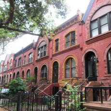
Pigtown, Historical residential district in Brooklyn, United States

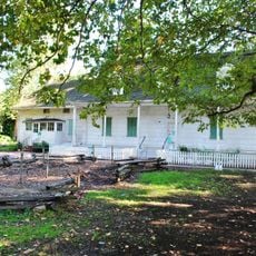
Pigtown was a residential district in Brooklyn that developed around pig farms supplying meat to the city. The neighborhood stretched across several blocks where farming activities mixed with residential buildings and the lives of working families.

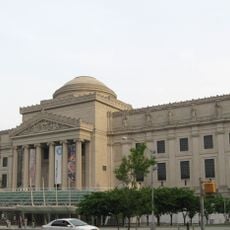
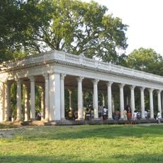
The area grew in the 1800s as a place where farmers raised pigs and shaped the neighborhood through their work. After 1912, this era ended when demolition began for the construction of a major baseball stadium.

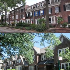
Immigrants from Europe found work and community here, creating tight-knit neighborhoods where families gathered and built social networks. This close sense of belonging shaped how people lived and celebrated together in their daily lives.

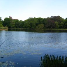
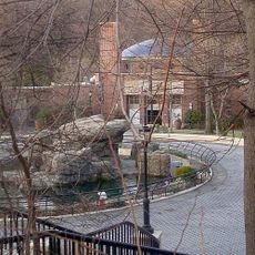
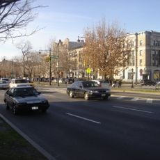
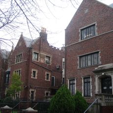
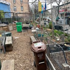
The neighborhood sits south of Prospect Park and connects easily to the rest of Brooklyn through local transportation. Keep in mind that little of the original structures remains today, since modern buildings have replaced what once stood here.

The district remains tied to early baseball history through the stadium that replaced the original neighborhood. This connection between stadium development and urban transformation marks a pivotal shift in how Brooklyn changed during the early 1900s.

The community of curious travelers

AroundUs brings together thousands of curated places, local tips, and hidden gems, enriched daily by 60,000 contributors worldwide.

Start exploring
Location
GPS coordinates
40.66000,-73.95000
Latest update
December 10, 2025 20:03
Around this place
Brooklyn Museum
United States of America

Brooklyn Museum

1.7 km
Prospect Park
United States of America

Prospect Park

1.7 km
Erasmus Hall High School
United States of America

Erasmus Hall High School

1.3 km
Brooklyn Botanic Garden
United States of America

Brooklyn Botanic Garden

1.5 km
Kings Theatre
United States of America

Kings Theatre

1.7 km
Prospect Park Zoo
United States of America

Prospect Park Zoo

1.4 km
Eastern Parkway
United States of America

Eastern Parkway

1.5 km
Brooklyn Children's Museum
United States of America

Brooklyn Children's Museum

1.7 km
Library of Agudas Chassidei Chabad
United States of America

Library of Agudas Chassidei Chabad

1.2 km
Flatbush Dutch Reformed Church Complex
United States of America

Flatbush Dutch Reformed Church Complex

1.4 km
Elizabeth A. Sackler Center for Feminist Art
United States of America

Elizabeth A. Sackler Center for Feminist Art

1.7 km
Prospect Park Boathouse
United States of America

Prospect Park Boathouse

1.3 km
Jewish Children's Museum
United States of America

Jewish Children's Museum

1.2 km
Kol Israel Synagogue
United States of America

Kol Israel Synagogue

1.6 km
Lefferts Manor Historic District
United States of America

Lefferts Manor Historic District

684 m
Albemarle-Kenmore Terraces Historic District
United States of America

Albemarle-Kenmore Terraces Historic District

1.5 km
Flatbush Town Hall
United States of America

Flatbush Town Hall

1.4 km
Grecian Shelter
United States of America

Grecian Shelter

1.6 km
Park Place Historic District
United States of America

Park Place Historic District

1.6 km
Congregation Beth Israel
United States of America

Congregation Beth Israel

1.1 km
Knickerbocker Field Club
United States of America

Knickerbocker Field Club

1.8 km
Alfred T. White Memorial
United States of America

Alfred T. White Memorial

1.4 km
Congregational Church of the Evangel
United States of America

Congregational Church of the Evangel

657 m
Dongan Oak Monument
United States of America

Dongan Oak Monument

1.6 km
Lefferts Historic House
United States of America

Lefferts Historic House

1.3 km
Loew's Kameo Theatre
United States of America

Loew's Kameo Theatre

1.1 km
Q Gardens
United States of America

Q Gardens

1.6 km
Flatbush Trees
United States of America

Flatbush Trees

1.1 km
Show the full map
Reviews
Share your experience

No review yet

Discussions
Start a discussion...

No discussion yet

« Pigtown - Historical residential district in Brooklyn, United States » is provided by Around Us (aroundus.com). Images and texts are derived from Wikimedia project under a Creative Commons license. You are allowed to copy, distribute, and modify copies of this page, under the conditions set by the license, as long as this note is clearly visible.

Discover hidden gems everywhere you go!

From secret cafés to breathtaking viewpoints, skip the crowded tourist spots and find places that match your style. Our app makes it easy with voice search, smart filtering, route optimization, and insider tips from travelers worldwide. Download now for the complete mobile experience.

Around Us App Screenshot

A unique approach to discovering new places

Le Figaro

All the places worth exploring

France Info

A tailor-made excursion in just a few clicks

20 Minutes

Around Us
Travel Guide & Maps
Download

Send to your phone

QR Code
1

Open the camera app on your mobile.

2

Point at the QR code with your camera. A notification will appear.

3

Tap the notification to open the link.