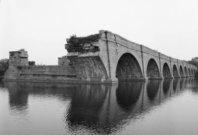
Schoharie Crossing State Historic Site, Erie Canal heritage site in Fort Hunter, New York.
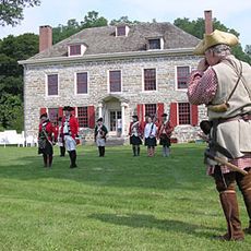
Schoharie Crossing State Historic Site is a canal heritage area in Fort Hunter, New York, where structures from three different phases of Erie Canal construction stand along the Mohawk River. The most visible feature is the remains of a stone aqueduct that once carried canal boats across the Schoharie Creek.
The first Erie Canal opened in 1825 and used a wooden aqueduct at this crossing to carry boats over the Schoharie Creek. The canal was later widened twice, in the mid-1800s and again in the early 1900s, and each phase left behind structures that can still be seen on the grounds.
The name Tiononderoge comes from the Mohawk people who settled where the Schoharie Creek meets the Mohawk River, and that meeting point is still visible from the grounds today. The site sits at a natural crossing that made it important long before the canal was ever built.
The site is fully open from May through October, when the visitor center offers exhibits and guided walks, though the grounds can be visited year-round. Wear comfortable shoes, as the paths between the ruins cover uneven terrain and can be muddy after rain.
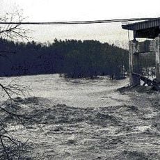
When Hurricane Irene struck in 2011, floodwaters stripped away layers of soil and exposed buried remains of the original Fort Hunter, which had not been seen for centuries. Archaeologists who came to the site afterward found objects and foundations that added a new layer to what was known about early settlement here.
The community of curious travelers
AroundUs brings together thousands of curated places, local tips, and hidden gems, enriched daily by 60,000 contributors worldwide.