Chest opened
+${chestReward.xp} XP
Explorer
NOUVEAU ×${chestReward.collectible.quantity}
tapez pour fermer

See the monuments around you in AR Open chests in the app

Around Us is built for your phone — point your camera at the streets and discover the monuments and places around you in augmented reality. Around Us is built for your phone — chests unlock when you walk, explore and capture nearby places.

Enable Location

We need your location to show you interesting places around you

Discover nearby places

Find interesting locations and hidden gems around you

Precise directions

Get accurate directions and distances to places

Your location is never shared with other users. It's only used when you tap the location button.

Sparta Rock House

Log in to your account

Start exploring — it's free

Trusted by 86,871 travelers worldwide

Continue with Google
Continue with Apple
or

We will send you a code to connect

By continuing, you accept our Terms and Conditions and our Privacy Policy

Check your inbox

We've sent a pincode in your inbox. Please enter the code below.

Discussion Reviews 1 Photos
3k Popularity

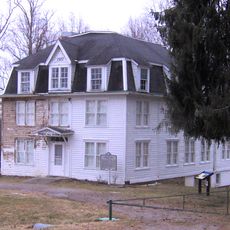
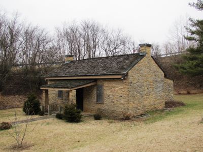
Sparta Rock House, Historical tollhouse in Sparta, United States.

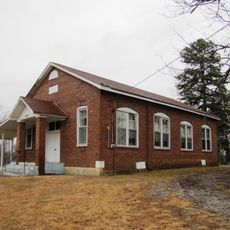
Sparta Rock House is a one-story structure built from local sandstone with three bays, positioned along U.S. Highway 70 in White County. The simple construction reflects the typical design of early 19th-century buildings built to serve travelers on long-distance routes.

Barlow Fiske built this structure between 1835 and 1839 to serve as a toll station and rest stop for travelers on the route connecting Knoxville and Nashville. It emerged during the early period of organized American overland transportation.

The name reflects the local sandstone used in its walls, and the space served as a gathering point where travelers from different regions met and purchased supplies. It was a practical rest stop that became embedded in the community's daily rhythms.

The site is easily accessible from the roadside and open to visitors during daytime hours when conditions permit. It helps to check local information beforehand about current access and any seasonal variations in availability.

The building did not simply fade away after its toll-taking days ended but was repurposed as a school from 1880 to 1921 to serve local children. This adaptation demonstrates how rural communities found new roles for buildings as their original purposes became obsolete.

The community of curious travelers

AroundUs brings together thousands of curated places, local tips, and hidden gems, enriched daily by 60,000 contributors worldwide.
Start exploring
Location
GPS coordinates
35.92028,-85.40361
Latest update
September 12, 2026 08:41
Around this place
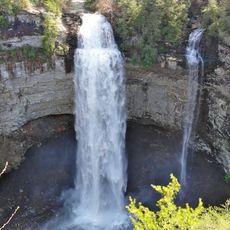
Fall Creek Falls State Park
United States of America

Fall Creek Falls State Park

18.1 mi
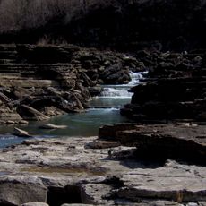
Burgess Falls State Park
United States of America

Burgess Falls State Park

13.7 mi
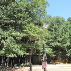
Horace Burgess's Treehouse
United States of America

Horace Burgess's Treehouse

23.4 mi
Rock Island State Park
United States of America

Rock Island State Park

15.2 mi
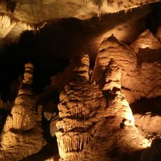
Cumberland Caverns
United States of America

Cumberland Caverns

23.6 mi
Fall Creek Falls
United States of America

Fall Creek Falls

17.8 mi
Cumberland Mountain State Park
United States of America

Cumberland Mountain State Park

21.8 mi
Great Falls Dam
United States of America

Great Falls Dam

14.7 mi
Tucker Stadium
United States of America

Tucker Stadium

18.7 mi
Burgess Falls
United States of America

Burgess Falls

13.7 mi
Scott's Gulf
United States of America

Scott's Gulf

8.8 mi
Cane Creek Falls
United States of America

Cane Creek Falls

18 mi
Burritt College
United States of America

Burritt College

12.5 mi
Palace Theater
United States of America

Palace Theater

21.2 mi
Piney Creek Falls
United States of America

Piney Creek Falls

17.1 mi
Rockhouse Falls
United States of America

Rockhouse Falls

18.1 mi
West End Church of Christ Silver Point
United States of America

West End Church of Christ Silver Point

21.1 mi
Cane Creek Cascades
United States of America

Cane Creek Cascades

18.1 mi
Coon Creek Falls
United States of America

Coon Creek Falls

17.8 mi
Broad Street Church of Christ
United States of America

Broad Street Church of Christ

17.9 mi
Cumberland County Courthouse
United States of America

Cumberland County Courthouse

21.2 mi
Algood United Methodist Church
United States of America

Algood United Methodist Church

19.1 mi
Pioneer Hall
United States of America

Pioneer Hall

12.3 mi
Sperry-Smith House
United States of America

Sperry-Smith House

3.2 mi
Community Building
United States of America

Community Building

3.4 mi
Crossville Model Railroad Club
United States of America

Crossville Model Railroad Club

22 mi
Greater Falls
United States of America

Greater Falls

15 mi
Oldham Theater
United States of America

Oldham Theater

3.4 mi
Show the full map
Reviews
Share your experience

No review yet

Discussions
Start a discussion...

No discussion yet

« Sparta Rock House - Historical tollhouse in Sparta, United States » is provided by Around Us (aroundus.com). Images and texts are derived from Wikimedia project under a Creative Commons license. You are allowed to copy, distribute, and modify copies of this page, under the conditions set by the license, as long as this note is clearly visible.

Discover hidden gems everywhere you go!

From secret cafés to breathtaking viewpoints, skip the crowded tourist spots and find places that match your style. Our app makes it easy with voice search, smart filtering, route optimization, and insider tips from travelers worldwide. Download now for the complete mobile experience.
Around Us App Screenshot

A unique approach to discovering new places

Le Figaro

All the places worth exploring

France Info

A tailor-made excursion in just a few clicks

20 Minutes

Around Us
Travel Guide & Maps
Download

Send to your phone

QR Code
1

Open the camera app on your mobile.

2

Point at the QR code with your camera. A notification will appear.

3

Tap the notification to open the link.