Taconic Skyline Trail, Hiking trail in Berkshire County, United States
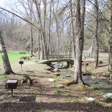
The Taconic Skyline Trail is a hiking path that runs along the ridge of the Taconic Range in Massachusetts, passing through mixed forests of oak and hickory trees. The route follows hilly terrain with sections of hard-packed earth and rocky ground that climb steadily throughout.
The path began as a recreational route developed in the Taconic Range region. Over time it was expanded and improved to serve different types of outdoor activities.
Massachusetts State Parks maintains this trail within Berkshire County, reflecting the region's dedication to outdoor recreation and environmental conservation principles.
The trail is accessible year-round, though spring through fall offers the most pleasant conditions for hiking. Sturdy footwear is essential as the ground is rocky and the slopes are steep in places.
Berry Pond sits along the middle section and is the highest natural lake in Massachusetts. This small body of water provides an unexpected break during the mountainous hike.
The community of curious travelers
AroundUs brings together thousands of curated places, local tips, and hidden gems, enriched daily by 60,000 contributors worldwide.