Tar Hollow State Park

Log in to your account

AroundUs is a community-driven map of interesting places, built by curious explorers like you. It grows with every review, story, and photo you share.
Connect to save your favorite spots, contribute locations, and create personalized routes.
Continue with Google
Continue with Apple
Continue with X
Continue with Facebook
Continue with email
By continuing, you accept our Terms and Conditions and our Privacy Policy
Create an account
Add to collection
Map
Suggest a change
Share

Tar Hollow State Park, State park in Hocking County, US

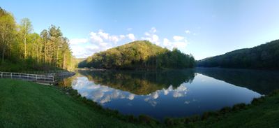
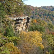
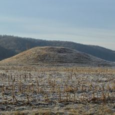
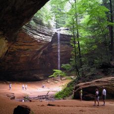
Tar Hollow State Park is a forested area in southeastern Ohio with deep ravines and rocky ridges of sandstone where low pines grow on the steeper slopes. A 15-acre lake sits in the central valley surrounded by dense hardwood forest that blankets most of the park.

The federal government acquired this land in the 1930s when it was no longer used for farming and officially established it as a state park in 1949. This conversion was part of a broader effort to protect and restore forest and wildlife in Ohio during that era.

The name comes from early settlers who extracted tar from pine trees for everyday household needs, a practice that shaped how the land has been understood and used. This heritage remains woven into how visitors experience the forest and ridges today.

Trails wind through ravines and across ridges with varying difficulty from flat lakeside paths to steep climbs and descents. The ground becomes slippery after rain so sturdy shoes and caution on slopes are important, and there are places to camp and fish at the lake.

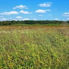
The park protects a habitat where timber rattlesnakes live and thrive, a rare snake species that is vanishing elsewhere in Ohio. These reptiles are shy and tend to avoid people, but their presence in this sandstone landscape is a sign of healthy woodland conditions.

Location: Hocking County

Inception: 1949

Website: https://ohiodnr.gov/wps/portal/gov/odnr/go-and-do/plan-a-visit/find-a-property/tar-hollow-state-park

GPS coordinates: 39.35600,-82.77700

Latest update: December 10, 2025 20:09

Photos
Around this place
Hopewell Culture National Historical Park
United States of America

Hopewell Culture National Historical Park

19.9 km
Adena Mansion
United States of America

Adena Mansion

20.4 km
Conkle's Hollow State Nature Preserve
United States of America

Conkle's Hollow State Nature Preserve

20.5 km
Yoctangee Park
United States of America

Yoctangee Park

18 km
Adena Mound
United States of America

Adena Mound

20 km
Grandview Cemetery
United States of America

Grandview Cemetery

18.3 km
Mary Worthington Macomb House
United States of America

Mary Worthington Macomb House

17.9 km
Mountain House
United States of America

Mountain House

18.7 km
Applethorpe Farm
United States of America

Applethorpe Farm

11.4 km
Horn Mound
United States of America

Horn Mound

18.8 km
Karshner Mound
United States of America

Karshner Mound

11.7 km
Seip House
United States of America

Seip House

18.7 km
Renick House
United States of America

Renick House

18.7 km
Tanglewood
United States of America

Tanglewood

18.5 km
Anthony and Susan Cardinal Walke House
United States of America

Anthony and Susan Cardinal Walke House

19.2 km
Mt. Olive Road Covered Bridge
United States of America

Mt. Olive Road Covered Bridge

17.9 km
Canal Warehouse
United States of America

Canal Warehouse

17.6 km
Vanmeter Church Street House
United States of America

Vanmeter Church Street House

18.6 km
Bellevue
United States of America

Bellevue

17.8 km
Chillicothe Water and Power Company Pumping Station
United States of America

Chillicothe Water and Power Company Pumping Station

17.7 km
Ratcliffe Mound
United States of America

Ratcliffe Mound

6.8 km
Mighty Children's Museum
United States of America

Mighty Children's Museum

17.8 km
Ash Cave
United States of America

Ash Cave

20.6 km
Scioto Trail State Park
United States of America

Scioto Trail State Park

20.7 km
Oak Hill
United States of America

Oak Hill

21.6 km
Hopeton Earthworks
United States of America

Hopeton Earthworks

17.7 km
Ross County Historical Society
United States of America

Ross County Historical Society

17.9 km
Banking Crisis of 1819
United States of America

Banking Crisis of 1819

17.8 km
Show the full map
Reviews

Visited this place? Tap the stars to rate it and share your experience / photos with the community! Try now! You can cancel it anytime.

« Tar Hollow State Park - State park in Hocking County, US » is provided by Around Us (aroundus.com). Images and texts are derived from Wikimedia project under a Creative Commons license. You are allowed to copy, distribute, and modify copies of this page, under the conditions set by the license, as long as this note is clearly visible.

Discover hidden gems everywhere you go!

From secret cafés to breathtaking viewpoints, skip the crowded tourist spots and find places that match your style. Our app makes it easy with voice search, smart filtering, route optimization, and insider tips from travelers worldwide. Download now for the complete mobile experience.

Around Us App Screenshot

A unique approach to discovering new places

Le Figaro

All the places worth exploring

France Info

A tailor-made excursion in just a few clicks

20 Minutes