Enable Location

We need your location to show you interesting places around you

Discover nearby places

Find interesting locations and hidden gems around you

Precise directions

Get accurate directions and distances to places

Your location is never shared with other users. It's only used when you tap the location button.

Susquehanna State Park

Log in to your account

Start exploring — it's free

Trusted by 61,817 travelers worldwide

Continue with Google
Continue with Apple
or

We will send you a code to connect

By continuing, you accept our Terms and Conditions and our Privacy Policy

Check your inbox

We've sent a pincode in your inbox. Please enter the code below.

Susquehanna State Park

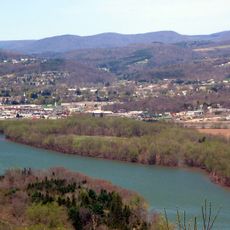
Susquehanna State Park, Riverside state park in Williamsport, United States.

Description

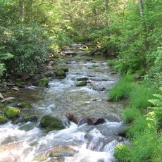
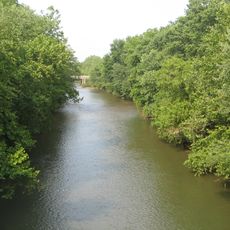
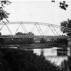
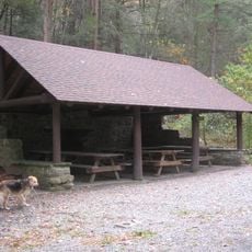
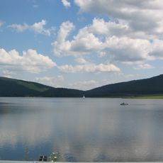
Susquehanna State Park is a 20-acre riverside park along the West Branch Susquehanna River featuring waterfront recreational facilities and walking paths. The park provides access to the river with picnic areas and viewpoints for visitors to enjoy the waterfront.

History

The land served as part of the West Branch Division of the Pennsylvania Canal from 1834 to 1889, until a major flood destroyed the infrastructure. The site lost its role as a key transportation corridor for the region afterward.

Culture

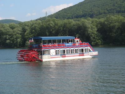
The Hiawatha paddlewheeler carries visitors along the river and keeps alive the maritime traditions that shaped the region's character. These seasonal excursions reflect how the waterfront remains central to how locals experience their environment.

Practical

The park is reached through the Reach Road exit from US Route 220, then turn right onto Reach Road and follow Arch Street to the entrance. Visitors should watch for uneven terrain along the paths and wear appropriate footwear for walking near the river.

Did you know?

From 1851 to 1909, the Susquehanna Boom operated at this location, using cribs and chained logs to capture floating timber for sawmills downstream. This ingenious system allowed the region to process wood on a massive scale.

Location
Inception
1961
GPS coordinates
41.22250,-77.08280
Latest update
December 12, 2025 17:48

AroundUs brings together thousands of curated places, local tips, and hidden gems, enriched daily by 60,000 contributors worldwide. Discover all places nearby (Pennsylvania).

Around this place
Pine Creek Gorge
United States of America

Pine Creek Gorge

21.2 km
Cogan House Covered Bridge
United States of America

Cogan House Covered Bridge

21.9 km
Tiadaghton State Forest
United States of America

Tiadaghton State Forest

7.8 km
Muncy Creek
United States of America

Muncy Creek

23.5 km
Ravensburg State Park
United States of America

Ravensburg State Park

18.4 km
Millionaire's Row Historic District
United States of America

Millionaire's Row Historic District

5.9 km
Peter Herdic House
United States of America

Peter Herdic House

6.5 km
Canfield Island Site
United States of America

Canfield Island Site

11.1 km
Allenwood River Bridge
United States of America

Allenwood River Bridge

20.6 km
Christ Episcopal Church
United States of America

Christ Episcopal Church

7.3 km
Watsontown River Bridge
United States of America

Watsontown River Bridge

24.1 km
Factory Bridge
United States of America

Factory Bridge

22.4 km
City Hall
United States of America

City Hall

6.7 km
Williamsport City Hall
United States of America

Williamsport City Hall

6.9 km
Eagle Grange No. 1
United States of America

Eagle Grange No. 1

15.2 km
Reading-Halls Station Bridge
United States of America

Reading-Halls Station Bridge

21 km
Bridge in Porter Township
United States of America

Bridge in Porter Township

17.1 km
Madigan Library
United States of America

Madigan Library

5.3 km
Sand Spring Run
United States of America

Sand Spring Run

18.2 km
Hopper-Snyder Homestead
United States of America

Hopper-Snyder Homestead

23.8 km
Benjamin Griffey House
United States of America

Benjamin Griffey House

14.9 km
Ravensburg State Park Historic District
United States of America

Ravensburg State Park Historic District

18.7 km
Jersey Shore Historic District
United States of America

Jersey Shore Historic District

14.6 km
Community Arts Center
United States of America

Community Arts Center

6.8 km
James V.Brown Library Bookmobile
United States of America

James V.Brown Library Bookmobile

7.2 km
Water tower, Williamsport, PA
United States of America

Water tower, Williamsport, PA

7 km
Holy Cross Orthodox Church, Williamsport, PA
United States of America

Holy Cross Orthodox Church, Williamsport, PA

10 km
Rose Valley Lake (Pennsylvania)
United States of America

Rose Valley Lake (Pennsylvania)

20 km
Show the full map
« Susquehanna State Park - Riverside state park in Williamsport, United States » is provided by Around Us (aroundus.com). Images and texts are derived from Wikimedia project under a Creative Commons license. You are allowed to copy, distribute, and modify copies of this page, under the conditions set by the license, as long as this note is clearly visible.

Discover hidden gems everywhere you go!

From secret cafés to breathtaking viewpoints, skip the crowded tourist spots and find places that match your style. Our app makes it easy with voice search, smart filtering, route optimization, and insider tips from travelers worldwide. Download now for the complete mobile experience.

Around Us App Screenshot

A unique approach to discovering new places

Le Figaro

All the places worth exploring

France Info

A tailor-made excursion in just a few clicks

20 Minutes

Around Us
Travel Guide & Maps
Download

Send to your phone

QR Code
1

Open the camera app on your mobile.

2

Point at the QR code with your camera. A notification will appear.

3

Tap the notification to open the link.