Enable Location

We need your location to show you interesting places around you

Discover nearby places

Find interesting locations and hidden gems around you

Precise directions

Get accurate directions and distances to places

Your location is never shared with other users. It's only used when you tap the location button.

Tiadaghton State Forest

Log in to your account

Start exploring — it's free

Trusted by 61,810 travelers worldwide

Continue with Google
Continue with Apple
or

We will send you a code to connect

By continuing, you accept our Terms and Conditions and our Privacy Policy

Check your inbox

We've sent a pincode in your inbox. Please enter the code below.

Tiadaghton State Forest

Tiadaghton State Forest, State forest in Pennsylvania, United States.

Description

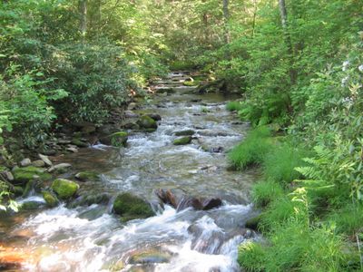
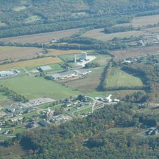
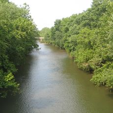
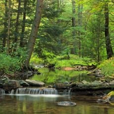
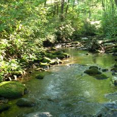
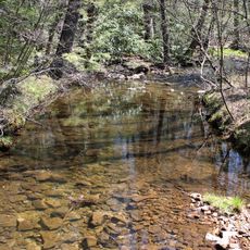
Tiadaghton State Forest is a large woodland area spanning multiple counties in Pennsylvania with varied terrain including narrow plateaus and steep valley slopes. The forest covers extensive ground and is crisscrossed by streams and mixed woodlands.

History

The forest began as a state acquisition in the late 1800s when the government purchased early parcels of land for public forest management. Over the following decades, the area grew through additional purchases and conservation efforts.

Culture

The name Tiadaghton comes from the Iroquois language and refers to Pine Creek, linking the forest to the region's Native American heritage. Walking through the woods today, visitors encounter this historical connection woven into the landscape itself.

Practical

The forest offers numerous trails ranging from short day hikes to longer multi-day routes suitable for different fitness levels. Visitors should bring proper hiking boots and weather-appropriate clothing since the terrain is demanding and conditions can change quickly.

Did you know?

Within the forest lies a protected natural area containing old-growth Eastern Hemlock and native hardwood trees rarely preserved in such extensive numbers in the region. This particular woodland section shows visitors what the landscape looked like before modern logging became common practice.

Location
GPS coordinates
41.16110,-77.03920
Latest update
December 10, 2025 20:04

AroundUs brings together thousands of curated places, local tips, and hidden gems, enriched daily by 60,000 contributors worldwide. Discover all places nearby (Pennsylvania).

Around this place
State Correctional Institution – Muncy
United States of America

State Correctional Institution – Muncy

18.6 km
Muncy Creek
United States of America

Muncy Creek

20.5 km
Ravensburg State Park
United States of America

Ravensburg State Park

18 km
Millionaire's Row Historic District
United States of America

Millionaire's Row Historic District

8.9 km
Susquehanna State Park
United States of America

Susquehanna State Park

7.8 km
McCalls Dam State Park
United States of America

McCalls Dam State Park

20.1 km
Sand Bridge State Park
United States of America

Sand Bridge State Park

19.2 km
Peter Herdic House
United States of America

Peter Herdic House

9.1 km
Canfield Island Site
United States of America

Canfield Island Site

11.6 km
Allenwood River Bridge
United States of America

Allenwood River Bridge

13.8 km
Christ Episcopal Church
United States of America

Christ Episcopal Church

9.7 km
Watsontown River Bridge
United States of America

Watsontown River Bridge

17.1 km
Factory Bridge
United States of America

Factory Bridge

15 km
William Kirk House
United States of America

William Kirk House

20.3 km
City Hall
United States of America

City Hall

9.2 km
Williamsport City Hall
United States of America

Williamsport City Hall

9.5 km
Warrior Run Presbyterian Church
United States of America

Warrior Run Presbyterian Church

20.7 km
Reading-Halls Station Bridge
United States of America

Reading-Halls Station Bridge

19.2 km
Bridge in Porter Township
United States of America

Bridge in Porter Township

20.2 km
Madigan Library
United States of America

Madigan Library

8.3 km
Sand Spring Run
United States of America

Sand Spring Run

11.8 km
Hopper-Snyder Homestead
United States of America

Hopper-Snyder Homestead

17.1 km
Benjamin Griffey House
United States of America

Benjamin Griffey House

7.6 km
Ravensburg State Park Historic District
United States of America

Ravensburg State Park Historic District

18.2 km
Jersey Shore Historic District
United States of America

Jersey Shore Historic District

18.6 km
Community Arts Center
United States of America

Community Arts Center

9.3 km
James V.Brown Library Bookmobile
United States of America

James V.Brown Library Bookmobile

9.6 km
Water tower, Williamsport, PA
United States of America

Water tower, Williamsport, PA

10.9 km
Show the full map
« Tiadaghton State Forest - State forest in Pennsylvania, United States » is provided by Around Us (aroundus.com). Images and texts are derived from Wikimedia project under a Creative Commons license. You are allowed to copy, distribute, and modify copies of this page, under the conditions set by the license, as long as this note is clearly visible.

Discover hidden gems everywhere you go!

From secret cafés to breathtaking viewpoints, skip the crowded tourist spots and find places that match your style. Our app makes it easy with voice search, smart filtering, route optimization, and insider tips from travelers worldwide. Download now for the complete mobile experience.

Around Us App Screenshot

A unique approach to discovering new places

Le Figaro

All the places worth exploring

France Info

A tailor-made excursion in just a few clicks

20 Minutes

Around Us
Travel Guide & Maps
Download

Send to your phone

QR Code
1

Open the camera app on your mobile.

2

Point at the QR code with your camera. A notification will appear.

3

Tap the notification to open the link.