Enable Location

We need your location to show you interesting places around you

Discover nearby places

Find interesting locations and hidden gems around you

Precise directions

Get accurate directions and distances to places

Your location is never shared with other users. It's only used when you tap the location button.

McCalls Dam State Park

Log in to your account

Start exploring — it's free

Trusted by 63,283 travelers worldwide

Continue with Google
Continue with Apple
or

We will send you a code to connect

By continuing, you accept our Terms and Conditions and our Privacy Policy

Check your inbox

We've sent a pincode in your inbox. Please enter the code below.

McCalls Dam State Park
Discussion Reviews 1 Photos
2.4k Popularity

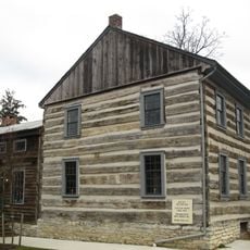
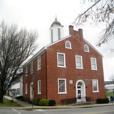
McCalls Dam State Park, State park in Miles Township, Pennsylvania, US.

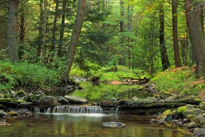
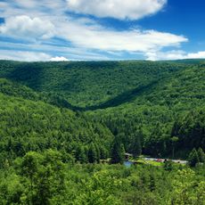
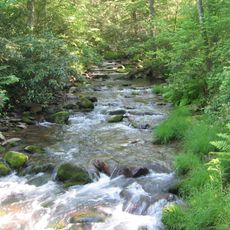
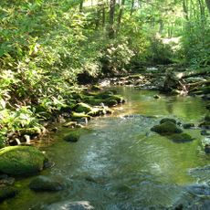
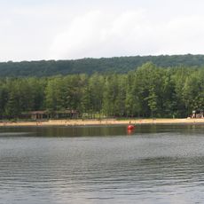
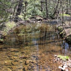
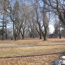
McCalls Dam State Park is an 8-acre wooded area in Pennsylvania situated along White Deer Creek. The space features natural walking paths and open clearings beneath tall trees, making it suitable for hiking and quiet outdoor time.

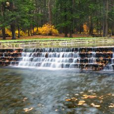
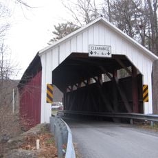
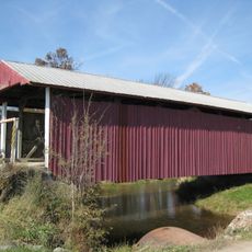
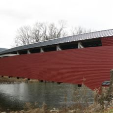
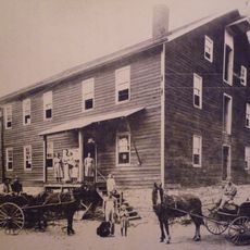
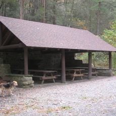
Johnny McCall built a splash dam on White Deer Creek in 1850 to power a sawmill operation. The facilities visible today were later developed by the Civilian Conservation Corps during the 1930s.

The name reflects Johnny McCall's presence here during the 1800s when he operated a splash dam. Today it serves as a quiet reminder of how people once shaped the land along White Deer Creek for their livelihoods.

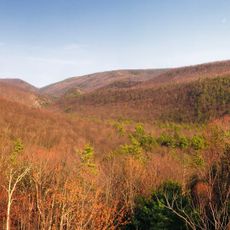
The park is accessed via gravel roads that become difficult to navigate during winter months, when snowmobiles or cross-country skis are needed. Plan to bring all your supplies and arrange to pack out all waste, as no trash facilities exist here.

During winter, the park transforms into a destination for snowmobilers and cross-country skiers who favor its snowy trails. This seasonal shift makes it feel like a different place compared to the warmer months when foot traffic changes the experience.

The community of curious travelers

AroundUs brings together thousands of curated places, local tips, and hidden gems, enriched daily by 60,000 contributors worldwide.

Start exploring
Location
Inception
1933
GPS coordinates
41.01690,-77.18250
Latest update
December 13, 2025 11:42
Around this place
R. B. Winter State Park
United States of America

R. B. Winter State Park

2.6 km
Tiadaghton State Forest
United States of America

Tiadaghton State Forest

20.1 km
Bald Eagle State Forest
United States of America

Bald Eagle State Forest

15.5 km
Ravensburg State Park
United States of America

Ravensburg State Park

11.5 km
Susquehanna State Park
United States of America

Susquehanna State Park

24.4 km
Sand Bridge State Park
United States of America

Sand Bridge State Park

6 km
Hassenplug Bridge
United States of America

Hassenplug Bridge

15.2 km
Piper Aviation Museum
United States of America

Piper Aviation Museum

24.3 km
Factory Bridge
United States of America

Factory Bridge

24.3 km
Hayes Bridge
United States of America

Hayes Bridge

12.6 km
Halfway Lake
United States of America

Halfway Lake

3 km
Millmont Red Bridge
United States of America

Millmont Red Bridge

15.6 km
Logan Mills Covered Bridge
United States of America

Logan Mills Covered Bridge

17.2 km
Rich-McCormick Woolen Factory
United States of America

Rich-McCormick Woolen Factory

23.4 km
Buffalo Presbyterian Church
United States of America

Buffalo Presbyterian Church

19 km
New Berlin Presbyterian Church
United States of America

New Berlin Presbyterian Church

22.5 km
Logan Mills Gristmill
United States of America

Logan Mills Gristmill

16.9 km
William A. Heiss House and Buggy Shop
United States of America

William A. Heiss House and Buggy Shop

16 km
Rebersburg Historic District
United States of America

Rebersburg Historic District

23.3 km
Bridge in Porter Township
United States of America

Bridge in Porter Township

20 km
Mifflinburg Historic District
United States of America

Mifflinburg Historic District

15.8 km
Sand Spring Run
United States of America

Sand Spring Run

10.2 km
Fought's Mill
United States of America

Fought's Mill

16.1 km
Benjamin Griffey House
United States of America

Benjamin Griffey House

21.6 km
Old Union County Courthouse
United States of America

Old Union County Courthouse

22.5 km
Ravensburg State Park Historic District
United States of America

Ravensburg State Park Historic District

11.3 km
Jersey Shore Historic District
United States of America

Jersey Shore Historic District

21.4 km
Memorial Park Site
United States of America

Memorial Park Site

23.9 km
Show the full map
Reviews
Share your experience

No review yet

Discussions
Start a discussion...

No discussion yet

« McCalls Dam State Park - State park in Miles Township, Pennsylvania, US » is provided by Around Us (aroundus.com). Images and texts are derived from Wikimedia project under a Creative Commons license. You are allowed to copy, distribute, and modify copies of this page, under the conditions set by the license, as long as this note is clearly visible.

Discover hidden gems everywhere you go!

From secret cafés to breathtaking viewpoints, skip the crowded tourist spots and find places that match your style. Our app makes it easy with voice search, smart filtering, route optimization, and insider tips from travelers worldwide. Download now for the complete mobile experience.

Around Us App Screenshot

A unique approach to discovering new places

Le Figaro

All the places worth exploring

France Info

A tailor-made excursion in just a few clicks

20 Minutes

Around Us
Travel Guide & Maps
Download

Send to your phone

QR Code
1

Open the camera app on your mobile.

2

Point at the QR code with your camera. A notification will appear.

3

Tap the notification to open the link.