Enable Location

We need your location to show you interesting places around you

Discover nearby places

Find interesting locations and hidden gems around you

Precise directions

Get accurate directions and distances to places

Your location is never shared with other users. It's only used when you tap the location button.

Tully Lake

Log in to your account

Start exploring — it's free

Trusted by 62,163 travelers worldwide

Continue with Google
Continue with Apple
or

We will send you a code to connect

By continuing, you accept our Terms and Conditions and our Privacy Policy

Check your inbox

We've sent a pincode in your inbox. Please enter the code below.

Tully Lake

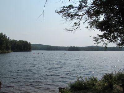
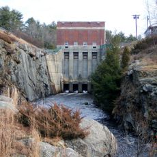
Tully Lake, dam in Royalston, Massachusetts

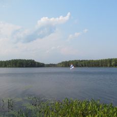
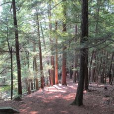
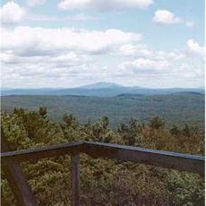
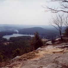
Tully Lake is a reservoir in Massachusetts covering approximately 200 acres and surrounded by forests and wetlands that support diverse wildlife including waterfowl, deer, and various smaller mammals. The recreation area includes a tent-only campground, trails including the 22-mile Tully Trail loop, picnic facilities with tables and grills, and water activities such as boating and fishing.

The lake was created by constructing a dam to control flooding on nearby rivers and has served as a public recreation area since its establishment. The site is managed by the U.S. Army Corps of Engineers while the campground operates under the Trustees of the Reservations.

The lake serves as a gathering place where visitors spend time with family and friends enjoying meals and games in picnic areas throughout the recreation area. The peaceful setting brings people together for simple outdoor enjoyment away from city life.

The recreation area is fully open from May to October, with trails and disc golf accessible year-round depending on weather conditions. Visitors should note there are no running water facilities on site, so plan to bring your own water or make other arrangements.

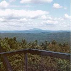
The approximately 22-mile Tully Trail is a multi-part hiking route that many visitors tackle over two days, giving the lake a distinct status among regional hiking destinations. This extended loop offers both short day trips and multi-day adventures for various fitness levels.

The community of curious travelers

AroundUs brings together thousands of curated places, local tips, and hidden gems, enriched daily by 60,000 contributors worldwide.

Start exploring
Location
GPS coordinates
42.64464,-72.21567
Latest update
February 7, 2026 11:40
Around this place
Harvard Forest
United States of America

Harvard Forest

12.8 km
Bear's Den
United States of America

Bear's Den

14.6 km
Doane's Falls
United States of America

Doane's Falls

1.2 km
Royalston Falls
United States of America

Royalston Falls

8.2 km
Tully Mountain
United States of America

Tully Mountain

2.8 km
Mount Grace
United States of America

Mount Grace

12.6 km
Lake Dennison Recreation Area
United States of America

Lake Dennison Recreation Area

11.5 km
Templeton Developmental Center
United States of America

Templeton Developmental Center

9.4 km
Jacobs Hill
United States of America

Jacobs Hill

3.6 km
Mount Grace State Forest
United States of America

Mount Grace State Forest

12.2 km
Tully Trail
United States of America

Tully Trail

836 m
United States of America

Spirit Falls

2.8 km
Whitaker-Clary House
United States of America

Whitaker-Clary House

14.2 km
Orange Center Historic District
United States of America

Orange Center Historic District

9.8 km
Mount Grace Land Conservation Trust
United States of America

Mount Grace Land Conservation Trust

2.4 km
Old Town Hall
United States of America

Old Town Hall

5.8 km
Old Centre Historic District
United States of America

Old Centre Historic District

14.6 km
Baldwinville Village Historic District
United States of America

Baldwinville Village Historic District

12.2 km
Royalston Common Historic District
United States of America

Royalston Common Historic District

4.3 km
Phillipston Center Historic District
United States of America

Phillipston Center Historic District

12.3 km
Grand Army of the Republic Hall
United States of America

Grand Army of the Republic Hall

9.7 km
Templeton Common Historic District
United States of America

Templeton Common Historic District

15.6 km
Richmond School House No. 6
United States of America

Richmond School House No. 6

13.2 km
Richmond Town Hall
United States of America

Richmond Town Hall

13.9 km
Winchendon Village Historic District
United States of America

Winchendon Village Historic District

14.2 km
Birch Hill Dam
United States of America

Birch Hill Dam

7.7 km
Warwick Fire Tower
United States of America

Warwick Fire Tower

12.6 km
Tully Cemetery
United States of America

Tully Cemetery

2.9 km
Show the full map
« Tully Lake - dam in Royalston, Massachusetts » is provided by Around Us (aroundus.com). Images and texts are derived from Wikimedia project under a Creative Commons license. You are allowed to copy, distribute, and modify copies of this page, under the conditions set by the license, as long as this note is clearly visible.

Discover hidden gems everywhere you go!

From secret cafés to breathtaking viewpoints, skip the crowded tourist spots and find places that match your style. Our app makes it easy with voice search, smart filtering, route optimization, and insider tips from travelers worldwide. Download now for the complete mobile experience.

Around Us App Screenshot

A unique approach to discovering new places

Le Figaro

All the places worth exploring

France Info

A tailor-made excursion in just a few clicks

20 Minutes

Around Us
Travel Guide & Maps
Download

Send to your phone

QR Code
1

Open the camera app on your mobile.

2

Point at the QR code with your camera. A notification will appear.

3

Tap the notification to open the link.