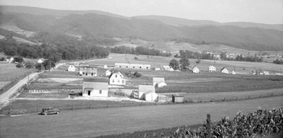
Tygart Valley Homesteads Historic District, Federal resettlement district in Randolph County, West Virginia.
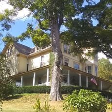
The Tygart Valley Homesteads Historic District is a 1930s resettlement project containing roughly 337 buildings, three sites, and three structures spread across about 1,500 acres near the town of Dailey. The homes feature Colonial Revival design in two distinct types, both showcasing oak flooring and pine paneling throughout their interiors.
The project was established in 1934 under the Roosevelt administration during the Great Depression to support displaced workers. Its creation marked a significant federal effort to help people restart their lives in a new community during economic hardship.
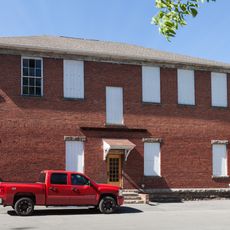
The Dailey Community Center, completed in 1937, served as the social hub where residents gathered for events and square dances. It reflects how the community built connections through shared activities and celebrations.
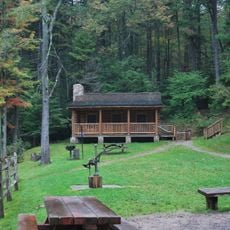
The area is best explored by taking time to visit the various homes and the community center. The flat terrain makes walking manageable, but bringing a map or visiting plan helps you navigate between the scattered locations.
Each family received a house with modern conveniences like running water and indoor toilets, plus two acres for growing vegetables and maintaining fruit trees. This arrangement was remarkably forward-thinking for a rural 1930s settlement and offered families a level of comfort that was uncommon at the time.
The community of curious travelers
AroundUs brings together thousands of curated places, local tips, and hidden gems, enriched daily by 60,000 contributors worldwide.