Laurel Fork North Wilderness

Log in to your account

AroundUs is a community-driven map of interesting places, built by curious explorers like you. It grows with every review, story, and photo you share.
Connect to save your favorite spots, contribute locations, and create personalized routes.
Continue with Google
Continue with Apple
Continue with X
Continue with Facebook
Continue with email
By continuing, you accept our Terms and Conditions and our Privacy Policy
Create an account

Laurel Fork North Wilderness

Add to collection
Map
Suggest a change
Share

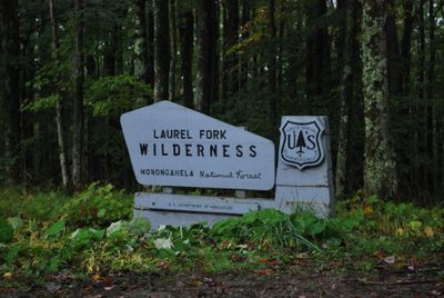
Laurel Fork North Wilderness, Wilderness Area in Monongahela National Forest, West Virginia, United States.

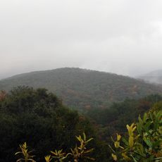
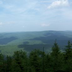
Laurel Fork North Wilderness is a protected forest area in Monongahela National Forest with multiple habitats and a river system. The area includes many trails through both hilly and flat terrain that follow the Laurel Fork River.

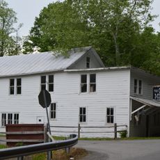
The area was logged heavily until 1921 when the old-growth forests were exhausted by the Laurel River Lumber Company. This period shaped the forest ecosystem and eventually led to the protected status it has today.

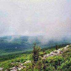
The protected forest offers visitors a chance to encounter native animals and observe different forest types while walking through the woods. Many use the trails as an opportunity to experience the forest's diversity and quietness firsthand.

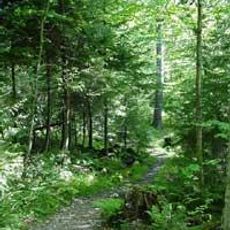
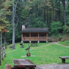
The area has marked trails including the Laurel Fork River Trail that lead to camping and swimming areas. The paths vary in difficulty, so visitors should check conditions before arriving.

Unlike many other wilderness areas in West Virginia, this place features flat hiking routes along the river. This unusual character makes it appealing to walkers who prefer not to tackle hilly terrain.

Location: West Virginia

GPS coordinates: 38.75750,-79.67310

Latest update: December 14, 2025 11:03

Photos
Around this place
Spruce Knob
United States of America

Spruce Knob

13.8 km
Monongahela National Forest
United States of America

Monongahela National Forest

24.4 km
White Top
United States of America

White Top

23.1 km
Bickle Knob
United States of America

Bickle Knob

20.3 km
Gaudineer Scenic Area
United States of America

Gaudineer Scenic Area

20.6 km
Gaudineer Knob
United States of America

Gaudineer Knob

21.7 km
Halliehurst mansion
United States of America

Halliehurst mansion

24.5 km
Middle Mountain Cabins
United States of America

Middle Mountain Cabins

9.4 km
Tygart Valley Homesteads Historic District
United States of America

Tygart Valley Homesteads Historic District

20.4 km
Randolph County Courthouse and Jail
United States of America

Randolph County Courthouse and Jail

23.6 km
Laurel Fork South Wilderness
United States of America

Laurel Fork South Wilderness

6.4 km
Shavers Fork Mountain Complex
United States of America

Shavers Fork Mountain Complex

21.7 km
Albert and Liberal Arts Halls
United States of America

Albert and Liberal Arts Halls

24.4 km
Gov. H. Guy Kump House
United States of America

Gov. H. Guy Kump House

23.1 km
Scott Hill
United States of America

Scott Hill

23.8 km
Circleville School
United States of America

Circleville School

18.8 km
Warfield-Dye Residence
United States of America

Warfield-Dye Residence

24.2 km
First Ward School
United States of America

First Ward School

23.7 km
Day-Vandevander Mill
United States of America

Day-Vandevander Mill

23.5 km
Downtown Elkins Historic District
United States of America

Downtown Elkins Historic District

24 km
Wees Historic District
United States of America

Wees Historic District

24 km
Beverly Historic District
United States of America

Beverly Historic District

19.9 km
Taylor-Condry House
United States of America

Taylor-Condry House

22.8 km
Butcher Hill Historic District
United States of America

Butcher Hill Historic District

19.5 km
Elkins Milling Company
United States of America

Elkins Milling Company

24.1 km
Blackman-Bosworth Store
United States of America

Blackman-Bosworth Store

19.9 km
Dr. John C. Irons House
United States of America

Dr. John C. Irons House

24 km
Beverly Heritage Center
United States of America

Beverly Heritage Center

19.8 km
Show the full map
Reviews

Visited this place? Tap the stars to rate it and share your experience / photos with the community! Try now! You can cancel it anytime.

« Laurel Fork North Wilderness - Wilderness Area in Monongahela National Forest, West Virginia, United States » is provided by Around Us (aroundus.com). Images and texts are derived from Wikimedia project under a Creative Commons license. You are allowed to copy, distribute, and modify copies of this page, under the conditions set by the license, as long as this note is clearly visible.

Discover hidden gems everywhere you go!

From secret cafés to breathtaking viewpoints, skip the crowded tourist spots and find places that match your style. Our app makes it easy with voice search, smart filtering, route optimization, and insider tips from travelers worldwide. Download now for the complete mobile experience.

Around Us App Screenshot

A unique approach to discovering new places

Le Figaro

All the places worth exploring

France Info

A tailor-made excursion in just a few clicks

20 Minutes