Warriors Path State Park

Log in to your account

AroundUs is a community-driven map of interesting places, built by curious explorers like you. It grows with every review, story, and photo you share.
Connect to save your favorite spots, contribute locations, and create personalized routes.
Continue with Google
Continue with Apple
Continue with X
Continue with Facebook
Continue with email
By continuing, you accept our Terms and Conditions and our Privacy Policy
Create an account
Add to collection
Map
Suggest a change
Share

Warriors Path State Park, State park in Liberty Township, Pennsylvania.

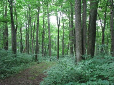
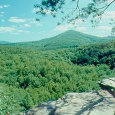
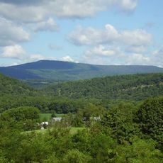
Warriors Path State Park covers 349 acres along the Raystown Branch of the Juniata River in Pennsylvania, featuring hiking trails and direct access to the water. The terrain includes woodlands, open fields, and riverbank areas suitable for outdoor recreation.

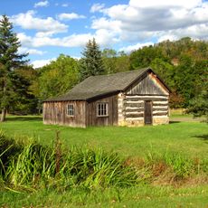
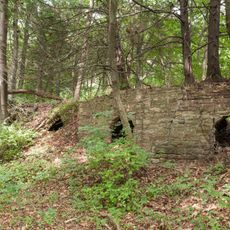
The land was purchased from the Nimchishin family in 1959 and officially established as a state park in 1965. A bronze marker commemorates the Bussard family's donation to the park property.

The name originates from the Great Indian Warpath, a route used by Iroquois nations during their military campaigns against Cherokee tribes.

The park is accessible on foot through the main gate, with the best visiting conditions between November and mid-April when activities like hiking and cross-country skiing are available. Visitors should prepare for variable weather and bring appropriate footwear.

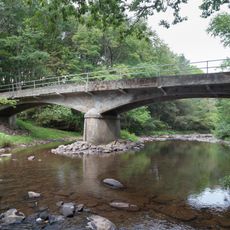
The Raystown Branch surrounds the property on three sides, creating multiple access points to the water. This allows fishing for smallmouth bass, carp, and muskie from various riverside locations.

Location: Pennsylvania

Inception: 1965

Website: https://dcnr.pa.gov/StateParks/FindAPark/WarriorsPathStatePark

GPS coordinates: 40.19580,-78.25640

Latest update: December 12, 2025 12:05

Photos
Around this place
Rays Hill Tunnel
United States of America

Rays Hill Tunnel

20.3 km
Bedford Village Archeological Site
United States of America

Bedford Village Archeological Site

27.6 km
Trough Creek State Park
United States of America

Trough Creek State Park

18.2 km
Minersville Coke Ovens
United States of America

Minersville Coke Ovens

6.6 km
Butler Knob
United States of America

Butler Knob

26.9 km
Baker Bridge
United States of America

Baker Bridge

15.3 km
Pine Knob
United States of America

Pine Knob

26.7 km
United States of America

The Narrows

27.3 km
Woodvale Historic District
United States of America

Woodvale Historic District

10.6 km
Jacksons Mill Covered Bridge
United States of America

Jacksons Mill Covered Bridge

25 km
Brumbaugh Homestead
United States of America

Brumbaugh Homestead

24 km
Halls Mill Covered Bridge
United States of America

Halls Mill Covered Bridge

9.5 km
Bridge in Snake Spring Township
United States of America

Bridge in Snake Spring Township

27.3 km
Feltons Mill Covered Bridge
United States of America

Feltons Mill Covered Bridge

24.9 km
Everett Historic District
United States of America

Everett Historic District

22.6 km
Paradise Furnace
United States of America

Paradise Furnace

16.9 km
Robertsdale Historic District
United States of America

Robertsdale Historic District

12.3 km
Mount Union Historic District
United States of America

Mount Union Historic District

22 km
Osterburg Covered Bridge
United States of America

Osterburg Covered Bridge

24.4 km
Hudson Grist Mill
United States of America

Hudson Grist Mill

21.3 km
Marklesburg Historic District
United States of America

Marklesburg Historic District

22 km
Pennsylvania Canal Guard Lock and Feeder Dam, Raystown Branch
United States of America

Pennsylvania Canal Guard Lock and Feeder Dam, Raystown Branch

6.6 km
McConnellsburg Historic District
United States of America

McConnellsburg Historic District

10.6 km
Frehn Bridge
United States of America

Frehn Bridge

23.6 km
Daniel Royer House
United States of America

Daniel Royer House

25.4 km
Roaring Spring Historic District
United States of America

Roaring Spring Historic District

19.6 km
New Enterprise Public School
United States of America

New Enterprise Public School

13.2 km
Juniata Woolen Mill and Newry Manor
United States of America

Juniata Woolen Mill and Newry Manor

25 km
Show the full map
Reviews

Visited this place? Tap the stars to rate it and share your experience / photos with the community! Try now! You can cancel it anytime.

« Warriors Path State Park - State park in Liberty Township, Pennsylvania » is provided by Around Us (aroundus.com). Images and texts are derived from Wikimedia project under a Creative Commons license. You are allowed to copy, distribute, and modify copies of this page, under the conditions set by the license, as long as this note is clearly visible.

Discover hidden gems everywhere you go!

From secret cafés to breathtaking viewpoints, skip the crowded tourist spots and find places that match your style. Our app makes it easy with voice search, smart filtering, route optimization, and insider tips from travelers worldwide. Download now for the complete mobile experience.

Around Us App Screenshot

A unique approach to discovering new places

Le Figaro

All the places worth exploring

France Info

A tailor-made excursion in just a few clicks

20 Minutes