Enable Location

We need your location to show you interesting places around you

Discover nearby places

Find interesting locations and hidden gems around you

Precise directions

Get accurate directions and distances to places

Your location is never shared with other users. It's only used when you tap the location button.

Log in to your account

Start exploring — it's free

Trusted by 68,292 travelers worldwide

Continue with Google
Continue with Apple
or

We will send you a code to connect

By continuing, you accept our Terms and Conditions and our Privacy Policy

Check your inbox

We've sent a pincode in your inbox. Please enter the code below.

Waldensian Church and Cemetery of Stone Prairie
Discussion Reviews Photo
1.3k Popularity

Waldensian Church and Cemetery of Stone Prairie, Presbyterian church and cemetery from the 1900s in Barry County, United States

The Waldensian Church is a stone-built structure with an adjacent cemetery in a rural area of Missouri. The grounds contain graves of early settlers who came from the Piedmont region of Italy.

The original community built a wooden meeting house in 1875, which was later replaced by the current stone structure. The new church was completed in 1908 after Waldensian emigrants from Italy had settled in Missouri.

The congregation preserves Waldensian heritage, a faith movement from medieval times, brought by Italian-speaking settlers from the Cottian Alps. Visitors can see how this long-standing community practiced their beliefs in this rural setting.

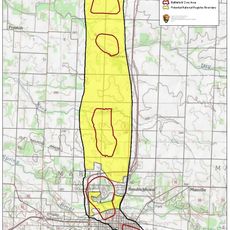
The building is located in a rural area of Barry County and is accessible via local roads. Visitors should be aware that the site is in open countryside and has limited facilities nearby, especially during quieter seasons.

Early services here used three languages: French, Italian dialect, and English, because the congregation included emigrants from France, Italy, and Switzerland. This linguistic variety reflects the complex origins of this settler group.

The community of curious travelers

AroundUs brings together thousands of curated places, local tips, and hidden gems, enriched daily by 60,000 contributors worldwide.

Start exploring
Location
GPS coordinates
36.89667,-93.91861
Latest update
December 14, 2025 18:07
Around this place
Roaring River State Park
United States of America

Roaring River State Park

35.3 km
George Washington Carver National Monument
United States of America

George Washington Carver National Monument

40.1 km
Blue Springs Heritage Center
United States of America

Blue Springs Heritage Center

48.8 km
Beaver Bridge
United States of America

Beaver Bridge

49.3 km
Y-Bridge
United States of America

Y-Bridge

42 km
United States of America

Jolly Mill

13.6 km
Big Sugar Creek State Park
United States of America

Big Sugar Creek State Park

45.4 km
United States of America

First Battle of Newtonia Historic District

23.9 km
Precious Moments Park and Chapel
United States of America

Precious Moments Park and Chapel

44.9 km
Battle of Carthage State Historic Site
United States of America

Battle of Carthage State Historic Site

45.6 km
Powell Bridge
United States of America

Powell Bridge

39.1 km
Lewis Shaw Coleman House
United States of America

Lewis Shaw Coleman House

19.8 km
Lawrence County Courthouse
United States of America

Lawrence County Courthouse

24.7 km
White River Bridge at Elkins
United States of America

White River Bridge at Elkins

49.3 km
Carthage Courthouse Square Historic District
United States of America

Carthage Courthouse Square Historic District

46.7 km
Second Baptist Church
United States of America

Second Baptist Church

40.7 km
Elijah Teague Anderson House
United States of America

Elijah Teague Anderson House

46.5 km
Colonial Apartments
United States of America

Colonial Apartments

46.8 km
Stone County Courthouse
United States of America

Stone County Courthouse

41.6 km
Phelps Country Estate
United States of America

Phelps Country Estate

48.4 km
Carthage South Historic District
United States of America

Carthage South Historic District

46.2 km
Neosho Wholesale Grocery Company
United States of America

Neosho Wholesale Grocery Company

40 km
Cassill Place Historic District
United States of America

Cassill Place Historic District

47.5 km
Lentz-Carter Merchandise Store
United States of America

Lentz-Carter Merchandise Store

28.8 km
Battle of Carthage Civil War Museum
United States of America

Battle of Carthage Civil War Museum

46.8 km
Island Green Golf Club
United States of America

Island Green Golf Club

43.6 km
Deer Leap Trail
United States of America

Deer Leap Trail

34.9 km
Jasper County Courthouse
United States of America

Jasper County Courthouse

46.9 km
Show the full map
Reviews
Share your experience

No review yet

Discussions
Start a discussion...

No discussion yet

« Waldensian Church and Cemetery of Stone Prairie - Presbyterian church and cemetery from the 1900s in Barry County, United States » is provided by Around Us (aroundus.com). Images and texts are derived from Wikimedia project under a Creative Commons license. You are allowed to copy, distribute, and modify copies of this page, under the conditions set by the license, as long as this note is clearly visible.

Discover hidden gems everywhere you go!

From secret cafés to breathtaking viewpoints, skip the crowded tourist spots and find places that match your style. Our app makes it easy with voice search, smart filtering, route optimization, and insider tips from travelers worldwide. Download now for the complete mobile experience.

Around Us App Screenshot

A unique approach to discovering new places

Le Figaro

All the places worth exploring

France Info

A tailor-made excursion in just a few clicks

20 Minutes

Around Us
Travel Guide & Maps
Download

Send to your phone

QR Code
1

Open the camera app on your mobile.

2

Point at the QR code with your camera. A notification will appear.

3

Tap the notification to open the link.