Barry County

Log in to your account

AroundUs is a community-driven map of interesting places, built by curious explorers like you. It grows with every review, story, and photo you share.
Connect to save your favorite spots, contribute locations, and create personalized routes.
By continuing, you accept our Terms and Conditions and our Privacy Policy
Add to collection
Map
Suggest a change
Share

Barry County, County administrative division in southwestern Missouri, United States

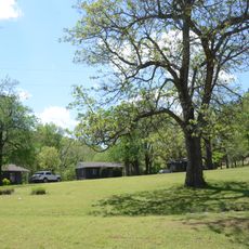
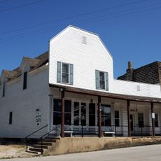
Barry County is an administrative division in southwestern Missouri that encompasses the Ozark region with its rolling hills, rivers, and streams. The landscape supports local wildlife and farms, with rural communities scattered throughout the area.

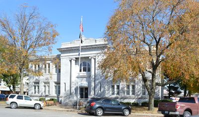
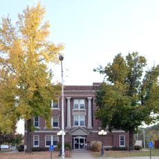
Barry County was established in January 1835, marking the beginning of organized administration in this part of Missouri. Cassville was designated as the county seat to serve as its administrative center.

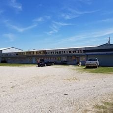
Local community gatherings, fairs, and festivals throughout the year bring together residents to maintain connections and celebrate regional traditions.

The county offers administrative services through its Register of Deeds office, which maintains property records and provides online payment options for residents. Visitors can easily access these services to handle local matters and official documentation.

The Barry County Trial Court implements specialized local administrative orders that regulate judicial proceedings and establish security measures for the community.

Location: Missouri

Inception: January 5, 1835

Capital city: Cassville

Shares border with: Lawrence County, Stone County, Carroll County, Benton County, McDonald County, Newton County

Website: https://barrycountycollector.com

GPS coordinates: 36.71000,-93.83000

Latest update: December 7, 2025 10:08

Photos
Around this place
Beaver Lake
United States of America

Beaver Lake

32.2 km
Christ of the Ozarks
United States of America

Christ of the Ozarks

34.8 km
Roaring River State Park
United States of America

Roaring River State Park

13.8 km
Onyx Cave
United States of America

Onyx Cave

32.6 km
Blue Springs Heritage Center
United States of America

Blue Springs Heritage Center

27.1 km
Beaver Bridge
United States of America

Beaver Bridge

27.2 km
Eureka Springs and North Arkansas Railway
United States of America

Eureka Springs and North Arkansas Railway

34.1 km
Lake Leatherwood City Park
United States of America

Lake Leatherwood City Park

31.2 km
Y-Bridge
United States of America

Y-Bridge

34.5 km
Jolly Mill
United States of America

Jolly Mill

30 km
Eureka Springs Historic District
United States of America

Eureka Springs Historic District

35.3 km
First Battle of Newtonia Historic District
United States of America

First Battle of Newtonia Historic District

37.3 km
Basin Park Hotel
United States of America

Basin Park Hotel

35.2 km
Powell Bridge
United States of America

Powell Bridge

33.1 km
Lewis Shaw Coleman House
United States of America

Lewis Shaw Coleman House

30.8 km
U.S. 62 White River Bridge
United States of America

U.S. 62 White River Bridge

28.8 km
White River Bridge at Elkins
United States of America

White River Bridge at Elkins

27.2 km
Mulladay Hollow Bridge
United States of America

Mulladay Hollow Bridge

31.1 km
Stone County Courthouse
United States of America

Stone County Courthouse

34.1 km
Lentz-Carter Merchandise Store
United States of America

Lentz-Carter Merchandise Store

32.9 km
Eureka Springs Historical Museum
United States of America

Eureka Springs Historical Museum

35.5 km
Deer Leap Trail
United States of America

Deer Leap Trail

13.2 km
Holy Land Tour
United States of America

Holy Land Tour

35.2 km
Crescent Spring
United States of America

Crescent Spring

34.7 km
Golden Pioneer Museum
United States of America

Golden Pioneer Museum

27.5 km
Pea Ridge National Military Park Visitor Center
United States of America

Pea Ridge National Military Park Visitor Center

34.4 km
Lake Leatherwood Recreational Facilities
United States of America

Lake Leatherwood Recreational Facilities

31.3 km
Lake Leatherwood
United States of America

Lake Leatherwood

30.8 km
Show the full map
Reviews

Visited this place? Tap the stars to rate it and share your experience / photos with the community! Try now! You can cancel it anytime.

Administrative divisions
« Barry County - County administrative division in southwestern Missouri, United States » is provided by Around Us (aroundus.com). Images and texts are derived from Wikimedia project under a Creative Commons license. You are allowed to copy, distribute, and modify copies of this page, under the conditions set by the license, as long as this note is clearly visible.

Discover hidden gems everywhere you go!

From secret cafés to breathtaking viewpoints, skip the crowded tourist spots and find places that match your style. Our app makes it easy with voice search, smart filtering, route optimization, and insider tips from travelers worldwide. Download now for the complete mobile experience.

Around Us App Screenshot

A unique approach to discovering new places

Le Figaro

All the places worth exploring

France Info

A tailor-made excursion in just a few clicks

20 Minutes