Wells State Park

Log in to your account

AroundUs is a community-driven map of interesting places, built by curious explorers like you. It grows with every review, story, and photo you share.
Connect to save your favorite spots, contribute locations, and create personalized routes.
Continue with Google
Continue with Apple
Continue with X
Continue with Facebook
Continue with email
By continuing, you accept our Terms and Conditions and our Privacy Policy
Create an account
Add to collection
Map
Suggest a change
Share

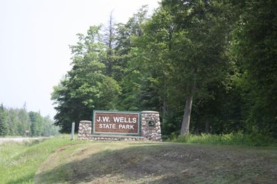
Wells State Park, Michigan state park in Cedarville Township, US.

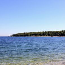
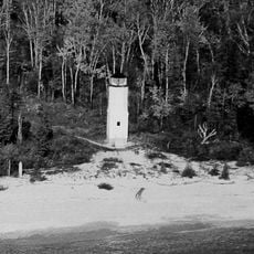
Wells State Park is a state park in Menominee County along Lake Michigan's Green Bay shoreline. The grounds contain sandy beaches, forested areas, and a network of marked trails for visitors to explore.

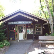
The children of John Walter Wells, a lumber industry pioneer, donated this land to Michigan in 1925. The Civilian Conservation Corps then built structures, water systems, and landscaping throughout the park during the 1930s and 1940s.

The Civilian Conservation Corps constructed numerous structures, including buildings, water systems, and landscaping elements throughout the park during the 1930s and 1940s.

The park provides about 150 camping spots near the shore with electrical hookups and dump stations for visitors. Water supplies and other basic facilities are distributed throughout the grounds.

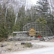
Three warming shelters positioned along the trail network offer breaks and refuge during winter months. These structures prove especially valuable in the harsh Upper Peninsula climate.

Location: Menominee County

Inception: 1925

Website: https://www2.dnr.state.mi.us/ParksandTrails/Details.aspx?id=432&type=SPRK

GPS coordinates: 45.40170,-87.37190

Latest update: December 12, 2025 14:20

Photos
Around this place
DeYoung Family Zoo
United States of America

DeYoung Family Zoo

23.8 km
Peninsula State Park
United States of America

Peninsula State Park

30.4 km
Newport State Park
United States of America

Newport State Park

34.9 km
Pilot Island
United States of America

Pilot Island

37.7 km
The Clearing Folk School
United States of America

The Clearing Folk School

28.3 km
Pilot Island Light
United States of America

Pilot Island Light

37.7 km
Green Bay National Wildlife Refuge
United States of America

Green Bay National Wildlife Refuge

34.3 km
Eagle Bluff Light
United States of America

Eagle Bluff Light

28.1 km
Gravel Island National Wildlife Refuge
United States of America

Gravel Island National Wildlife Refuge

36.5 km
Alexander Noble House
United States of America

Alexander Noble House

32.1 km
Minneapolis Shoal Light Station
United States of America

Minneapolis Shoal Light Station

35.3 km
Chambers Island Light
United States of America

Chambers Island Light

22.2 km
Church of the Atonement
United States of America

Church of the Atonement

31.9 km
Ephraim Moravian Church
United States of America

Ephraim Moravian Church

31.8 km
Free Evangelical Lutheran Church-Bethania Scandinavian Evangelical Lutheran Congregation
United States of America

Free Evangelical Lutheran Church-Bethania Scandinavian Evangelical Lutheran Congregation

31.7 km
St. John the Baptist Catholic Church
United States of America

St. John the Baptist Catholic Church

37.7 km
Gibraltar District School No. 2
United States of America

Gibraltar District School No. 2

31.6 km
School House Beach Park
United States of America

School House Beach Park

34.9 km
First Street Historic District
United States of America

First Street Historic District

37.7 km
Freeman and Jesse Thorp House and Cottages
United States of America

Freeman and Jesse Thorp House and Cottages

32.2 km
Ephraim Village Hall
United States of America

Ephraim Village Hall

31.5 km
Peter Peterson House
United States of America

Peter Peterson House

31.4 km
Grand Avenue Bridge
United States of America

Grand Avenue Bridge

35.7 km
Menominee Pier Light
United States of America

Menominee Pier Light

37.8 km
Jacobsen Museum
United States of America

Jacobsen Museum

33.4 km
Washington Island Farm Museum
United States of America

Washington Island Farm Museum

35.5 km
Plum Island Range rear light
United States of America

Plum Island Range rear light

34 km
Plum Island Range front light
United States of America

Plum Island Range front light

34.4 km
Show the full map
Reviews

Visited this place? Tap the stars to rate it and share your experience / photos with the community! Try now! You can cancel it anytime.

« Wells State Park - Michigan state park in Cedarville Township, US » is provided by Around Us (aroundus.com). Images and texts are derived from Wikimedia project under a Creative Commons license. You are allowed to copy, distribute, and modify copies of this page, under the conditions set by the license, as long as this note is clearly visible.

Discover hidden gems everywhere you go!

From secret cafés to breathtaking viewpoints, skip the crowded tourist spots and find places that match your style. Our app makes it easy with voice search, smart filtering, route optimization, and insider tips from travelers worldwide. Download now for the complete mobile experience.

Around Us App Screenshot

A unique approach to discovering new places

Le Figaro

All the places worth exploring

France Info

A tailor-made excursion in just a few clicks

20 Minutes