Chest opened
+${chestReward.xp} XP
Explorer
NOUVEAU ×${chestReward.collectible.quantity}
tapez pour fermer
Chest locked

Open chests in the app

Around Us is built for your phone — chests unlock when you walk, explore and capture nearby places.

Enable Location

We need your location to show you interesting places around you

Discover nearby places

Find interesting locations and hidden gems around you

Precise directions

Get accurate directions and distances to places

Your location is never shared with other users. It's only used when you tap the location button.

Log in to your account

Start exploring — it's free

Trusted by 72,880 travelers worldwide

Continue with Google
Continue with Apple
or

We will send you a code to connect

By continuing, you accept our Terms and Conditions and our Privacy Policy

Check your inbox

We've sent a pincode in your inbox. Please enter the code below.

Winterset City Park
Discussion Reviews Photo
2k Popularity

Winterset City Park, Urban park in Winterset, Iowa, US

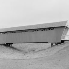
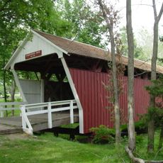
Winterset City Park is an urban park spanning 76 acres with three limestone shelters, natural wooded areas, and a maze-like garden layout. Playgrounds and open spaces are distributed throughout the grounds for different activities.

The park began in 1869 when the city first acquired land, making it one of the region's oldest public spaces. Development expanded significantly in the early 1900s as structures and features were added to enhance its purpose.

Clark Tower serves as a focal point where visitors learn about the pioneers who settled the area. The tower connects the park to the region's frontier heritage and the families who shaped the community.

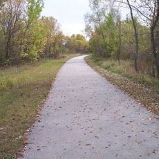
Visitors can explore the park on maintained trails and paths suitable for different activity levels and interests. Camping areas are located in distinct zones, keeping overnight guests separate from day-use visitors.

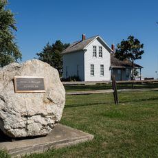
The park preserves a large granite boulder commemorating the discovery of the Red Delicious apple variety, which originated in the local area. This marker highlights an unexpected agricultural legacy tied to the region.

The community of curious travelers

AroundUs brings together thousands of curated places, local tips, and hidden gems, enriched daily by 60,000 contributors worldwide.

Start exploring
Location
GPS coordinates
41.33000,-94.00444
Latest update
December 14, 2025 09:44
Around this place
Roseman Covered Bridge
United States of America

Roseman Covered Bridge

12.8 km
Cedar Covered Bridge
United States of America

Cedar Covered Bridge

4 km
Hogback Covered Bridge
United States of America

Hogback Covered Bridge

7.2 km
Holliwell Covered Bridge
United States of America

Holliwell Covered Bridge

3.9 km
Imes Bridge
United States of America

Imes Bridge

17.6 km
Cutler–Donahoe Bridge
United States of America

Cutler–Donahoe Bridge

124 m
Great Western Trail
United States of America

Great Western Trail

22.2 km
John Wayne Birthplace Museum
United States of America

John Wayne Birthplace Museum

795 m
Robert William Andrew Feller Farmstead
United States of America

Robert William Andrew Feller Farmstead

25.3 km
St. Patrick's Church
United States of America

St. Patrick's Church

20.8 km
Adel Bridge
United States of America

Adel Bridge

31.8 km
Madison County Courthouse
United States of America

Madison County Courthouse

1.1 km
Henry C. Wallace House
United States of America

Henry C. Wallace House

1.4 km
Dexter Community House
United States of America

Dexter Community House

28 km
C.D. Bevington House and Stone Barn
United States of America

C.D. Bevington House and Stone Barn

916 m
North River Stone Schoolhouse
United States of America

North River Stone Schoolhouse

8.7 km
Guiberson House
United States of America

Guiberson House

1.2 km
W.J. and Nettie J. Cornell House
United States of America

W.J. and Nettie J. Cornell House

1.4 km
Winterset Courthouse Square Commercial Historic District
United States of America

Winterset Courthouse Square Commercial Historic District

968 m
Catalpa
United States of America

Catalpa

31.7 km
Earlham Public School
United States of America

Earlham Public School

20.5 km
C.D. and Eliza Heath Bevington Privy
United States of America

C.D. and Eliza Heath Bevington Privy

894 m
Emily Hornback House
United States of America

Emily Hornback House

1.3 km
White, Munger and Company Store
United States of America

White, Munger and Company Store

976 m
William and Mary
United States of America

William and Mary

14.7 km
Miller Richard and Mary Fisher Tidrick House
United States of America

Miller Richard and Mary Fisher Tidrick House

1.2 km
William R. and Martha Foster Shriver House
United States of America

William R. and Martha Foster Shriver House

509 m
Mahaska County Courthouse
United States of America

Mahaska County Courthouse

30.5 km
Show the full map
Reviews
Share your experience

No review yet

Discussions
Start a discussion...

No discussion yet

« Winterset City Park - Urban park in Winterset, Iowa, US » is provided by Around Us (aroundus.com). Images and texts are derived from Wikimedia project under a Creative Commons license. You are allowed to copy, distribute, and modify copies of this page, under the conditions set by the license, as long as this note is clearly visible.

Discover hidden gems everywhere you go!

From secret cafés to breathtaking viewpoints, skip the crowded tourist spots and find places that match your style. Our app makes it easy with voice search, smart filtering, route optimization, and insider tips from travelers worldwide. Download now for the complete mobile experience.

Around Us App Screenshot

A unique approach to discovering new places

Le Figaro

All the places worth exploring

France Info

A tailor-made excursion in just a few clicks

20 Minutes

Around Us
Travel Guide & Maps
Download

Send to your phone

QR Code
1

Open the camera app on your mobile.

2

Point at the QR code with your camera. A notification will appear.

3

Tap the notification to open the link.