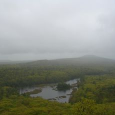
Mount Watatic, Mountain summit in Ashburnham, Massachusetts, US
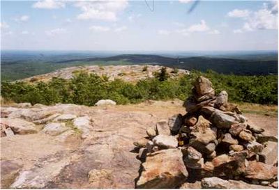
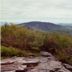
Mount Watatic is a mountain in Ashburnham with open slopes, rock formations, and dense forest covering its steep sides. The terrain shifts between exposed ridges and wooded sections, creating a varied landscape as you climb.
The mountain served as a winter sports destination from the 1930s until 1984, with multiple ski runs and a state fire tower on the summit. This long period of recreational use shaped the landscape before operations ended.
The name comes from a Native American term, Wetu-tick, meaning wigwam brook, reflecting the indigenous connection to the water flowing nearby. Walkers can sense this link to the land's past when passing the water sources on the trail.
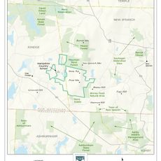
The mountain is accessible via the Wapack Trail from the parking area on Rindge State Road, offering a round trip hike of about three miles. The path is clearly marked and provides a steady climb to the summit.
The water drainage at the summit splits in two directions: the Souhegan River flows toward the Atlantic Ocean, while the Millers River heads toward Long Island Sound. This geography makes the summit a rare point where rainfall eventually reaches two different bodies of water.
The community of curious travelers
AroundUs brings together thousands of curated places, local tips, and hidden gems, enriched daily by 60,000 contributors worldwide.