Chest opened
+${chestReward.xp} XP
Explorer
NOUVEAU ×${chestReward.collectible.quantity}
tapez pour fermer
Chest locked

Open chests in the app

Around Us is built for your phone — chests unlock when you walk, explore and capture nearby places.

Enable Location

We need your location to show you interesting places around you

Discover nearby places

Find interesting locations and hidden gems around you

Precise directions

Get accurate directions and distances to places

Your location is never shared with other users. It's only used when you tap the location button.

Slab Fork

Log in to your account

Start exploring — it's free

Trusted by 72,879 travelers worldwide

Continue with Google
Continue with Apple
or

We will send you a code to connect

By continuing, you accept our Terms and Conditions and our Privacy Policy

Check your inbox

We've sent a pincode in your inbox. Please enter the code below.

Discussion Reviews 1 Photos
18.6k Popularity

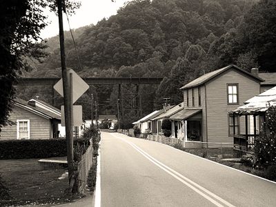
Slab Fork, unincorporated community in Raleigh County, West Virginia

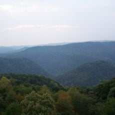
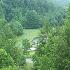
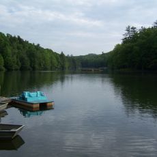
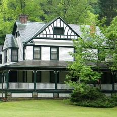
Slab Fork is a small unincorporated community in Raleigh County, West Virginia situated along a stream bearing the same name. The settlement sits at roughly 1,840 feet elevation in rolling terrain near County Route 34 and West Virginia Route 54, with modest homes scattered throughout the area.

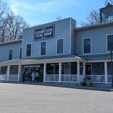
Slab Fork developed in a coal-mining region that shaped the economy and daily life of West Virginia for generations. The community's roots run deep in this industrial heritage, though many mines have since closed.

The community is accessible by car via West Virginia Route 54 and operates in the Eastern Time Zone. As a small unincorporated area, it has no stores or major services, so visitors should plan accordingly and bring necessities with them.

Slab Fork produced notable people including singer-songwriter Bill Withers, boxer Billy Arnold, and professional baseball players. Despite its small size, the community has a quiet tradition of raising individuals who went on to achieve success beyond their hometown.

The community of curious travelers

AroundUs brings together thousands of curated places, local tips, and hidden gems, enriched daily by 60,000 contributors worldwide.

Start exploring
Location
Elevation above the sea
561 m
GPS coordinates
37.68690,-81.33140
Latest update
February 16, 2026 23:20
Around this place
Pipestem Resort State Park
United States of America

Pipestem Resort State Park

33.9 km
Phil G. McDonald Bridge
United States of America

Phil G. McDonald Bridge

27.1 km
Bluestone National Scenic River
United States of America

Bluestone National Scenic River

33.5 km
Twin Falls Resort State Park
United States of America

Twin Falls Resort State Park

13.3 km
Bluestone State Park
United States of America

Bluestone State Park

35.5 km
Tamarack Marketplace
United States of America

Tamarack Marketplace

16.2 km
Oak Hill High School
United States of America

Oak Hill High School

37.5 km
Little Beaver State Park
United States of America

Little Beaver State Park

23.4 km
Phillips-Sprague Mine
United States of America

Phillips-Sprague Mine

16.1 km
Camp Creek State Park
United States of America

Camp Creek State Park

26.9 km
St. Colman's Roman Catholic Church and Cemetery
United States of America

St. Colman's Roman Catholic Church and Cemetery

37.2 km
McDowell County Courthouse
United States of America

McDowell County Courthouse

36 km
Itmann Company Store and Office
United States of America

Itmann Company Store and Office

14.7 km
World War Memorial
United States of America

World War Memorial

33 km
Bank of Glen Jean
United States of America

Bank of Glen Jean

31 km
Ashland Company Store
United States of America

Ashland Company Store

31 km
Wildwood
United States of America

Wildwood

15.8 km
Wyco Church
United States of America

Wyco Church

9.8 km
Beckley Courthouse Square Historic District
United States of America

Beckley Courthouse Square Historic District

16.1 km
Jordan's Chapel
United States of America

Jordan's Chapel

36.3 km
Welch Commercial Historic District
United States of America

Welch Commercial Historic District

36.1 km
Mount Hope Historic District
United States of America

Mount Hope Historic District

27 km
New River Company General Office Building
United States of America

New River Company General Office Building

27.5 km
Whitesville School
United States of America

Whitesville School

37.4 km
Sophia Historic District
United States of America

Sophia Historic District

7.4 km
James Ellwood Jones House
United States of America

James Ellwood Jones House

36 km
Mullens Historic District
United States of America

Mullens Historic District

12.5 km
John J. Lincoln House
United States of America

John J. Lincoln House

34.3 km
Show the full map
Reviews
Share your experience

No review yet

Discussions
Start a discussion...

No discussion yet

« Slab Fork - unincorporated community in Raleigh County, West Virginia » is provided by Around Us (aroundus.com). Images and texts are derived from Wikimedia project under a Creative Commons license. You are allowed to copy, distribute, and modify copies of this page, under the conditions set by the license, as long as this note is clearly visible.

Discover hidden gems everywhere you go!

From secret cafés to breathtaking viewpoints, skip the crowded tourist spots and find places that match your style. Our app makes it easy with voice search, smart filtering, route optimization, and insider tips from travelers worldwide. Download now for the complete mobile experience.

Around Us App Screenshot

A unique approach to discovering new places

Le Figaro

All the places worth exploring

France Info

A tailor-made excursion in just a few clicks

20 Minutes

Around Us
Travel Guide & Maps
Download

Send to your phone

QR Code
1

Open the camera app on your mobile.

2

Point at the QR code with your camera. A notification will appear.

3

Tap the notification to open the link.