Enable Location

We need your location to show you interesting places around you

Discover nearby places

Find interesting locations and hidden gems around you

Precise directions

Get accurate directions and distances to places

Your location is never shared with other users. It's only used when you tap the location button.

St. Colman's Roman Catholic Church and Cemetery

Log in to your account

Start exploring — it's free

Trusted by 62,519 travelers worldwide

Continue with Google
Continue with Apple
or

We will send you a code to connect

By continuing, you accept our Terms and Conditions and our Privacy Policy

Check your inbox

We've sent a pincode in your inbox. Please enter the code below.

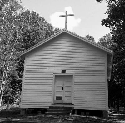
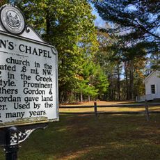
St. Colman's Roman Catholic Church and Cemetery, historic church 2 miles east of the town Beckley in West Virginia

St. Colman's Roman Catholic Church and Cemetery is a church and burial ground in Raleigh County, West Virginia, standing since 1877 on Irish Mountain. The simple white wooden structure sits beside a well-maintained cemetery with rows of gravestones marking the burial places of local residents spanning multiple generations.

The church was founded in 1877 after Maurice Sullivan donated land in 1876 to Bishop Joseph J. Kane for one dollar, giving the growing Irish community a place to worship on Irish Mountain. The original log building was later covered with boards and painted white, preserving the appearance it holds today.

The church served as a gathering place for the Irish community on Irish Mountain, where families gathered for worship and marked important life events. The cemetery stones reflect the heritage of Irish settlers, with some inscriptions showing where buried people were born in Ireland.

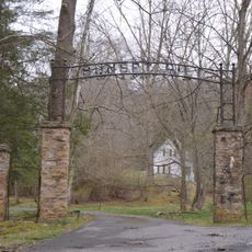
The site is easily accessible in a rural area at the top of Sullivan's Knob on Irish Mountain. Visitors can walk through both the church and cemetery grounds at their own pace, taking time to read the gravestones and observe the layout of the burial area.

The cemetery holds a special section called the 'Lost Corner' in its back area, containing graves of infants and people who died without baptism or proper burial rites. This quiet area marks the difficult realities faced by early Irish settlers in this isolated mountain region.

The community of curious travelers

AroundUs brings together thousands of curated places, local tips, and hidden gems, enriched daily by 60,000 contributors worldwide.

Start exploring
Location
Inception
1870s
GPS coordinates
37.76580,-80.92110
Latest update
February 9, 2026 08:22
Around this place
Federal Prison Camp, Alderson
United States of America

Federal Prison Camp, Alderson

22.8 km
Babcock State Park
United States of America

Babcock State Park

25.8 km
Bluestone Lake
United States of America

Bluestone Lake

14.3 km
Phil G. McDonald Bridge
United States of America

Phil G. McDonald Bridge

10.6 km
Bluestone National Scenic River
United States of America

Bluestone National Scenic River

25.9 km
Bluestone State Park
United States of America

Bluestone State Park

16.5 km
Little Beaver State Park
United States of America

Little Beaver State Park

14.1 km
Phillips-Sprague Mine
United States of America

Phillips-Sprague Mine

24.4 km
Col. James Graham House
United States of America

Col. James Graham House

21 km
Blue Sulphur Springs Pavilion
United States of America

Blue Sulphur Springs Pavilion

25.5 km
Alexander McVeigh Miller House
United States of America

Alexander McVeigh Miller House

25.5 km
Summers County Courthouse
United States of America

Summers County Courthouse

10.7 km
Wildwood
United States of America

Wildwood

23.4 km
Hinton Historic District
United States of America

Hinton Historic District

10.7 km
Alderson Bridge
United States of America

Alderson Bridge

24.9 km
Alderson Historic District
United States of America

Alderson Historic District

25 km
Pence Springs Hotel Historic District
United States of America

Pence Springs Hotel Historic District

19.9 km
Beckley Courthouse Square Historic District
United States of America

Beckley Courthouse Square Historic District

23.5 km
Jordan's Chapel
United States of America

Jordan's Chapel

24.7 km
Mount Hope Historic District
United States of America

Mount Hope Historic District

25.9 km
Trump-Lilly Farmstead
United States of America

Trump-Lilly Farmstead

7.7 km
Sunset Hill
United States of America

Sunset Hill

25.7 km
New River Company General Office Building
United States of America

New River Company General Office Building

25.9 km
Argabrite House
United States of America

Argabrite House

25.4 km
Dr. John Hughart House
United States of America

Dr. John Hughart House

23.1 km
Glade Creek Grist Mill
United States of America

Glade Creek Grist Mill

23.9 km
Sandstone Falls
United States of America

Sandstone Falls

1.6 km
Camp Brookside Environmental Education Center
United States of America

Camp Brookside Environmental Education Center

5.5 km
Show the full map
« St. Colman's Roman Catholic Church and Cemetery - historic church 2 miles east of the town Beckley in West Virginia » is provided by Around Us (aroundus.com). Images and texts are derived from Wikimedia project under a Creative Commons license. You are allowed to copy, distribute, and modify copies of this page, under the conditions set by the license, as long as this note is clearly visible.

Discover hidden gems everywhere you go!

From secret cafés to breathtaking viewpoints, skip the crowded tourist spots and find places that match your style. Our app makes it easy with voice search, smart filtering, route optimization, and insider tips from travelers worldwide. Download now for the complete mobile experience.

Around Us App Screenshot

A unique approach to discovering new places

Le Figaro

All the places worth exploring

France Info

A tailor-made excursion in just a few clicks

20 Minutes

Around Us
Travel Guide & Maps
Download

Send to your phone

QR Code
1

Open the camera app on your mobile.

2

Point at the QR code with your camera. A notification will appear.

3

Tap the notification to open the link.