Enable Location

We need your location to show you interesting places around you

Discover nearby places

Find interesting locations and hidden gems around you

Precise directions

Get accurate directions and distances to places

Your location is never shared with other users. It's only used when you tap the location button.

Ben Lomond Plantation

Log in to your account

Start exploring — it's free

Trusted by 63,103 travelers worldwide

Continue with Google
Continue with Apple
or

We will send you a code to connect

By continuing, you accept our Terms and Conditions and our Privacy Policy

Check your inbox

We've sent a pincode in your inbox. Please enter the code below.

Discussion Reviews 1 Photos
1.7k Popularity

Ben Lomond Plantation, human settlement in United States of America

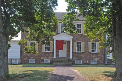
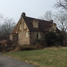
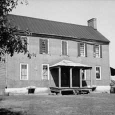
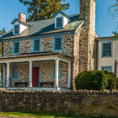
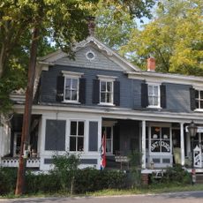
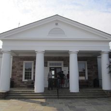
Ben Lomond Plantation is a house built in 1832 in Prince William County, Virginia, now operated as a historic site open to visitors. The main residence is accompanied by several outbuildings including slave quarters, a smokehouse, a dairy, and a rose garden that together document life on a 19th-century plantation.

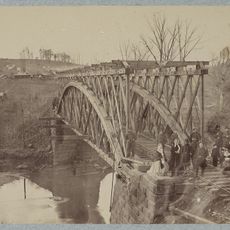
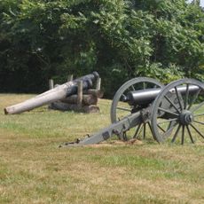
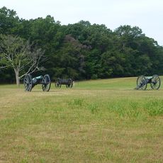
The house was built in 1832 by Benjamin Tasker Chinn, whose family owned considerable land holdings in Northern Virginia. During the Civil War it served as a field hospital for wounded soldiers, and was later occupied by Union forces who left behind damage and graffiti still visible today.

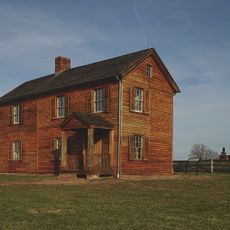
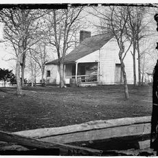
The site preserves slave quarters and farm buildings that reveal how daily work was organized on the plantation and the role of enslaved workers. The Scottish heritage visible in place names and the rose garden reflect the cultural preferences and traditions of the families who lived here.

The site is open from May through October, Thursday to Monday from 11 a.m. to 4 p.m., while the grounds remain accessible year-round from dawn to dusk. The first floor is wheelchair accessible with nearby parking, and both self-guided and group tours are offered.

Interior walls still bear visible signatures and inscriptions written by soldiers during the occupation, including one by a Medal of Honor recipient. These personal marks provide a direct connection to the individuals who experienced the place during the Civil War.

The community of curious travelers

AroundUs brings together thousands of curated places, local tips, and hidden gems, enriched daily by 60,000 contributors worldwide.

Start exploring
GPS coordinates
38.78833,-77.50583
Latest update
February 9, 2026 08:20
Around this place
Centreville High School
United States of America

Centreville High School

9.2 km
Henry House
United States of America

Henry House

3.3 km
Splash Down Waterpark
United States of America

Splash Down Waterpark

2.6 km
Hemlock Overlook Regional Park
United States of America

Hemlock Overlook Regional Park

8.6 km
Ellanor C. Lawrence Park
United States of America

Ellanor C. Lawrence Park

10.5 km
Stone Bridge
United States of America

Stone Bridge

4 km
Robinson House
United States of America

Robinson House

3.6 km
Old Town Manassas
United States of America

Old Town Manassas

5 km
"A" Fort and Battery Hill Redoubt-Camp Early
United States of America

"A" Fort and Battery Hill Redoubt-Camp Early

6.8 km
Manassas Industrial School for Colored Youth
United States of America

Manassas Industrial School for Colored Youth

4.9 km
United States of America

Culpeper Basin

1.8 km
Blackburn's Ford
United States of America

Blackburn's Ford

5.2 km
Nokesville Truss Bridge
United States of America

Nokesville Truss Bridge

10.4 km
Prince William County Courthouse
United States of America

Prince William County Courthouse

4.5 km
Conner House
United States of America

Conner House

5.8 km
Moor Green
United States of America

Moor Green

9.1 km
Cannon Branch Fort
United States of America

Cannon Branch Fort

5.9 km
Signal Hill
United States of America

Signal Hill

7.1 km
Manassas Water Tower
United States of America

Manassas Water Tower

5.1 km
Clifton Historic District
United States of America

Clifton Historic District

10.4 km
Orange and Alexandria Railroad Bridge Piers
United States of America

Orange and Alexandria Railroad Bridge Piers

7.4 km
Atoka Historic District
United States of America

Atoka Historic District

10.4 km
Mayfield Fortification
United States of America

Mayfield Fortification

6.1 km
Davis-Beard House
United States of America

Davis-Beard House

7.7 km
Jiffy Lube Live
United States of America

Jiffy Lube Live

7.3 km
Henry Hill Visitor Center
United States of America

Henry Hill Visitor Center

3.1 km
Henry Hill
United States of America

Henry Hill

3.3 km
Centreville Regional Library
United States of America

Centreville Regional Library

7.7 km
Show the full map
Reviews
Share your experience

No review yet

Discussions
Start a discussion...

No discussion yet

« Ben Lomond Plantation - human settlement in United States of America » is provided by Around Us (aroundus.com). Images and texts are derived from Wikimedia project under a Creative Commons license. You are allowed to copy, distribute, and modify copies of this page, under the conditions set by the license, as long as this note is clearly visible.

Discover hidden gems everywhere you go!

From secret cafés to breathtaking viewpoints, skip the crowded tourist spots and find places that match your style. Our app makes it easy with voice search, smart filtering, route optimization, and insider tips from travelers worldwide. Download now for the complete mobile experience.

Around Us App Screenshot

A unique approach to discovering new places

Le Figaro

All the places worth exploring

France Info

A tailor-made excursion in just a few clicks

20 Minutes

Around Us
Travel Guide & Maps
Download

Send to your phone

QR Code
1

Open the camera app on your mobile.

2

Point at the QR code with your camera. A notification will appear.

3

Tap the notification to open the link.