Enable Location

We need your location to show you interesting places around you

Discover nearby places

Find interesting locations and hidden gems around you

Precise directions

Get accurate directions and distances to places

Your location is never shared with other users. It's only used when you tap the location button.

Battery Rock

Log in to your account

Start exploring — it's free

Trusted by 62,170 travelers worldwide

Continue with Google
Continue with Apple
or

We will send you a code to connect

By continuing, you accept our Terms and Conditions and our Privacy Policy

Check your inbox

We've sent a pincode in your inbox. Please enter the code below.

Battery Rock, Limestone cliff in Hardin County, Illinois, US

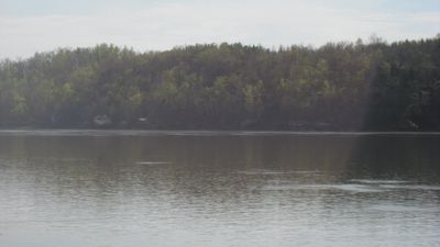
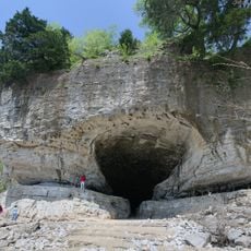
Battery Rock is a limestone cliff in Hardin County that rises dramatically above the Ohio River, featuring a sheer vertical wall with distinct geological layers. The formation showcases the natural stratification of rock that reveals the geological history of the region.

The cliff was recognized in the 1840s as a strategic vantage point for monitoring river traffic and activity along the Ohio River. Its historical importance led to its inclusion on the National Register of Historic Places in 1998.

Local residents gather annually at Battery Rock for traditional spring celebrations, maintaining connections with early Illinois settler communities.

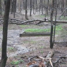
Access to the cliff is via Bend of the River Road, which provides parking areas and walking trails to different vantage points. The paths are marked and offer several ways to view the rock formation from various angles.

The rock face contains fossils of marine organisms from the Mississippian period, approximately 350 million years ago. These petrified remains allow visitors to witness the deep geological past directly at the site.

The community of curious travelers

AroundUs brings together thousands of curated places, local tips, and hidden gems, enriched daily by 60,000 contributors worldwide.

Start exploring
Location
GPS coordinates
37.52940,-88.08110
Latest update
December 14, 2025 11:41
Around this place
Crenshaw House
United States of America

Crenshaw House

29.1 km
Garden of the Gods Wilderness
United States of America

Garden of the Gods Wilderness

29 km
Cave-in-Rock State Park
United States of America

Cave-in-Rock State Park

9.5 km
Illinois Salines
United States of America

Illinois Salines

27.2 km
United States of America

Tolu Site

18.2 km
Shawneetown Bank State Historic Site
United States of America

Shawneetown Bank State Historic Site

19.2 km
Illinois Iron Furnace
United States of America

Illinois Iron Furnace

22.1 km
John T. Myers Locks and Dam
United States of America

John T. Myers Locks and Dam

30.5 km
Shawneetown Bridge
United States of America

Shawneetown Bridge

18.5 km
United States of America

Welborn Village Archeological Site

30.6 km
Hovey Lake Archaeological District
United States of America

Hovey Lake Archaeological District

36.3 km
Orr-Herl Mound and Village Site
United States of America

Orr-Herl Mound and Village Site

24.2 km
United States of America

Gallatin County Courthouse

22.8 km
Hovey Lake Fish and Wildlife Area
United States of America

Hovey Lake Fish and Wildlife Area

34.5 km
John Marshall House Museum
United States of America

John Marshall House Museum

19 km
Confederate Monument of Morganfield
United States of America

Confederate Monument of Morganfield

23.6 km
Union County Courthouse
United States of America

Union County Courthouse

22.4 km
Hardin County Courthouse
United States of America

Hardin County Courthouse

21.8 km
Camp Breckinridge Non-Commissioned Officers' Club
United States of America

Camp Breckinridge Non-Commissioned Officers' Club

23.7 km
Fredonia Cumberland Presbyterian Church
United States of America

Fredonia Cumberland Presbyterian Church

35.6 km
Daniel H. Hughes House
United States of America

Daniel H. Hughes House

22.4 km
George N. Proctor House
United States of America

George N. Proctor House

30.3 km
Robert and John McKee Peeples Houses
United States of America

Robert and John McKee Peeples Houses

19.3 km
Webster County Courthouse
United States of America

Webster County Courthouse

34.5 km
Providence Commercial Historic District
United States of America

Providence Commercial Historic District

31.7 km
Cave In Rock State Park
United States of America

Cave In Rock State Park

9.2 km
Morganfield Commercial District
United States of America

Morganfield Commercial District

22.5 km
Peters Creek Lookout Tower
United States of America

Peters Creek Lookout Tower

13.9 km
Show the full map
« Battery Rock - Limestone cliff in Hardin County, Illinois, US » is provided by Around Us (aroundus.com). Images and texts are derived from Wikimedia project under a Creative Commons license. You are allowed to copy, distribute, and modify copies of this page, under the conditions set by the license, as long as this note is clearly visible.

Discover hidden gems everywhere you go!

From secret cafés to breathtaking viewpoints, skip the crowded tourist spots and find places that match your style. Our app makes it easy with voice search, smart filtering, route optimization, and insider tips from travelers worldwide. Download now for the complete mobile experience.

Around Us App Screenshot

A unique approach to discovering new places

Le Figaro

All the places worth exploring

France Info

A tailor-made excursion in just a few clicks

20 Minutes

Around Us
Travel Guide & Maps
Download

Send to your phone

QR Code
1

Open the camera app on your mobile.

2

Point at the QR code with your camera. A notification will appear.

3

Tap the notification to open the link.