Enable Location

We need your location to show you interesting places around you

Discover nearby places

Find interesting locations and hidden gems around you

Precise directions

Get accurate directions and distances to places

Your location is never shared with other users. It's only used when you tap the location button.

Hardin County

Log in to your account

Start exploring — it's free

Trusted by 62,172 travelers worldwide

Continue with Google
Continue with Apple
or

We will send you a code to connect

By continuing, you accept our Terms and Conditions and our Privacy Policy

Check your inbox

We've sent a pincode in your inbox. Please enter the code below.

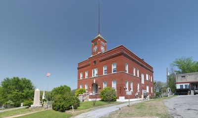
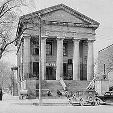
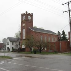
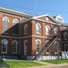
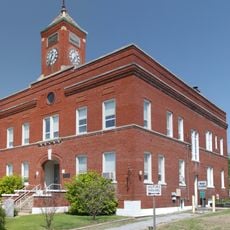
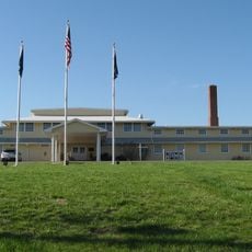
Hardin County, County administration center in Elizabethtown, Illinois.

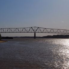
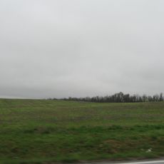
Hardin County is an administrative division in southern Illinois bordered by the Ohio River and encompassing the Shawnee National Forest. The county seat of Elizabethtown serves as the main hub for county services and local governance.

The county was established in 1839 when it separated from Pope County, and later received additional land from Gallatin County to define its present boundaries. These territorial changes marked the growing development of southern Illinois during the 1800s.

Local residents gather at Elizabethtown for annual festivals that highlight traditional music, food, and agricultural products from the region.

Illinois Routes 1, 34, and 146 are the main roads connecting different parts of the county and provide access to outdoor areas. These routes help visitors navigate between small communities and natural attractions in the region.

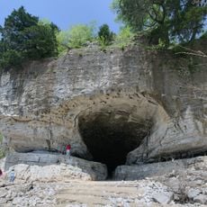
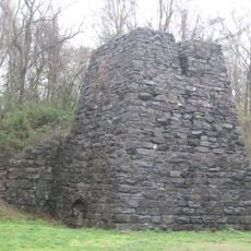
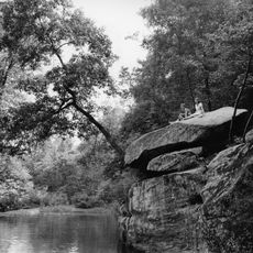
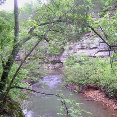
The area contains Hicks Dome, a geological feature created by deep underground volcanic activity and mineral accumulation over time. This unusual formation represents an interesting chapter in the region's natural history.

The community of curious travelers

AroundUs brings together thousands of curated places, local tips, and hidden gems, enriched daily by 60,000 contributors worldwide.

Start exploring
Location
Inception
March 1, 1839
Capital city
Elizabethtown
Shares border with
Gallatin County, Union County, Crittenden County, Livingston County, Pope County, Saline County
GPS coordinates
37.53139,-88.36833
Latest update
December 7, 2025 10:06
Around this place
Crenshaw House
United States of America

Crenshaw House

23.1 km
Garden of the Gods Wilderness
United States of America

Garden of the Gods Wilderness

8.7 km
Cave-in-Rock State Park
United States of America

Cave-in-Rock State Park

20 km
Illinois Salines
United States of America

Illinois Salines

20.4 km
United States of America

Tolu Site

14.7 km
Shawneetown Bank State Historic Site
United States of America

Shawneetown Bank State Historic Site

27.6 km
Illinois Iron Furnace
United States of America

Illinois Iron Furnace

5 km
Shawneetown Bridge
United States of America

Shawneetown Bridge

27.4 km
Battery Rock
United States of America

Battery Rock

25.4 km
Mantle Rock Archeological District
United States of America

Mantle Rock Archeological District

20.6 km
Orr-Herl Mound and Village Site
United States of America

Orr-Herl Mound and Village Site

11.4 km
Golconda Historic District
United States of America

Golconda Historic District

21.1 km
United States of America

Gallatin County Courthouse

26.2 km
United States of America

Lusk's Ferry, Illinois

20.9 km
John Marshall House Museum
United States of America

John Marshall House Museum

27.3 km
Bell Smith Springs
United States of America

Bell Smith Springs

25.4 km
Lusk Creek Canyon
United States of America

Lusk Creek Canyon

15.2 km
Confederate Monument of Morganfield
United States of America

Confederate Monument of Morganfield

44.1 km
Union County Courthouse
United States of America

Union County Courthouse

43.2 km
Hardin County Courthouse
United States of America

Hardin County Courthouse

10.9 km
Camp Breckinridge Non-Commissioned Officers' Club
United States of America

Camp Breckinridge Non-Commissioned Officers' Club

45.3 km
Fredonia Cumberland Presbyterian Church
United States of America

Fredonia Cumberland Presbyterian Church

45.1 km
Daniel H. Hughes House
United States of America

Daniel H. Hughes House

43.1 km
Robert and John McKee Peeples Houses
United States of America

Robert and John McKee Peeples Houses

27.8 km
Cave In Rock State Park
United States of America

Cave In Rock State Park

20.3 km
Morganfield Commercial District
United States of America

Morganfield Commercial District

43.3 km
Raum Lookout Tower
United States of America

Raum Lookout Tower

16.7 km
Peters Creek Lookout Tower
United States of America

Peters Creek Lookout Tower

11.7 km
Show the full map
« Hardin County - County administration center in Elizabethtown, Illinois » is provided by Around Us (aroundus.com). Images and texts are derived from Wikimedia project under a Creative Commons license. You are allowed to copy, distribute, and modify copies of this page, under the conditions set by the license, as long as this note is clearly visible.

Discover hidden gems everywhere you go!

From secret cafés to breathtaking viewpoints, skip the crowded tourist spots and find places that match your style. Our app makes it easy with voice search, smart filtering, route optimization, and insider tips from travelers worldwide. Download now for the complete mobile experience.

Around Us App Screenshot

A unique approach to discovering new places

Le Figaro

All the places worth exploring

France Info

A tailor-made excursion in just a few clicks

20 Minutes

Around Us
Travel Guide & Maps
Download

Send to your phone

QR Code
1

Open the camera app on your mobile.

2

Point at the QR code with your camera. A notification will appear.

3

Tap the notification to open the link.