Enable Location

We need your location to show you interesting places around you

Discover nearby places

Find interesting locations and hidden gems around you

Precise directions

Get accurate directions and distances to places

Your location is never shared with other users. It's only used when you tap the location button.

Laburnum Park Historic District

Log in to your account

Start exploring — it's free

Trusted by 61,809 travelers worldwide

Continue with Google
Continue with Apple
or

We will send you a code to connect

By continuing, you accept our Terms and Conditions and our Privacy Policy

Check your inbox

We've sent a pincode in your inbox. Please enter the code below.

Laburnum Park Historic District, Historic residential district in Richmond, United States.

Description

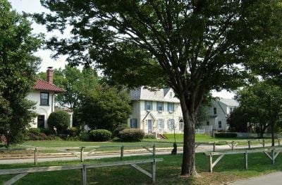
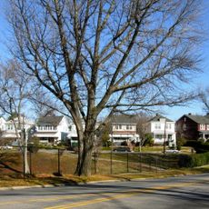
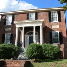
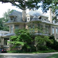
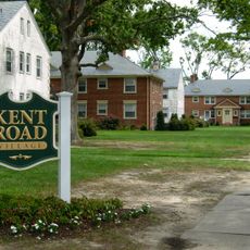
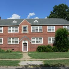
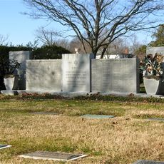
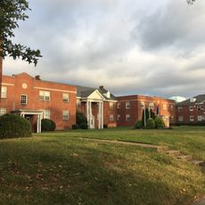
Laburnum Park Historic District is a residential neighborhood with wide, tree-lined avenues and spacious lots where houses sit back from the street with generous distance. The area contains about 226 buildings that show different architectural styles from the early to mid-20th century.

History

The neighborhood developed between 1908 and 1961 as a residential area northwest of Richmond, showing the pattern of suburban growth during that period. This expansion shaped how the district looks and functions today.

Culture

The neighborhood displays residential architecture from different eras, reflecting how homeowners chose to build their houses over several decades. Walking through the streets, you can see how these varied building styles sit side by side along the same tree-lined roads.

Practical

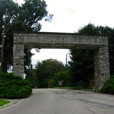
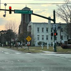
The district is located a few miles northwest of Richmond's center and is bounded by Brook Road, Hermitage Road, Laburnum Avenue, and Westwood Avenue. The wide streets and clear boundaries make it easy to navigate and walk through the area.

Did you know?

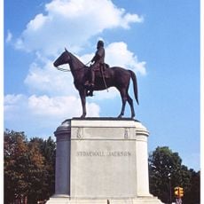
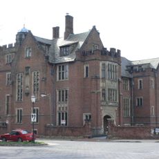
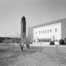
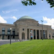
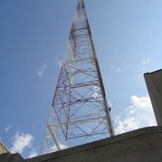
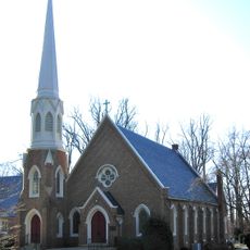
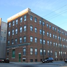
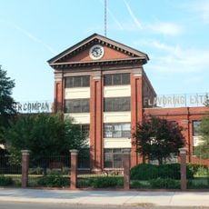
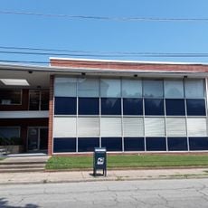
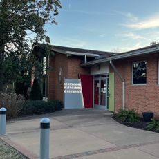
The southern edge of the district features three institutional complexes, including a former hospital and educational facility, each with distinctive architectural styles. These buildings show a shift from classical to modern design approaches across different decades.

Location
GPS coordinates
37.58110,-77.45640
Latest update
December 14, 2025 14:21

AroundUs brings together thousands of curated places, local tips, and hidden gems, enriched daily by 60,000 contributors worldwide. Discover all places nearby (Richmond).

Around this place
Monument Avenue
United States of America

Monument Avenue

3 km
Robert E. Lee Monument
United States of America

Robert E. Lee Monument

3.1 km
Jefferson Davis Monument
United States of America

Jefferson Davis Monument

2.7 km
Stonewall Jackson Statue
United States of America

Stonewall Jackson Statue

2.6 km
Virginia Historical Society
United States of America

Virginia Historical Society

3 km
Pelican
Russian Federation

Pelican

3.1 km
Branch House
United States of America

Branch House

2.8 km
Commodore Matthew Fontaine Maury Monument
United States of America

Commodore Matthew Fontaine Maury Monument

2.6 km
Scott's Addition Historic District
United States of America

Scott's Addition Historic District

2 km
Belgian Building
United States of America

Belgian Building

2.1 km
Science Museum of Virginia
United States of America

Science Museum of Virginia

2.4 km
Bryan Park
United States of America

Bryan Park

2.2 km
WTVR TV Tower
United States of America

WTVR TV Tower

2.4 km
Battery Court Historic District
United States of America

Battery Court Historic District

2.1 km
Columbia
United States of America

Columbia

3.1 km
Emmanuel Church at Brook Hill
United States of America

Emmanuel Church at Brook Hill

2.8 km
Brookland Park Historic District
United States of America

Brookland Park Historic District

808 m
Holly Lawn
United States of America

Holly Lawn

1.1 km
Carver Industrial Historic District
United States of America

Carver Industrial Historic District

3 km
Kent Road Village
United States of America

Kent Road Village

3 km
Chamberlayne Gardens
United States of America

Chamberlayne Gardens

1.7 km
Emek Sholom Holocaust Memorial Cemetery
United States of America

Emek Sholom Holocaust Memorial Cemetery

2 km
West Broad Street Industrial and Commercial Historic District
United States of America

West Broad Street Industrial and Commercial Historic District

2.7 km
Wicker Apartments
United States of America

Wicker Apartments

1.5 km
North Thompson Street Historic District
United States of America

North Thompson Street Historic District

2.6 km
Movieland at Boulevard Square
United States of America

Movieland at Boulevard Square

1.9 km
Ginter Park Historic District
United States of America

Ginter Park Historic District

1.4 km
Ginter Park Library
United States of America

Ginter Park Library

1.8 km
Show the full map
« Laburnum Park Historic District - Historic residential district in Richmond, United States » is provided by Around Us (aroundus.com). Images and texts are derived from Wikimedia project under a Creative Commons license. You are allowed to copy, distribute, and modify copies of this page, under the conditions set by the license, as long as this note is clearly visible.

Discover hidden gems everywhere you go!

From secret cafés to breathtaking viewpoints, skip the crowded tourist spots and find places that match your style. Our app makes it easy with voice search, smart filtering, route optimization, and insider tips from travelers worldwide. Download now for the complete mobile experience.

Around Us App Screenshot

A unique approach to discovering new places

Le Figaro

All the places worth exploring

France Info

A tailor-made excursion in just a few clicks

20 Minutes

Around Us
Travel Guide & Maps
Download

Send to your phone

QR Code
1

Open the camera app on your mobile.

2

Point at the QR code with your camera. A notification will appear.

3

Tap the notification to open the link.