Chest opened
+${chestReward.xp} XP
Explorer
NOUVEAU ×${chestReward.collectible.quantity}
tapez pour fermer
Chest locked

Open chests in the app

Around Us is built for your phone — chests unlock when you walk, explore and capture nearby places.

Enable Location

We need your location to show you interesting places around you

Discover nearby places

Find interesting locations and hidden gems around you

Precise directions

Get accurate directions and distances to places

Your location is never shared with other users. It's only used when you tap the location button.

Log in to your account

Start exploring — it's free

Trusted by 72,880 travelers worldwide

Continue with Google
Continue with Apple
or

We will send you a code to connect

By continuing, you accept our Terms and Conditions and our Privacy Policy

Check your inbox

We've sent a pincode in your inbox. Please enter the code below.

Discussion Reviews Photo
1.1k Popularity

Lugenbeel County, Former administrative county in South Dakota, United States

Lugenbeel County was an administrative territory in South Dakota situated within the Dakota Territory region. After its dissolution, the area was subdivided among neighboring counties, reflecting how administrative boundaries changed during early settlement.

The territory was established in 1875 from unorganized lands and portions of Meyer and Pratt Counties. It remained in operation until its dissolution on June 2, 1909, when its lands were divided among Bennett, Todd, and Mellette Counties.

The area took its name from Pinkney Lugenbeel, a military commander who oversaw operations during the settlement of Dakota Territory. This choice reflected how military leaders shaped early governance and development in the region.

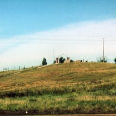
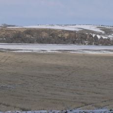
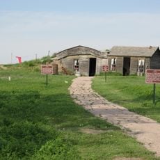
There are no physical structures or boundaries to visit today since this administrative territory no longer exists. Historical information about this former county is accessible through South Dakota state archives and geographic records.

This former territory is still cataloged in the U.S. Geological Survey Geographic Names database under a specific identification number, even though it ceased to exist as an administrative unit generations ago. This archival system helps researchers trace vanished jurisdictions and reconstruct their original boundaries.

The community of curious travelers

AroundUs brings together thousands of curated places, local tips, and hidden gems, enriched daily by 60,000 contributors worldwide.

Start exploring
Location
GPS coordinates
43.14167,-101.68389
Latest update
March 5, 2026 18:17
Around this place
Wall Drug
United States of America

Wall Drug

104.9 km
Minuteman Missile National Historic Site
United States of America

Minuteman Missile National Historic Site

95.9 km
Wounded Knee National Historic Landmark
United States of America

Wounded Knee National Historic Landmark

55.3 km
United States of America

Spade Ranch

98.8 km
Fort Niobrara National Wildlife Refuge
United States of America

Fort Niobrara National Wildlife Refuge

104.8 km
St. Francis Mission
United States of America

St. Francis Mission

63.9 km
Camp Sheridan
United States of America

Camp Sheridan

92.2 km
Lacreek National Wildlife Refuge
United States of America

Lacreek National Wildlife Refuge

9.3 km
Badlands Observatory
United States of America

Badlands Observatory

101.2 km
Prairie Homestead
United States of America

Prairie Homestead

75.6 km
Bryan Bridge
United States of America

Bryan Bridge

100.2 km
Cherry County Courthouse
United States of America

Cherry County Courthouse

96.8 km
Valentine Public School
United States of America

Valentine Public School

97.2 km
Adamson Bridge
United States of America

Adamson Bridge

90.4 km
Borman Bridge
United States of America

Borman Bridge

100 km
Plains Theatre
United States of America

Plains Theatre

78.9 km
Inland Theater
United States of America

Inland Theater

5.6 km
Mt. Moriah Masonic Lodge No. 155
United States of America

Mt. Moriah Masonic Lodge No. 155

78.6 km
Quinn Methodist Church
United States of America

Quinn Methodist Church

100.9 km
Sheridan County Courthouse
United States of America

Sheridan County Courthouse

78.9 km
F.M. Walcott House
United States of America

F.M. Walcott House

96.6 km
Spotted Tail Gravesite
United States of America

Spotted Tail Gravesite

68.4 km
Lee and Gottliebe Fritz House
United States of America

Lee and Gottliebe Fritz House

56.6 km
Wounded Knee cemetery
United States of America

Wounded Knee cemetery

55.3 km
Distrito electoral de Valentine (condado de Cherry, Nebraska)
United States of America

Distrito electoral de Valentine (condado de Cherry, Nebraska)

99.2 km
Ben Reifel Visitor Center
United States of America

Ben Reifel Visitor Center

70.7 km
Minuteman Missile National Historic Site Visitor Center
United States of America

Minuteman Missile National Historic Site Visitor Center

80.2 km
Ancient Hunters Overlook
United States of America

Ancient Hunters Overlook

91.8 km
Show the full map
Reviews
Share your experience

No review yet

Discussions
Start a discussion...

No discussion yet

« Lugenbeel County - Former administrative county in South Dakota, United States » is provided by Around Us (aroundus.com). Images and texts are derived from Wikimedia project under a Creative Commons license. You are allowed to copy, distribute, and modify copies of this page, under the conditions set by the license, as long as this note is clearly visible.

Discover hidden gems everywhere you go!

From secret cafés to breathtaking viewpoints, skip the crowded tourist spots and find places that match your style. Our app makes it easy with voice search, smart filtering, route optimization, and insider tips from travelers worldwide. Download now for the complete mobile experience.

Around Us App Screenshot

A unique approach to discovering new places

Le Figaro

All the places worth exploring

France Info

A tailor-made excursion in just a few clicks

20 Minutes

Around Us
Travel Guide & Maps
Download

Send to your phone

QR Code
1

Open the camera app on your mobile.

2

Point at the QR code with your camera. A notification will appear.

3

Tap the notification to open the link.