Enable Location

We need your location to show you interesting places around you

Discover nearby places

Find interesting locations and hidden gems around you

Precise directions

Get accurate directions and distances to places

Your location is never shared with other users. It's only used when you tap the location button.

Log in to your account

Start exploring — it's free

Trusted by 62,522 travelers worldwide

Continue with Google
Continue with Apple
or

We will send you a code to connect

By continuing, you accept our Terms and Conditions and our Privacy Policy

Check your inbox

We've sent a pincode in your inbox. Please enter the code below.

Foothills Park

Foothills Park, Nature preserve in Palo Alto, United States.

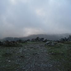
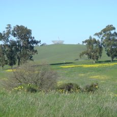
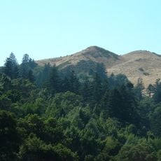
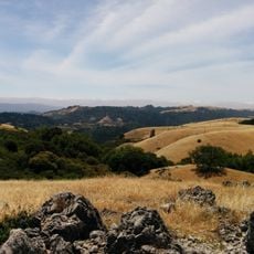
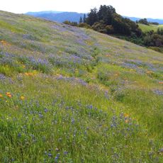
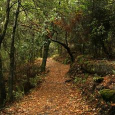
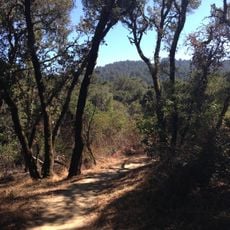
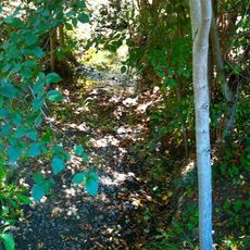
Foothills Park is a 1,400-acre nature preserve in the Santa Cruz Mountains near Palo Alto, featuring woodlands, meadows, and several streams across its terrain. Boronda Lake sits within the park and serves as a focal point along the trail system.

Physician Russel Lee sold the land to Palo Alto in 1958, and the park remained restricted to city residents for decades. The access policy changed in 2020, allowing the broader public to visit.

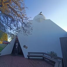
The Nature Interpretive Center teaches visitors about local wildlife and plant life through guided programs throughout the year. People come here to understand how the landscape functions and what makes the Santa Cruz Mountains important for the region's ecology.

The park is open daily, and visitors can explore the grounds on foot or by bicycle. Parking is available, and shaded areas with picnic spots are scattered throughout for comfortable visits.

The property was kept private for many years as a retreat for wealthy residents before opening to the public. This shift from exclusive access to open use represents an unusual change in how the region manages its natural spaces.

The community of curious travelers

AroundUs brings together thousands of curated places, local tips, and hidden gems, enriched daily by 60,000 contributors worldwide.

Start exploring
Location
GPS coordinates
37.35333,-122.18167
Latest update
December 8, 2025 19:52
Around this place
Center for Advanced Study in the Behavioral Sciences
United States of America

Center for Advanced Study in the Behavioral Sciences

7.5 km
Hanna–Honeycomb House
United States of America

Hanna–Honeycomb House

7.2 km
Lou Henry and Herbert Hoover House
United States of America

Lou Henry and Herbert Hoover House

7.3 km
Permanente Quarry

Permanente Quarry

7.3 km
Black Mountain
United States of America

Black Mountain

5 km
Arastradero Preserve
United States of America

Arastradero Preserve

3.8 km
Searsville Dam
United States of America

Searsville Dam

7.8 km
Windy Hill Open Space Preserve
United States of America

Windy Hill Open Space Preserve

3.9 km
Braun Music Center
United States of America

Braun Music Center

7.9 km
Stanford Fire Truck House
United States of America

Stanford Fire Truck House

8 km
Our Lady of the Wayside Church
United States of America

Our Lady of the Wayside Church

5.7 km
Monte Bello Open Space Preserve
United States of America

Monte Bello Open Space Preserve

5.6 km
Russian Ridge Open Space Preserve
United States of America

Russian Ridge Open Space Preserve

4.9 km
United States of America

Old Union Fountain

8.1 km
Palo Alto Stock Farm Horse Barn
United States of America

Palo Alto Stock Farm Horse Barn

7.9 km
Casa De Tableta
United States of America

Casa De Tableta

3.4 km
Los Trancos Open Space Preserve
United States of America

Los Trancos Open Space Preserve

3 km
White Memorial Fountain
United States of America

White Memorial Fountain

8 km
Los Altos History Museum
United States of America

Los Altos History Museum

6.9 km
Roble Hall
United States of America

Roble Hall

7.9 km
Foothill Observatory
United States of America

Foothill Observatory

4.5 km
Paul Shoup House
United States of America

Paul Shoup House

6 km
Thornewood Open Space Preserve
United States of America

Thornewood Open Space Preserve

8 km
Purisima Creek
United States of America

Purisima Creek

5.9 km
Stanford Dish
United States of America

Stanford Dish

6.1 km
MacFarland House
United States of America

MacFarland House

7.2 km
Portola Valley School
United States of America

Portola Valley School

5.3 km
Wilcox Solar Observatory
United States of America

Wilcox Solar Observatory

6.3 km
Show the full map
« Foothills Park - Nature preserve in Palo Alto, United States » is provided by Around Us (aroundus.com). Images and texts are derived from Wikimedia project under a Creative Commons license. You are allowed to copy, distribute, and modify copies of this page, under the conditions set by the license, as long as this note is clearly visible.

Discover hidden gems everywhere you go!

From secret cafés to breathtaking viewpoints, skip the crowded tourist spots and find places that match your style. Our app makes it easy with voice search, smart filtering, route optimization, and insider tips from travelers worldwide. Download now for the complete mobile experience.

Around Us App Screenshot

A unique approach to discovering new places

Le Figaro

All the places worth exploring

France Info

A tailor-made excursion in just a few clicks

20 Minutes

Around Us
Travel Guide & Maps
Download

Send to your phone

QR Code
1

Open the camera app on your mobile.

2

Point at the QR code with your camera. A notification will appear.

3

Tap the notification to open the link.