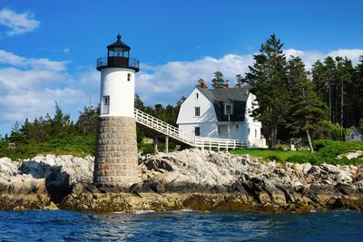
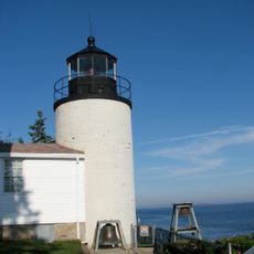
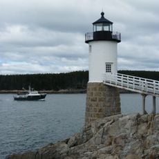
Isle Au Haut, Remote island in Penobscot Bay, Maine.
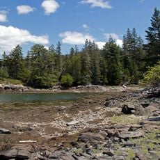
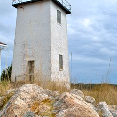
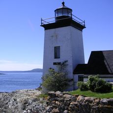
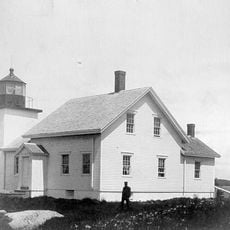
Isle au Haut is an island in Penobscot Bay characterized by rocky granite shorelines, dense forest cover, and salt marshes along its edges. The terrain is hilly and rugged, with the Atlantic Ocean surrounding all sides.
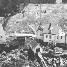
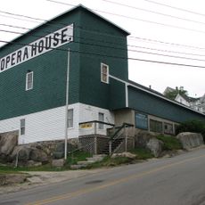
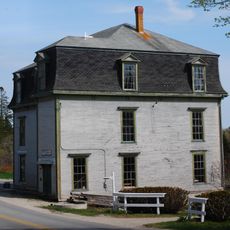
French explorer Samuel de Champlain named the island in 1604 during his coastal explorations. After the American Revolution, farmers and fishermen established permanent settlements and gradually built a community here.
Residents here follow the rhythms of the sea, with fishing families maintaining traditions passed down for generations in these waters.
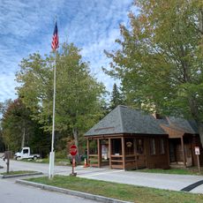
Getting here means taking a passenger ferry from Stonington, which takes about 45 minutes and requires advance booking. Ferry schedules are limited and seasonal, so checking times ahead of your visit is important.
A significant portion of the island belongs to Acadia National Park with roughly 30 kilometers of hiking trails along rocky shores, while the remainder stays privately owned. This split makes it a place where conservation and local life coexist in an unusual arrangement.
Location: Isle au Haut
GPS coordinates: 44.07250,-68.61250
Latest update: December 6, 2025 17:47
Maine offers coastal areas, forest landscapes and many historic sites. The region extends from the Atlantic Ocean to wooded mountains inland. Visitors find state parks like Baxter and Acadia, which provide opportunities for hiking and observing wildlife. The coast is lined with lighthouses, including Pemaquid Point and West Quoddy Head. Islands such as Monhegan and Peaks Island lie offshore. Waterfalls like Screw Auger Falls and Angel Falls draw hikers. Lakes such as Moosehead Lake attract people in warmer months. Old military structures like Fort Gorges remain from earlier centuries. Trails lead through areas like Gulf Hagas and Vaughan Woods. The landscape includes beaches at Roque Bluffs and Reid State Park, where sand meets the ocean. Mountain trails at Tumbledown offer views of surrounding valleys. The Carriage Roads on Mount Desert Island provide paths through forests and along lakeshores. Nature areas like Orono Bog Boardwalk allow close views of wetland plants. These places show the variety of terrain Maine contains, from rocky shores to inland wilderness.
Bass Harbor Head Light
27.6 km
Kragsyde
19.2 km
Deer Isle Bridge
25.3 km
Owls Head Light
34.6 km
Isle Au Haut Light
3.2 km
Holbrook Island Sanctuary State Park
34.7 km
Seawall Campground
30.9 km
Pumpkin Island Light
28.3 km
Browns Head Light
24.1 km
Burnt Coat Harbor Light
14.9 km
Grindel Point Light
35.2 km
Saddleback Ledge Light
11.2 km
Goose Rocks Light
18.8 km
Heron Neck Light
20.7 km
Great Duck Island Light
30.3 km
Blue Hill Bay Light
21.7 km
Eagle Island Light
20.4 km
Winter Harbor Light
28.3 km
Stonington Opera House
10.2 km
St. Mary's-By-The-Sea
35.5 km
Moses Webster House
17.7 km
Brooklin IOOF Hall
21.6 km
Deer Island Thorofare Light
10 km
Union Church of Northeast Harbor
35.6 km
Bass Harbor Memorial Library
27.8 km
Beech Mountain Lookout Tower
34 km
Seawall Campground Ranger Station
30.9 kmReviews
Visited this place? Tap the stars to rate it and share your experience / photos with the community! Try now! You can cancel it anytime.
Discover hidden gems everywhere you go!
From secret cafés to breathtaking viewpoints, skip the crowded tourist spots and find places that match your style. Our app makes it easy with voice search, smart filtering, route optimization, and insider tips from travelers worldwide. Download now for the complete mobile experience.
A unique approach to discovering new places❞
— Le Figaro
All the places worth exploring❞
— France Info
A tailor-made excursion in just a few clicks❞
— 20 Minutes