Enable Location

We need your location to show you interesting places around you

Discover nearby places

Find interesting locations and hidden gems around you

Precise directions

Get accurate directions and distances to places

Your location is never shared with other users. It's only used when you tap the location button.

Isle Au Haut Light

Log in to your account

Start exploring — it's free

Trusted by 61,956 travelers worldwide

Continue with Google
Continue with Apple
or

We will send you a code to connect

By continuing, you accept our Terms and Conditions and our Privacy Policy

Check your inbox

We've sent a pincode in your inbox. Please enter the code below.

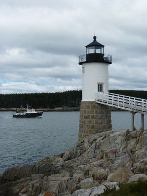
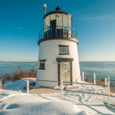
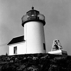
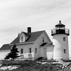
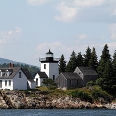
Isle Au Haut Light, Maritime navigation point in Knox County, United States.

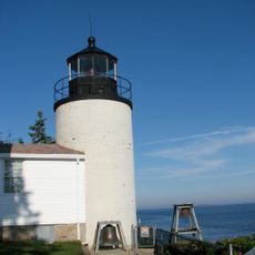
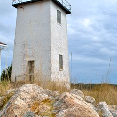
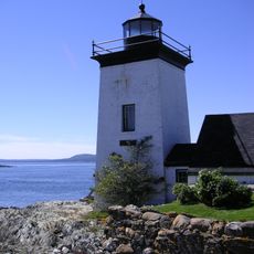
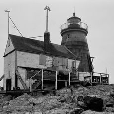
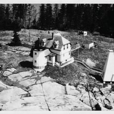
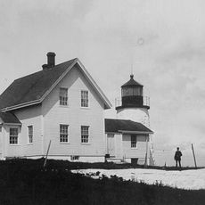
The Isle Au Haut Light is a white cylindrical structure made of granite and brick, standing on a conical granite foundation at Robinson Point. The tower sits on an elevated rocky outcrop and overlooks the waters below with solid, functional construction.

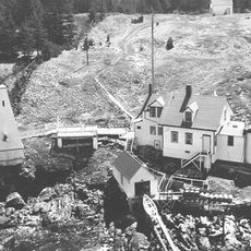
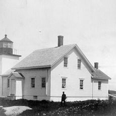
Built in 1907 by the United States Army Corps of Engineers on land purchased from Charles E. Robinson, the light was designed to guide vessels safely. It became part of a wider system of navigation aids that protected ships along Maine's rocky coastline.

The name Isle Au Haut comes from French and means "high island". Locals and visitors recognize this light as a symbol of safe passage along this stretch of the Maine coast.

The light operates with a solar-powered lens system that emits red flashes every four seconds, with a white sector marking the safe shipping channel. The island location means the site is exposed to weather and tidal conditions, so plan your visit accordingly.

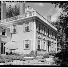
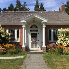
The original light lens is a fourth-order Fresnel lens now housed in the Maine Lighthouse Museum in Rockland. The former keeper's quarters were later converted into a bed and breakfast that operated from 1986 to 2007.

The community of curious travelers

AroundUs brings together thousands of curated places, local tips, and hidden gems, enriched daily by 60,000 contributors worldwide.

Start exploring
Location
Inception
1907
Height
12 m
GPS coordinates
44.06474,-68.65138
Latest update
December 12, 2025 17:43
« Isle Au Haut Light - Maritime navigation point in Knox County, United States » is provided by Around Us (aroundus.com). Images and texts are derived from Wikimedia project under a Creative Commons license. You are allowed to copy, distribute, and modify copies of this page, under the conditions set by the license, as long as this note is clearly visible.

Discover hidden gems everywhere you go!

From secret cafés to breathtaking viewpoints, skip the crowded tourist spots and find places that match your style. Our app makes it easy with voice search, smart filtering, route optimization, and insider tips from travelers worldwide. Download now for the complete mobile experience.

Around Us App Screenshot

A unique approach to discovering new places

Le Figaro

All the places worth exploring

France Info

A tailor-made excursion in just a few clicks

20 Minutes

Around Us
Travel Guide & Maps
Download

Send to your phone

QR Code
1

Open the camera app on your mobile.

2

Point at the QR code with your camera. A notification will appear.

3

Tap the notification to open the link.