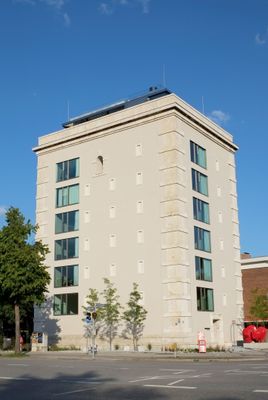
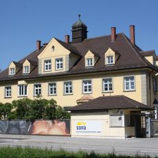
Ungererstraße 158, Civil defense bunker in Schwabing, Germany.
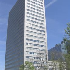
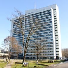
Ungererstraße 158 is a seven-story concrete structure in Schwabing with corner rustication and blind window openings set into its rectangular form. The flat roof and substantial walls reflect its original function as a civil defense installation.
Built in 1943 during World War II, it provided shelter for around 700 civilians during air raids on Munich. After the war, it was converted into residential and commercial space, with a major renovation completed in 2013 that adapted it for modern use.
The structure shapes Schwabing's streetscape with its imposing concrete form, showing how residents and workers now inhabit a former shelter. The conversion has turned it into a neighborhood gathering point where wartime history remains part of daily life.
The structure is clearly visible from the street and accessible for exterior viewing where you can observe its robust construction and details. Keep in mind this is an active residential and commercial building, so access to interior spaces is limited to public or authorized areas only.
The structure faded from public awareness for decades after the war and only regained attention through the 2013 renovation project. This rediscovery reveals how Munich integrates its hidden wartime traces back into the modern fabric of the neighborhood.
The community of curious travelers
AroundUs brings together thousands of curated places, local tips, and hidden gems, enriched daily by 60,000 contributors worldwide.