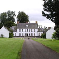
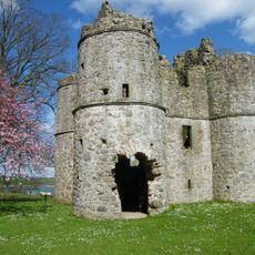
Beaghmore, Bronze Age archaeological site in County Tyrone, Northern Ireland
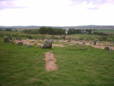
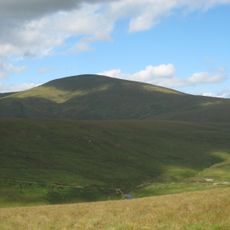
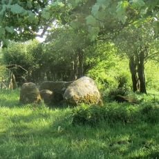
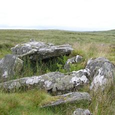
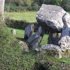
Beaghmore is an archaeological site on the southeastern edge of the Sperrin Mountains that contains seven stone circles, ten alignments of stones, and twelve cairns. The stones are arranged in tight formations, with the largest circle containing approximately 800 small stones.
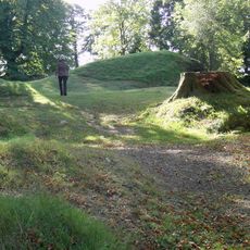
The site was created by Bronze Age farmers between 2900 and 2600 BC and remained hidden for millennia. It was rediscovered in 1930 when peat cutting exposed the stones, leading to investigations that revealed the full extent of the complex.
The name comes from Irish 'an Bheitheach Mhór', meaning this area was once covered with birch trees before early farmers cleared the land. The stones mark a place that held meaning for gatherings and ceremonies in ancient times.
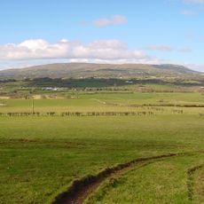
The site sits about 14 kilometers northwest of Cookstown and is freely accessible as a State Care Historic Monument. You can explore the grounds year-round, though the open landscape offers little shelter from weather.
A polished stone axe from the Tievebulliagh factory was found during excavations in one of the cairns, revealing trade connections to distant regions. This discovery shows that the community had links reaching far beyond its immediate surroundings.
Location: County Tyrone
GPS coordinates: 54.70147,-6.93870
Latest update: December 6, 2025 19:10
Northern Ireland tells its story through stones, cliffs, and memories. From the Giant's Causeway to Derry's walls, each place seems filled with stories where Celtic myths, medieval heritage, and traces of the modern world intertwine. Belfast, once an industrial hub turned cultural center, showcases...
Slieve Gallion
11.9 km
Springhill House
18.3 km
Sawel Mountain
14.7 km
Tullyhogue Fort
17.2 km
Lissan House
11.9 km
Castle Caulfield
22.8 km
Aughlish
22.6 km
Parkanaur House
23.3 km
Mullaghcarn
17.7 km
Patrician Hall
13.8 km
Roughan Castle
18.7 km
Tamlaght Dolmen
20.7 km
Portal Tomb von Cloghfin
20.5 km
Clogherny Meenerrigal
22.1 km
Tirnony Dolmen
23.7 km
Straidarran House Clagan Road Claudy Co Londonderry Bt47 4db
23.1 km
Coagh Bridge Over Ballinderry River At S End Of Bridgend Road Cookstown Co Londonderry
21.3 km
St Mary's Roman Catholic Church 7 Cavanakeeran Road Pomeroy Dungannon Co Tyrone
11.9 km
Dungannon Library
24.5 km
Holy Trinity Roman Catholic Church Chapel Street Cookstown Bt80 8qb
14.1 km
St. Columba's Church Draperstown Magherafelt Co.londonderry
14.4 km
St. Swithins Church Church St. Magherafelt Co.londonderry
22.4 km
Wellbrook Beetling Mill
8.2 km
St Luran's Church Of Ireland Church 96 Church Street Cookstown Co Tyrone Bt80 8hx
14.5 km
Banagher Old Church
22.4 km
Former Bank of Ireland aka Ranfurly House 26 Market Square Dungannon, Co. Tyrone
24.5 km
Court House, Union Road Magherafelt Co.londonderry
22 km
St. Michael's Church Castlecaulfield Dungannon Co.tyrone
22.4 kmVisited this place? Tap the stars to rate it and share your experience / photos with the community! Try now! You can cancel it anytime.
Discover hidden gems everywhere you go!
From secret cafés to breathtaking viewpoints, skip the crowded tourist spots and find places that match your style. Our app makes it easy with voice search, smart filtering, route optimization, and insider tips from travelers worldwide. Download now for the complete mobile experience.
A unique approach to discovering new places❞
— Le Figaro
All the places worth exploring❞
— France Info
A tailor-made excursion in just a few clicks❞
— 20 Minutes