Enable Location

We need your location to show you interesting places around you

Discover nearby places

Find interesting locations and hidden gems around you

Precise directions

Get accurate directions and distances to places

Your location is never shared with other users. It's only used when you tap the location button.

Nagara Bridge, Osaka

Log in to your account

Start exploring — it's free

Trusted by 62,946 travelers worldwide

Continue with Google
Continue with Apple
or

We will send you a code to connect

By continuing, you accept our Terms and Conditions and our Privacy Policy

Check your inbox

We've sent a pincode in your inbox. Please enter the code below.

Nagara Bridge, Osaka
Discussion Reviews 1 Photos
12.2k Popularity

Nagara Bridge, Osaka, Arch bridge in Kita-ku, Japan

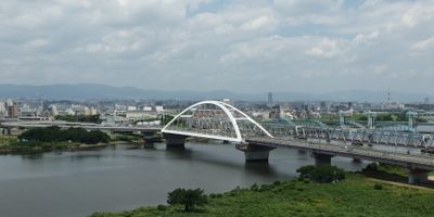
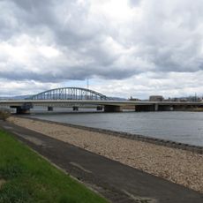
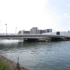
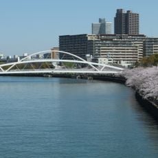
Nagara Bridge is a concrete arch structure spanning 656 meters across the Yodo River with a width of 20 meters. It employs the Nielsen-Lohse arch design and connects the districts of Kita and Higashiyodogawa while serving both vehicles and pedestrians.

A wooden bridge stood at this location starting in 812 during Emperor Saga's reign, serving as an early crossing point. The original structure was destroyed by flooding within 40 years, establishing this spot as a challenging place to build.

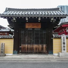
The bridge carries stories of local struggles with natural disasters and human loss that shaped the community's memory. A Buddhist statue at its southern end honors those affected by floods and wartime tragedy, inviting visitors to pause and reflect.

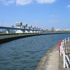
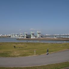
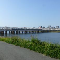
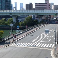
The structure forms part of Route 14 between Osaka and Kyoto and provides pedestrians with a dedicated pathway alongside vehicle traffic. The best views of the arch structure are available from the river banks below, where visitors can also rest briefly.

The current structure was completed in 1983 with a maximum span of 153 meters, representing a notable engineering solution for its time. This design successfully overcame the site's historical challenges with flooding and created a lasting crossing point.

The community of curious travelers

AroundUs brings together thousands of curated places, local tips, and hidden gems, enriched daily by 60,000 contributors worldwide.

Start exploring
Location
Location
Inception
March 1983
Length
655.6 m
Width
20 m
GPS coordinates
34.72117,135.51003
Latest update
December 7, 2025 20:46
Reviews
Share your experience

No review yet

Discussions
Start a discussion...

No discussion yet

« Nagara Bridge, Osaka - Arch bridge in Kita-ku, Japan » is provided by Around Us (aroundus.com). Images and texts are derived from Wikimedia project under a Creative Commons license. You are allowed to copy, distribute, and modify copies of this page, under the conditions set by the license, as long as this note is clearly visible.

Discover hidden gems everywhere you go!

From secret cafés to breathtaking viewpoints, skip the crowded tourist spots and find places that match your style. Our app makes it easy with voice search, smart filtering, route optimization, and insider tips from travelers worldwide. Download now for the complete mobile experience.

Around Us App Screenshot

A unique approach to discovering new places

Le Figaro

All the places worth exploring

France Info

A tailor-made excursion in just a few clicks

20 Minutes

Around Us
Travel Guide & Maps
Download

Send to your phone

QR Code
1

Open the camera app on your mobile.

2

Point at the QR code with your camera. A notification will appear.

3

Tap the notification to open the link.