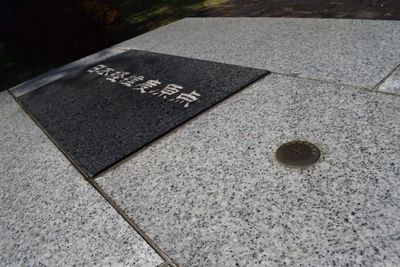
Geodetic Datum Origin of Japan, Geodetic station in Azabudai, Japan
The Geodetic Datum Origin of Japan sits in a small park marked by a metal plate that indicates the starting point for all longitude and latitude measurements across the country. The location contains documented information about the precise coordinates and the geodetic reference system's development.
The site originally housed the Tokyo Astronomical Observatory with a meridian circle instrument until the Great Kanto earthquake of 1923 destroyed the structure. Following this destruction, the location was established as the nation's geodetic reference system.
This point represents Japan's commitment to mapping accuracy and serves as the reference for all national surveys. The simple marker in the park shows how important precise measurements are for the country's infrastructure.
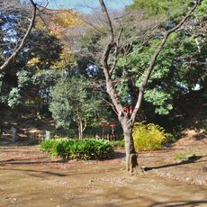
The site is easily accessible and located within a public park where visitors can clearly see the metal marker. The best time to visit is during daylight hours when the surroundings are well-lit and the park is open.
The metal marker has shifted 27 centimeters eastward due to seismic activity while maintaining its original latitude position. This movement documents the region's earthquake history and shows how the ground beneath Tokyo has actually moved.
The community of curious travelers
AroundUs brings together thousands of curated places, local tips, and hidden gems, enriched daily by 60,000 contributors worldwide.