Grist Mill Covered Bridge

Log in to your account

AroundUs is a community-driven map of interesting places, built by curious explorers like you. It grows with every review, story, and photo you share.
Connect to save your favorite spots, contribute locations, and create personalized routes.
Continue with Google
Continue with Apple
Continue with X
Continue with Facebook
Continue with email
By continuing, you accept our Terms and Conditions and our Privacy Policy
Create an account
Add to collection
Map
Suggest a change
Share

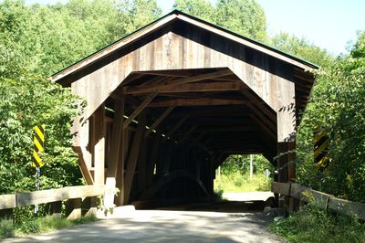
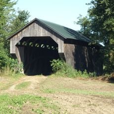
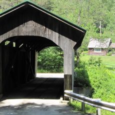
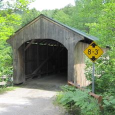
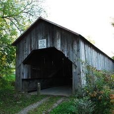
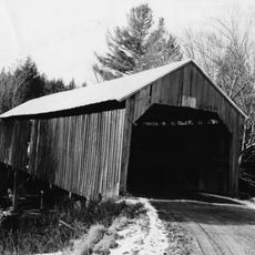
Grist Mill Covered Bridge, 19th century covered bridge in Jeffersonville, United States

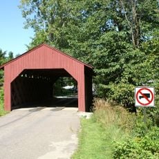
The Grist Mill Covered Bridge is a wooden structure spanning the Brewster River with a single traffic lane. Its long side walls feature rectangular window cutouts, and the red exterior is typical of this bridge type.

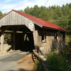
This structure was built in 1872 using the Burr arch truss system, a common design of that era. It was added to the National Register of Historic Places in 1974 and remains one of three covered bridges still standing in Cambridge.

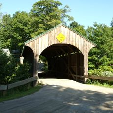
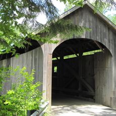
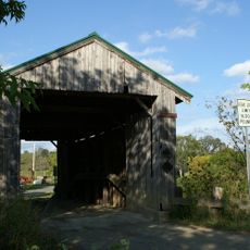
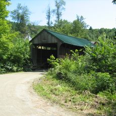
The bridge reflects Vermont's rural heritage and shows how communities crossed rivers during the 1800s. Visitors can see the traditional craftsmanship and engineering methods that were typical for structures of this kind.

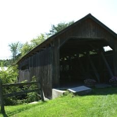
Visitors can find parking at Brewster River Park and walk to the bridge for a closer look at its structure. The site is accessible on foot, and there is enough space to take time examining the wooden construction up close.

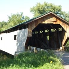
The structure is known by four different names: Grist Mill, Bryant, Canyon, and Scott Bridge, with each reflecting different local features. This variety shows how rural bridges often received multiple designations based on nearby mills, owners, or geographical landmarks.

Location: Cambridge

GPS coordinates: 44.63667,-72.82500

Latest update: December 14, 2025 14:43

Photos
Around this place
Mount Mansfield
United States of America

Mount Mansfield

10.4 km
Long Trail
United States of America

Long Trail

11.2 km
Smugglers' Notch State Park
United States of America

Smugglers' Notch State Park

9.5 km
Mount Mansfield State Forest
United States of America

Mount Mansfield State Forest

16.1 km
Gates Farm Covered Bridge
United States of America

Gates Farm Covered Bridge

3.9 km
Underhill State Park
United States of America

Underhill State Park

11.8 km
Church Street Covered Bridge
United States of America

Church Street Covered Bridge

7.3 km
Poland Covered Bridge
United States of America

Poland Covered Bridge

1.8 km
Morgan Covered Bridge
United States of America

Morgan Covered Bridge

14.1 km
St. Thomas Church
United States of America

St. Thomas Church

15.6 km
Montgomery Covered Bridge
United States of America

Montgomery Covered Bridge

8 km
Cambridge Meetinghouse
United States of America

Cambridge Meetinghouse

898 m
Maple Street Covered Bridge
United States of America

Maple Street Covered Bridge

15 km
Power House Covered Bridge
United States of America

Power House Covered Bridge

12.2 km
Browns River Covered Bridge
United States of America

Browns River Covered Bridge

14.8 km
Mill Covered Bridge
United States of America

Mill Covered Bridge

13.7 km
East Fairfield Covered Bridge
United States of America

East Fairfield Covered Bridge

16.9 km
St. George's Catholic Church
United States of America

St. George's Catholic Church

16.2 km
Scribner Covered Bridge
United States of America

Scribner Covered Bridge

14 km
Jeffersonville Bridge
United States of America

Jeffersonville Bridge

1.5 km
Fletcher Union Church
United States of America

Fletcher Union Church

8.6 km
Waterman Covered Bridge
United States of America

Waterman Covered Bridge

11.6 km
Nye Block
United States of America

Nye Block

11.4 km
Jaynes Covered Bridge
United States of America

Jaynes Covered Bridge

10 km
Bridge 6
United States of America

Bridge 6

11.1 km
District No. 5 Schoolhouse
United States of America

District No. 5 Schoolhouse

15.3 km
Waterville Village Historic District
United States of America

Waterville Village Historic District

7.4 km
Jeffersonville Historic District
United States of America

Jeffersonville Historic District

971 m
Show the full map
Reviews

Visited this place? Tap the stars to rate it and share your experience / photos with the community! Try now! You can cancel it anytime.

« Grist Mill Covered Bridge - 19th century covered bridge in Jeffersonville, United States » is provided by Around Us (aroundus.com). Images and texts are derived from Wikimedia project under a Creative Commons license. You are allowed to copy, distribute, and modify copies of this page, under the conditions set by the license, as long as this note is clearly visible.

Discover hidden gems everywhere you go!

From secret cafés to breathtaking viewpoints, skip the crowded tourist spots and find places that match your style. Our app makes it easy with voice search, smart filtering, route optimization, and insider tips from travelers worldwide. Download now for the complete mobile experience.

Around Us App Screenshot

A unique approach to discovering new places

Le Figaro

All the places worth exploring

France Info

A tailor-made excursion in just a few clicks

20 Minutes