Enable Location

We need your location to show you interesting places around you

Discover nearby places

Find interesting locations and hidden gems around you

Precise directions

Get accurate directions and distances to places

Your location is never shared with other users. It's only used when you tap the location button.

Mount Mansfield

Log in to your account

Start exploring — it's free

Trusted by 61,887 travelers worldwide

Continue with Google
Continue with Apple
or

We will send you a code to connect

By continuing, you accept our Terms and Conditions and our Privacy Policy

Check your inbox

We've sent a pincode in your inbox. Please enter the code below.

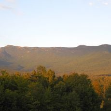
Mount Mansfield, Mountain peak in Underhill, US.

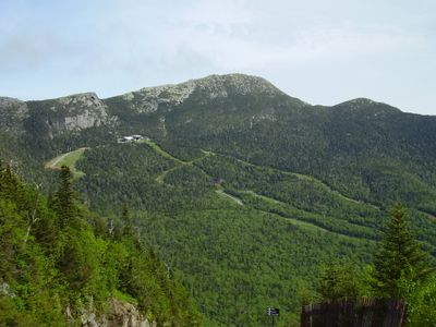
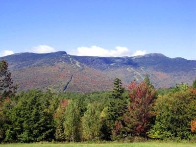
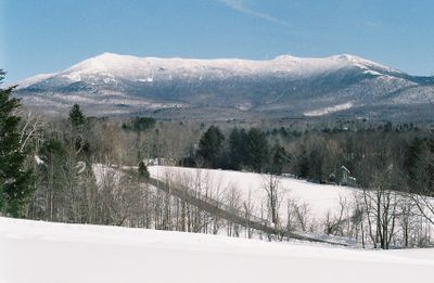
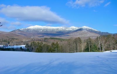
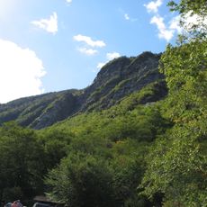
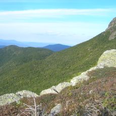
Mount Mansfield rises to 4,393 feet (1,339 meters) as the tallest summit in Vermont and shows a ridgeline that looks like a reclining human profile. The alpine tundra near the top shelters plant species that have grown here since the Ice Age and appear nowhere else outside arctic regions.

The summit received its name in the 18th century after the Mansfield family, who were early settlers in the region. The Civilian Conservation Corps built a dam on the Little River below the mountain during the 1930s that generates power and controls flooding.

The ridgeline carries names like The Forehead, The Nose, and The Chin because it resembles a human face when seen from the side. Hikers use these landmarks today to locate their position on the mountain and plan their route.

A toll road runs from Stowe Base Lodge up to a point called The Nose, where hiking trails continue the rest of the climb. The road typically opens from May through October, depending on snow and weather conditions at higher elevations.

Over 36 miles (58 kilometers) of snowmobile trails wind through the forested slopes around the mountain and connect three separate state parks. Two Nordic ski centers use the terrain in winter for cross-country skiing and touring.

The community of curious travelers

AroundUs brings together thousands of curated places, local tips, and hidden gems, enriched daily by 60,000 contributors worldwide.

Start exploring
Location
Elevation above the sea
1,339.69 m
GPS coordinates
44.54395,-72.81431
Latest update
December 13, 2025 19:06
Around this place
Long Trail
United States of America

Long Trail

1.5 km
Gold Brook Covered Bridge
United States of America

Gold Brook Covered Bridge

15.7 km
Smugglers' Notch State Park
United States of America

Smugglers' Notch State Park

1.8 km
Vermont Ski and Snowboard Museum
United States of America

Vermont Ski and Snowboard Museum

11.7 km
Mount Mansfield State Forest
United States of America

Mount Mansfield State Forest

5.8 km
Galusha House
United States of America

Galusha House

15.2 km
Gates Farm Covered Bridge
United States of America

Gates Farm Covered Bridge

12.2 km
Underhill State Park
United States of America

Underhill State Park

2.1 km
Grist Mill Covered Bridge
United States of America

Grist Mill Covered Bridge

10.4 km
Red Covered Bridge
United States of America

Red Covered Bridge

11.2 km
Church Street Covered Bridge
United States of America

Church Street Covered Bridge

16.6 km
Poland Covered Bridge
United States of America

Poland Covered Bridge

11.9 km
St. Thomas Church
United States of America

St. Thomas Church

8 km
Old Red Mill and Mill House
United States of America

Old Red Mill and Mill House

15.4 km
Stowe Village Historic District
United States of America

Stowe Village Historic District

13.4 km
Wilson Alwyn "Snowflake" Bentley House
United States of America

Wilson Alwyn "Snowflake" Bentley House

14 km
Cambridge Meetinghouse
United States of America

Cambridge Meetinghouse

11.1 km
Power House Covered Bridge
United States of America

Power House Covered Bridge

15.3 km
The Current
United States of America

The Current

13.6 km
Jeffersonville Bridge
United States of America

Jeffersonville Bridge

11.8 km
Waterman Covered Bridge
United States of America

Waterman Covered Bridge

12.6 km
Nye Block
United States of America

Nye Block

14.6 km
Lamoille County Courthouse
United States of America

Lamoille County Courthouse

16.5 km
Jericho Center Historic District
United States of America

Jericho Center Historic District

15 km
Bridge 6
United States of America

Bridge 6

14.4 km
Jericho Village Historic District
United States of America

Jericho Village Historic District

15.2 km
District No. 5 Schoolhouse
United States of America

District No. 5 Schoolhouse

7.5 km
Waterville Village Historic District
United States of America

Waterville Village Historic District

16.7 km
Show the full map
« Mount Mansfield - Mountain peak in Underhill, US » is provided by Around Us (aroundus.com). Images and texts are derived from Wikimedia project under a Creative Commons license. You are allowed to copy, distribute, and modify copies of this page, under the conditions set by the license, as long as this note is clearly visible.

Discover hidden gems everywhere you go!

From secret cafés to breathtaking viewpoints, skip the crowded tourist spots and find places that match your style. Our app makes it easy with voice search, smart filtering, route optimization, and insider tips from travelers worldwide. Download now for the complete mobile experience.

Around Us App Screenshot

A unique approach to discovering new places

Le Figaro

All the places worth exploring

France Info

A tailor-made excursion in just a few clicks

20 Minutes

Around Us
Travel Guide & Maps
Download

Send to your phone

QR Code
1

Open the camera app on your mobile.

2

Point at the QR code with your camera. A notification will appear.

3

Tap the notification to open the link.