Enable Location

We need your location to show you interesting places around you

Discover nearby places

Find interesting locations and hidden gems around you

Precise directions

Get accurate directions and distances to places

Your location is never shared with other users. It's only used when you tap the location button.

Stowe Village Historic District

Log in to your account

Start exploring — it's free

Trusted by 62,461 travelers worldwide

Continue with Google
Continue with Apple
or

We will send you a code to connect

By continuing, you accept our Terms and Conditions and our Privacy Policy

Check your inbox

We've sent a pincode in your inbox. Please enter the code below.

Stowe Village Historic District, historic district in Vermont, United States

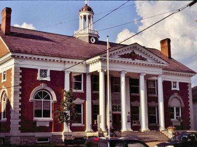
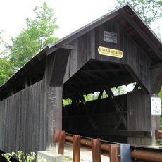
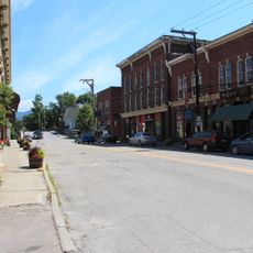
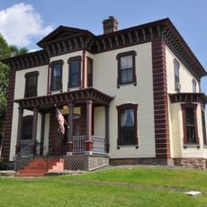
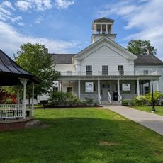
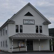
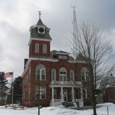
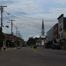
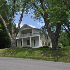
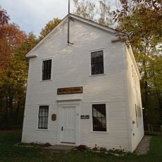
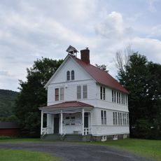
Stowe Village Historic District is a roughly 153-acre area with historic buildings and streets forming the village center in Stowe, Vermont. The streets are lined with structures from the 1800s, mostly wood-frame with some brick buildings, displaying various styles from that period alongside two town halls from 1818 and 1902.

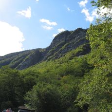
The area was established in the early 1800s when a tavern was built in 1811, making it a business hub. In the 1800s, roads to the mountains were constructed, attracting wealthy visitors and leading to the construction of the Mount Mansfield Hotel in 1864, which helped transform the area into a resort destination.

The district reflects how a community keeps its past alive through daily use. Historic buildings serve as homes, shops, and gathering places where people maintain simple habits of walking, greeting neighbors, and marking the seasons together.

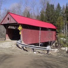
The district is located at the intersection of Vermont Routes 100 and 108 and is best explored on foot since traffic is light. Walking is the comfortable way to view the buildings and streets, as structures are closely spaced and pathways are accessible throughout the area.

The Green Mountain Inn from 1833 stands out as a brick Federal-style building amid predominantly wood-frame structures. This brick exception reveals the architectural diversity of the village and was built to be a landmark during the town's early growth as a gathering place.

The community of curious travelers

AroundUs brings together thousands of curated places, local tips, and hidden gems, enriched daily by 60,000 contributors worldwide.

Start exploring
Location
GPS coordinates
44.46611,-72.68583
Latest update
February 9, 2026 07:44
Around this place
Mount Mansfield
United States of America

Mount Mansfield

13.4 km
Long Trail
United States of America

Long Trail

11.9 km
Gold Brook Covered Bridge
United States of America

Gold Brook Covered Bridge

2.9 km
Smugglers' Notch State Park
United States of America

Smugglers' Notch State Park

13.1 km
Vermont Ski and Snowboard Museum
United States of America

Vermont Ski and Snowboard Museum

1.7 km
Mount Mansfield State Forest
United States of America

Mount Mansfield State Forest

10.9 km
Elmore State Park
United States of America

Elmore State Park

13.9 km
Little River State Park
United States of America

Little River State Park

10.7 km
Peoples Academy
United States of America

Peoples Academy

13.2 km
Underhill State Park
United States of America

Underhill State Park

13.7 km
Red Covered Bridge
United States of America

Red Covered Bridge

5.9 km
Waterbury Village Historic District
United States of America

Waterbury Village Historic District

15.6 km
St. Thomas Church
United States of America

St. Thomas Church

17.7 km
Green Mountain Seminary
United States of America

Green Mountain Seminary

10.2 km
Colby Mansion
United States of America

Colby Mansion

13.7 km
Middlesex–Winooski River Bridge
United States of America

Middlesex–Winooski River Bridge

17.8 km
The Current
United States of America

The Current

262 m
Waterman Covered Bridge
United States of America

Waterman Covered Bridge

15.9 km
Worcester Town Hall
United States of America

Worcester Town Hall

15 km
Lamoille River Route 15-A Bridge
United States of America

Lamoille River Route 15-A Bridge

14.4 km
Lamoille County Courthouse
United States of America

Lamoille County Courthouse

15.1 km
Morrisville Historic District
United States of America

Morrisville Historic District

12.7 km
Winooski Street Bridge
United States of America

Winooski Street Bridge

15.4 km
Mill Village Historic District (Vermont)
United States of America

Mill Village Historic District (Vermont)

14.6 km
Bridge 6
United States of America

Bridge 6

18.7 km
District No. 5 Schoolhouse
United States of America

District No. 5 Schoolhouse

17.3 km
Worcester Village School
United States of America

Worcester Village School

15.1 km
Lake Elmore
United States of America

Lake Elmore

14.8 km
Show the full map
« Stowe Village Historic District - historic district in Vermont, United States » is provided by Around Us (aroundus.com). Images and texts are derived from Wikimedia project under a Creative Commons license. You are allowed to copy, distribute, and modify copies of this page, under the conditions set by the license, as long as this note is clearly visible.

Discover hidden gems everywhere you go!

From secret cafés to breathtaking viewpoints, skip the crowded tourist spots and find places that match your style. Our app makes it easy with voice search, smart filtering, route optimization, and insider tips from travelers worldwide. Download now for the complete mobile experience.

Around Us App Screenshot

A unique approach to discovering new places

Le Figaro

All the places worth exploring

France Info

A tailor-made excursion in just a few clicks

20 Minutes

Around Us
Travel Guide & Maps
Download

Send to your phone

QR Code
1

Open the camera app on your mobile.

2

Point at the QR code with your camera. A notification will appear.

3

Tap the notification to open the link.