Enable Location

We need your location to show you interesting places around you

Discover nearby places

Find interesting locations and hidden gems around you

Precise directions

Get accurate directions and distances to places

Your location is never shared with other users. It's only used when you tap the location button.

Waterbury Village Historic District

Log in to your account

Start exploring — it's free

Trusted by 61,343 travelers worldwide

Continue with Google
Continue with Apple
or

We will send you a code to connect

By continuing, you accept our Terms and Conditions and our Privacy Policy

Check your inbox

We've sent a pincode in your inbox. Please enter the code below.

Waterbury Village Historic District, Historic district in Waterbury, Vermont, United States.

Description

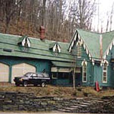
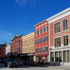
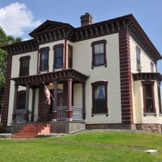
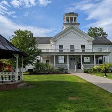
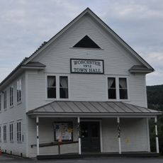
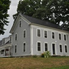
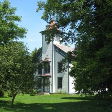
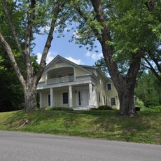
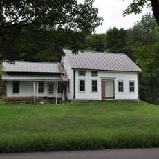
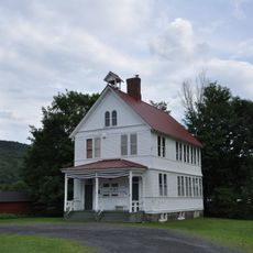
Waterbury Village Historic District is a neighborhood in Waterbury, Vermont, that spreads along Main Street and Stowe Street with commercial buildings and homes built in different styles across many decades. The structures range from early trading areas to later public buildings, showing how architecture changed as the town developed.

History

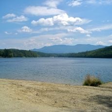
The area started as an early settlement near the Winooski River around 1770, but only became a real business center after Main Street was built in the 1790s. This street became the backbone of the town and later attracted mills and commerce.

Culture

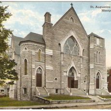
Churches, shops, and homes in the district show how the town grew and changed over time through the choices and needs of its residents. Walking through, you notice how different generations left their mark on the buildings and shaped the community.

Practical

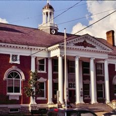
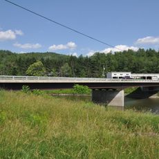
The district is easy to reach via United States Route 2 and simple to explore since it mainly follows two main streets. Key landmarks like the old railroad station and the state office complex at the southern end help you find your way around.

Did you know?

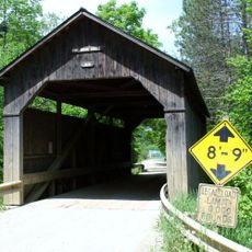
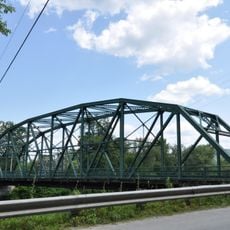
Thatcher Branch stream once powered the mills and factories that grew along Stowe Street and shaped how the district is laid out. Without this water power advantage, the area would look completely different today.

Location
GPS coordinates
44.33500,-72.75472
Latest update
December 14, 2025 18:07

AroundUs brings together thousands of curated places, local tips, and hidden gems, enriched daily by 60,000 contributors worldwide. Discover all places nearby (Waterbury).

Around this place
Camel's Hump
United States of America

Camel's Hump

10.6 km
Vermont State House
United States of America

Vermont State House

16.1 km
Gold Brook Covered Bridge
United States of America

Gold Brook Covered Bridge

13.1 km
The Pavilion
United States of America

The Pavilion

16.2 km
Hubbard Park
United States of America

Hubbard Park

16 km
Vermont Ski and Snowboard Museum
United States of America

Vermont Ski and Snowboard Museum

16.2 km
Little River State Park
United States of America

Little River State Park

6.2 km
Christ Episcopal Church
United States of America

Christ Episcopal Church

16.3 km
Saint Augustine Church, Montpelier
United States of America

Saint Augustine Church, Montpelier

16.6 km
Montpelier City Hall
United States of America

Montpelier City Hall

16.6 km
Athenwood and the Thomas W. Wood Studio
United States of America

Athenwood and the Thomas W. Wood Studio

16.6 km
Pine Brook Covered Bridge
United States of America

Pine Brook Covered Bridge

14.7 km
Montpelier Historic District
United States of America

Montpelier Historic District

16.4 km
Stowe Village Historic District
United States of America

Stowe Village Historic District

15.6 km
Honey Hollow Camp
United States of America

Honey Hollow Camp

13.1 km
Green Mountain Seminary
United States of America

Green Mountain Seminary

5.6 km
Colby Mansion
United States of America

Colby Mansion

1.9 km
Middlesex–Winooski River Bridge
United States of America

Middlesex–Winooski River Bridge

5.6 km
The Current
United States of America

The Current

15.4 km
Worcester Town Hall
United States of America

Worcester Town Hall

16.8 km
Mad River Valley Rural Historic District
United States of America

Mad River Valley Rural Historic District

13 km
Jonesville Academy
United States of America

Jonesville Academy

15.5 km
Winooski Street Bridge
United States of America

Winooski Street Bridge

884 m
Mill Village Historic District (Vermont)
United States of America

Mill Village Historic District (Vermont)

1.1 km
Preston-Lafreniere Farm
United States of America

Preston-Lafreniere Farm

12.9 km
Worcester Village School
United States of America

Worcester Village School

16.9 km
Waitsfield Common Historic District
United States of America

Waitsfield Common Historic District

16.7 km
Capitol Theatre
United States of America

Capitol Theatre

16.3 km
Show the full map
« Waterbury Village Historic District - Historic district in Waterbury, Vermont, United States » is provided by Around Us (aroundus.com). Images and texts are derived from Wikimedia project under a Creative Commons license. You are allowed to copy, distribute, and modify copies of this page, under the conditions set by the license, as long as this note is clearly visible.

Discover hidden gems everywhere you go!

From secret cafés to breathtaking viewpoints, skip the crowded tourist spots and find places that match your style. Our app makes it easy with voice search, smart filtering, route optimization, and insider tips from travelers worldwide. Download now for the complete mobile experience.

Around Us App Screenshot

A unique approach to discovering new places

Le Figaro

All the places worth exploring

France Info

A tailor-made excursion in just a few clicks

20 Minutes

Around Us
Travel Guide & Maps
Download

Send to your phone

QR Code
1

Open the camera app on your mobile.

2

Point at the QR code with your camera. A notification will appear.

3

Tap the notification to open the link.