Chest opened
+${chestReward.xp} XP
Explorer
NOUVEAU ×${chestReward.collectible.quantity}
tapez pour fermer

See the monuments around you in AR Open chests in the app

Around Us is built for your phone — point your camera at the streets and discover the monuments and places around you in augmented reality. Around Us is built for your phone — chests unlock when you walk, explore and capture nearby places.

Enable Location

We need your location to show you interesting places around you

Discover nearby places

Find interesting locations and hidden gems around you

Precise directions

Get accurate directions and distances to places

Your location is never shared with other users. It's only used when you tap the location button.

Red Covered Bridge

Log in to your account

Start exploring — it's free

Trusted by 86,785 travelers worldwide

Continue with Google
Continue with Apple
or

We will send you a code to connect

By continuing, you accept our Terms and Conditions and our Privacy Policy

Check your inbox

We've sent a pincode in your inbox. Please enter the code below.

Discussion Reviews 1 Photos
1.4k Popularity

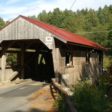
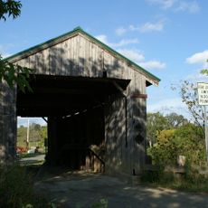
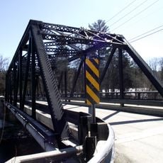
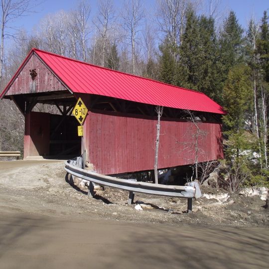
Red Covered Bridge, Covered bridge in Morristown, Vermont, United States.

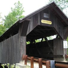
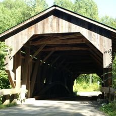
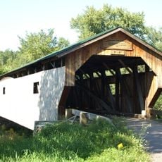
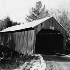
Red Covered Bridge crosses Sterling Brook with a span of about 64 feet, displaying vertical wood siding and a traditional red metal roof. The structure employs a queen post truss design that was typical for bridges built during that period.

The bridge was built in 1896 and remains the only surviving 19th-century bridge in Morristown. It gained National Register of Historic Places status in 1974.

Vermont contains more than 100 covered bridges, with the Red Covered Bridge representing a significant example of late 19th-century engineering and construction methods.

The bridge sits at the junction of Cole Hill Road, Sterling Valley Road, and Moren Loop with a single lane about 15 feet wide for vehicles. Access is limited to standard-size vehicles, and visitors should be aware of local road conditions.

The bridge floor contains twelve layers of planking, and the north abutment rests partially on a natural granite outcrop, showing how builders made use of existing geological features. This clever approach to construction often goes unnoticed by visitors.

The community of curious travelers

AroundUs brings together thousands of curated places, local tips, and hidden gems, enriched daily by 60,000 contributors worldwide.
Start exploring
Location
GPS coordinates
44.51861,-72.67778
Latest update
September 11, 2026 22:36
Around this place
Mount Mansfield
United States of America

Mount Mansfield

7 mi
Long Trail
United States of America

Long Trail

6 mi
Gold Brook Covered Bridge
United States of America

Gold Brook Covered Bridge

5.4 mi
Smugglers' Notch State Park
United States of America

Smugglers' Notch State Park

6.3 mi
Vermont Ski and Snowboard Museum
United States of America

Vermont Ski and Snowboard Museum

3.2 mi
Mount Mansfield State Forest
United States of America

Mount Mansfield State Forest

7.2 mi
Elmore State Park
United States of America

Elmore State Park

6.9 mi
Little River State Park
United States of America

Little River State Park

9.9 mi
Peoples Academy
United States of America

Peoples Academy

5.3 mi
Underhill State Park
United States of America

Underhill State Park

7.7 mi
Grist Mill Covered Bridge
United States of America

Grist Mill Covered Bridge

10.9 mi
Green River Reservoir State Park
United States of America

Green River Reservoir State Park

10.3 mi
Poland Covered Bridge
United States of America

Poland Covered Bridge

11.4 mi
St. Thomas Church
United States of America

St. Thomas Church

11 mi
Stowe Village Historic District
United States of America

Stowe Village Historic District

3.7 mi
Power House Covered Bridge
United States of America

Power House Covered Bridge

8.1 mi
Green Mountain Seminary
United States of America

Green Mountain Seminary

10 mi
United States of America

The Current

3.8 mi
Scribner Covered Bridge
United States of America

Scribner Covered Bridge

8.4 mi
Waterman Covered Bridge
United States of America

Waterman Covered Bridge

6.3 mi
Nye Block
United States of America

Nye Block

8.1 mi
Lamoille River Route 15-A Bridge
United States of America

Lamoille River Route 15-A Bridge

6.3 mi
Lamoille County Courthouse
United States of America

Lamoille County Courthouse

5.9 mi
Morrisville Historic District
United States of America

Morrisville Historic District

4.9 mi
Bridge 6
United States of America

Bridge 6

8 mi
District No. 5 Schoolhouse
United States of America

District No. 5 Schoolhouse

10.8 mi
Jeffersonville Historic District
United States of America

Jeffersonville Historic District

11.5 mi
Lake Elmore
United States of America

Lake Elmore

7.6 mi
Show the full map
Reviews
Share your experience

No review yet

Discussions
Start a discussion...

No discussion yet

« Red Covered Bridge - Covered bridge in Morristown, Vermont, United States » is provided by Around Us (aroundus.com). Images and texts are derived from Wikimedia project under a Creative Commons license. You are allowed to copy, distribute, and modify copies of this page, under the conditions set by the license, as long as this note is clearly visible.

Discover hidden gems everywhere you go!

From secret cafés to breathtaking viewpoints, skip the crowded tourist spots and find places that match your style. Our app makes it easy with voice search, smart filtering, route optimization, and insider tips from travelers worldwide. Download now for the complete mobile experience.
Around Us App Screenshot

A unique approach to discovering new places

Le Figaro

All the places worth exploring

France Info

A tailor-made excursion in just a few clicks

20 Minutes

Around Us
Travel Guide & Maps
Download

Send to your phone

QR Code
1

Open the camera app on your mobile.

2

Point at the QR code with your camera. A notification will appear.

3

Tap the notification to open the link.