Enable Location

We need your location to show you interesting places around you

Discover nearby places

Find interesting locations and hidden gems around you

Precise directions

Get accurate directions and distances to places

Your location is never shared with other users. It's only used when you tap the location button.

Haines Memorial State Park

Log in to your account

Start exploring — it's free

Trusted by 62,917 travelers worldwide

Continue with Google
Continue with Apple
or

We will send you a code to connect

By continuing, you accept our Terms and Conditions and our Privacy Policy

Check your inbox

We've sent a pincode in your inbox. Please enter the code below.

Haines Memorial State Park
Discussion Reviews 1 Photos
1.6k Popularity

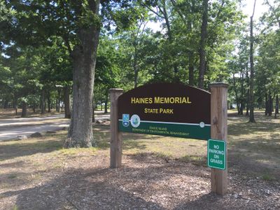
Haines Memorial State Park, State park in East Providence, United States.

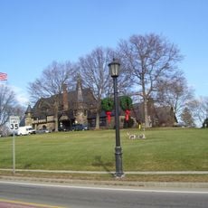
Haines Memorial State Park is a waterfront area in East Providence featuring sports fields, picnic zones, and direct access to Narragansett Bay. The grounds include two baseball fields, equipped picnic sites, and a boat launch for water recreation.

The site was acquired in 1911 by the Rhode Island Metropolitan Park Commission from Ida Haines for one dollar, honoring her brother Dr. George B. Haines. In the 1930s the Civilian Conservation Corps constructed fireplaces and reshaped the beach to improve conditions for swimmers.

The park incorporates the East Bay Bike Path, transformed from former train tracks, connecting local communities through recreational activities and transportation alternatives.

The park is open during daylight hours with parking available and easy access to picnic areas and sports fields for visitors of any skill level. The boat ramp provides straightforward water access, and you can explore the grounds on foot without difficulty.

The East Bay Bike Path runs through the park along the former route of an old railroad line, now serving cyclists and walkers. This transformed route creates a green corridor linking nearby communities together.

The community of curious travelers

AroundUs brings together thousands of curated places, local tips, and hidden gems, enriched daily by 60,000 contributors worldwide.

Start exploring
Location
Inception
1911
GPS coordinates
41.75250,-71.33970
Latest update
December 14, 2025 14:25
Around this place
Pawtuxet Village
United States of America

Pawtuxet Village

4.4 km
Crescent Park Looff Carousel
United States of America

Crescent Park Looff Carousel

1.7 km
Crescent Park
United States of America

Crescent Park

1.6 km
Belton Court
United States of America

Belton Court

1.2 km
Pomham Rocks Light
United States of America

Pomham Rocks Light

3.7 km
Rhodes-on-the Pawtuxet
United States of America

Rhodes-on-the Pawtuxet

4.7 km
Nayatt Point Light
United States of America

Nayatt Point Light

3 km
Conimicut Light
United States of America

Conimicut Light

4 km
Barrington Civic Center Historic District
United States of America

Barrington Civic Center Historic District

2.9 km
Sabin Point Light
United States of America

Sabin Point Light

3 km
James Dennis House
United States of America

James Dennis House

4.6 km
Barrington Beach
United States of America

Barrington Beach

4.2 km
Alfred Drowne Road Historic District
United States of America

Alfred Drowne Road Historic District

1.2 km
St. Matthew's Episcopal Church
United States of America

St. Matthew's Episcopal Church

1.1 km
O'Bannon Mill
United States of America

O'Bannon Mill

748 m
Bicknell-Armington Lightning Splitter House
United States of America

Bicknell-Armington Lightning Splitter House

3.3 km
Christopher Rhodes House
United States of America

Christopher Rhodes House

4.5 km
Phillipsdale Historic District
United States of America

Phillipsdale Historic District

4.4 km
John Waterman Arnold House
United States of America

John Waterman Arnold House

4.9 km
District 6 Schoolhouse
United States of America

District 6 Schoolhouse

2.6 km
Whitcomb Farm
United States of America

Whitcomb Farm

3.3 km
Edgewood Historic District-Sally Greene Homestead Plats
United States of America

Edgewood Historic District-Sally Greene Homestead Plats

4.9 km
Elm Tree Plat Historic District
United States of America

Elm Tree Plat Historic District

2.3 km
Rose Land Park Plat Historic District
United States of America

Rose Land Park Plat Historic District

2.1 km
Benjamin Aborn Jackson House
United States of America

Benjamin Aborn Jackson House

3 km
Allen-West House
United States of America

Allen-West House

3.1 km
Edgewood Historic District-Aberdeen Plat
United States of America

Edgewood Historic District-Aberdeen Plat

4.8 km
Edgewood Historic District-Taft Estate Plat
United States of America

Edgewood Historic District-Taft Estate Plat

4.7 km
Show the full map
Reviews
Share your experience

No review yet

Discussions
Start a discussion...

No discussion yet

« Haines Memorial State Park - State park in East Providence, United States » is provided by Around Us (aroundus.com). Images and texts are derived from Wikimedia project under a Creative Commons license. You are allowed to copy, distribute, and modify copies of this page, under the conditions set by the license, as long as this note is clearly visible.

Discover hidden gems everywhere you go!

From secret cafés to breathtaking viewpoints, skip the crowded tourist spots and find places that match your style. Our app makes it easy with voice search, smart filtering, route optimization, and insider tips from travelers worldwide. Download now for the complete mobile experience.

Around Us App Screenshot

A unique approach to discovering new places

Le Figaro

All the places worth exploring

France Info

A tailor-made excursion in just a few clicks

20 Minutes

Around Us
Travel Guide & Maps
Download

Send to your phone

QR Code
1

Open the camera app on your mobile.

2

Point at the QR code with your camera. A notification will appear.

3

Tap the notification to open the link.