Lake Ellen Kimberlite, Volcanic formation in Crystal Falls region, Michigan, United States
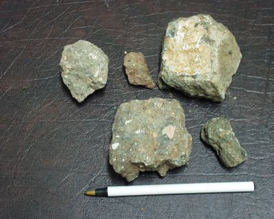
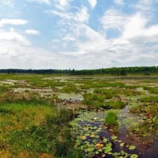
Lake Ellen Kimberlite is a volcanic rock formation in the Crystal Falls region of Michigan's Upper Peninsula. The site displays a larger main structure with a smaller adjacent body nearby and contains fragments of schist, granulite, and rare pieces of rock from the upper mantle.
This geological formation was discovered in 1971 during forestry road construction and first documented scientifically in 1981. The chance discovery during logging activities brought the site to the attention of the broader scientific community.
Sammler von seltenen Mineralien besuchen die Stelle, um Pyrope, Magnesianilit und Chromdiopsid in den verwitterten Fragmenten zu finden. Die Fundstelle hat sich unter Mineralienkundlern als Ort etabliert, wo man diese besonderen Gesteine entdecken kann.
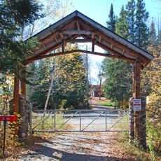
Access to the site is limited and may require knowing the exact location and in some cases permission from landowners. Visitors should bring appropriate gear and take safety precautions since the site sits in a forested area with uneven ground.
The kimberlite pipe originates from roughly 180 million years ago and formed at extraordinary depths beneath the Earth. This ancient and deep origin makes it a rare example of rock material from deep within the planet that is accessible at the surface.
The community of curious travelers
AroundUs brings together thousands of curated places, local tips, and hidden gems, enriched daily by 60,000 contributors worldwide.