Log in to your account

AroundUs is a community-driven map of interesting places, built by curious explorers like you. It grows with every review, story, and photo you share.
Connect to save your favorite spots, contribute locations, and create personalized routes.
Continue with Google
Continue with Apple
Continue with X
Continue with Facebook
Continue with email
By continuing, you accept our Terms and Conditions and our Privacy Policy
Create an account
Add to collection
Map
Suggest a change
Share

Wyoming State Forest, State forest in Pennsylvania, United States.

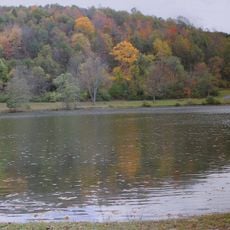
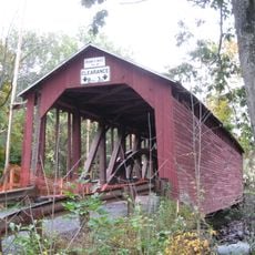
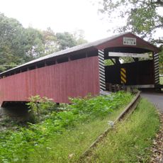
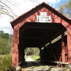
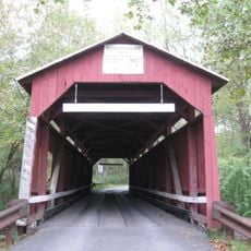
Wyoming State Forest is a wooded area in Sullivan County featuring dense trees and several creeks that flow through mountain valleys. The land offers multiple hiking trails, camping areas, and fishing locations spread throughout the forest.

The forest was originally part of Pennsylvania's state forestry system and developed over many decades. In 2005, it was reorganized and merged into the Loyalsock State Forest when the state restructured its forest districts.

Today the forest serves as a place where people come to walk, fish, and enjoy the outdoors without much development around them. You will notice hikers, anglers, and families using the trails and clearings throughout the year.

The forest can be reached through entrance points near Montoursville and Williamsport, where you will find signs and parking areas. Most activities like hiking and fishing are available year-round, though fall and summer attract more visitors.

The forest contains an S-shaped gorge carved by Loyalsock Creek with steep stone walls on either side that few visitors notice at first. This geological feature creates a dramatic landscape that becomes more striking the further you explore into that section.

Location: Pennsylvania

GPS coordinates: 41.00060,-76.45390

Latest update: December 14, 2025 16:40

Photos
Around this place
Knoebels Amusement Resort
United States of America

Knoebels Amusement Resort

14.3 km
Flying Turns
United States of America

Flying Turns

14.3 km
Impulse
United States of America

Impulse

14.1 km
United States of America

Bloomsburg–Berwick metropolitan area

10.1 km
Basilica of Saints Cyril and Methodius
United States of America

Basilica of Saints Cyril and Methodius

13.2 km
High Speed Thrill Coaster
United States of America

High Speed Thrill Coaster

14 km
Rupert Covered Bridge No. 56
United States of America

Rupert Covered Bridge No. 56

2.7 km
Jakey Hollow Natural Area
United States of America

Jakey Hollow Natural Area

7.9 km
Catawissa Friends Meetinghouse
United States of America

Catawissa Friends Meetinghouse

5.3 km
Bloomsburg Historic District
United States of America

Bloomsburg Historic District

213 m
Wagner Covered Bridge No. 19
United States of America

Wagner Covered Bridge No. 19

13.8 km
Thomas Beaver Free Library and Danville YMCA
United States of America

Thomas Beaver Free Library and Danville YMCA

13.6 km
General William Montgomery House
United States of America

General William Montgomery House

14.3 km
Lake Glory
United States of America

Lake Glory

10.6 km
Davis Covered Bridge
United States of America

Davis Covered Bridge

10 km
Wanich Covered Bridge No. 69
United States of America

Wanich Covered Bridge No. 69

5 km
Parr's Mill Covered Bridge No. 10
United States of America

Parr's Mill Covered Bridge No. 10

10.6 km
Welle Hess Covered Bridge No. S1
United States of America

Welle Hess Covered Bridge No. S1

12.5 km
Rohrbach Covered Bridge No. 24
United States of America

Rohrbach Covered Bridge No. 24

12.2 km
Hollingshead Covered Bridge No. 40
United States of America

Hollingshead Covered Bridge No. 40

5.5 km
Johnson Covered Bridge No. 28
United States of America

Johnson Covered Bridge No. 28

13.9 km
East Bloomsburg Bridge
United States of America

East Bloomsburg Bridge

1.5 km
Furnace Covered Bridge No. 11
United States of America

Furnace Covered Bridge No. 11

10.5 km
Riegel Covered Bridge No. 6
United States of America

Riegel Covered Bridge No. 6

11 km
Fowlersville Covered Bridge
United States of America

Fowlersville Covered Bridge

12.2 km
Kramer Covered Bridge No. 113
United States of America

Kramer Covered Bridge No. 113

13.5 km
Snyder Covered Bridge No. 17
United States of America

Snyder Covered Bridge No. 17

12.1 km
Patterson Covered Bridge No. 112
United States of America

Patterson Covered Bridge No. 112

12.5 km
Show the full map
Reviews

Visited this place? Tap the stars to rate it and share your experience / photos with the community! Try now! You can cancel it anytime.

« Wyoming State Forest - State forest in Pennsylvania, United States » is provided by Around Us (aroundus.com). Images and texts are derived from Wikimedia project under a Creative Commons license. You are allowed to copy, distribute, and modify copies of this page, under the conditions set by the license, as long as this note is clearly visible.

Discover hidden gems everywhere you go!

From secret cafés to breathtaking viewpoints, skip the crowded tourist spots and find places that match your style. Our app makes it easy with voice search, smart filtering, route optimization, and insider tips from travelers worldwide. Download now for the complete mobile experience.

Around Us App Screenshot

A unique approach to discovering new places

Le Figaro

All the places worth exploring

France Info

A tailor-made excursion in just a few clicks

20 Minutes