Enable Location

We need your location to show you interesting places around you

Discover nearby places

Find interesting locations and hidden gems around you

Precise directions

Get accurate directions and distances to places

Your location is never shared with other users. It's only used when you tap the location button.

Cherrydale Historic District

Log in to your account

Start exploring — it's free

Trusted by 62,466 travelers worldwide

Continue with Google
Continue with Apple
or

We will send you a code to connect

By continuing, you accept our Terms and Conditions and our Privacy Policy

Check your inbox

We've sent a pincode in your inbox. Please enter the code below.

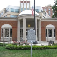
Cherrydale Historic District, Historic district in Arlington County, Virginia, United States.

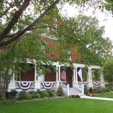
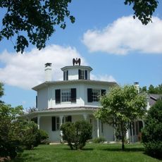
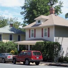
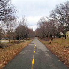
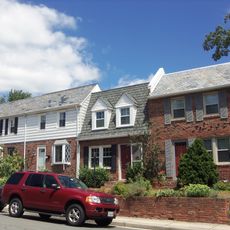
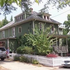
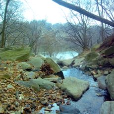
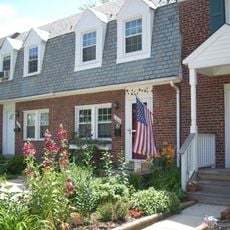
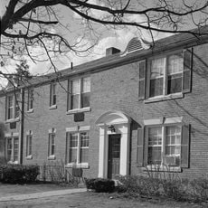
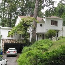
Cherrydale Historic District is a residential area in Arlington County containing 948 buildings and structures spread across 286 acres. The streets are lined with trees and connect homes of different architectural periods that form a typical early 20th-century suburban landscape.

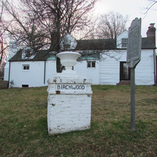
The area was originally planned in 1898 as agricultural land with few buildings. After the courthouse and railroad arrived in 1906, it grew rapidly into a residential community.

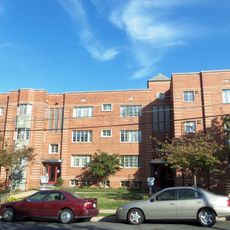
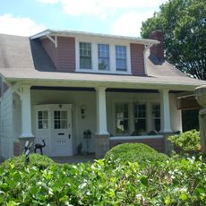
The architecture displays Colonial Revival, Queen Anne, Craftsman, and Spanish Revival styles that define early residential design in this area. These different building styles are visible throughout the tree-lined streets and shape how the neighborhood looks today.

The area is bounded by Lorcom Lane, North Utah Street, North Taylor Street, and Interstate 66, while Lee Highway serves as the main business street. Visitors can walk the streets and view homes from outside, with the main commercial corridor providing the best orientation.

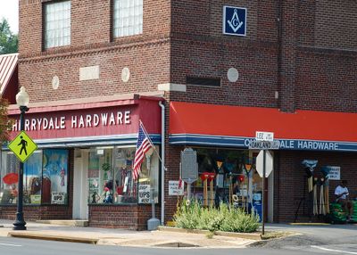
Within the commercial area stand notable examples of Art Deco and Moderne design, particularly the Cherrydale Hardware Store and Family Tea House. These business buildings provide a contrast to the predominant residential styles and reveal the commercial development of the district.

The community of curious travelers

AroundUs brings together thousands of curated places, local tips, and hidden gems, enriched daily by 60,000 contributors worldwide.

Start exploring
Location
GPS coordinates
38.89470,-77.10890
Latest update
December 14, 2025 18:07
Around this place
Quarters 1
United States of America

Quarters 1

2.7 km
Three Sisters
United States of America

Three Sisters

2.7 km
Georgetown Reservoir
United States of America

Georgetown Reservoir

2.4 km
Fletcher's Cove
United States of America

Fletcher's Cove

2.8 km
Castle Gatehouse, Washington Aqueduct
United States of America

Castle Gatehouse, Washington Aqueduct

2.4 km
Fort C. F. Smith
United States of America

Fort C. F. Smith

1.7 km
Glebe House
United States of America

Glebe House

840 m
Lyon Park Historic District
United States of America

Lyon Park Historic District

2.3 km
United States of America

Arlington Line

2.3 km
Bluemont Junction Trail
United States of America

Bluemont Junction Trail

2.5 km
Glebewood Village Historic District
United States of America

Glebewood Village Historic District

2.7 km
Maywood Historic District
United States of America

Maywood Historic District

752 m
Clarendon School
United States of America

Clarendon School

1.6 km
Lee Gardens North Historic District
United States of America

Lee Gardens North Historic District

2.2 km
Windy Run
United States of America

Windy Run

1.8 km
Calvert Manor
United States of America

Calvert Manor

1.4 km
Monroe Courts Historic District
United States of America

Monroe Courts Historic District

1 km
Mount Olivet United Methodist Church
United States of America

Mount Olivet United Methodist Church

1.6 km
Buckingham Historic District
United States of America

Buckingham Historic District

2.2 km
United States Post Office (Arlington, Virginia)
United States of America

United States Post Office (Arlington, Virginia)

1.5 km
Westover Historic District
United States of America

Westover Historic District

2.7 km
Potomac Palisades Site
United States of America

Potomac Palisades Site

2.7 km
Waverly Hills Historic District
United States of America

Waverly Hills Historic District

784 m
Birchwood
United States of America

Birchwood

1.7 km
First Presbyterian Church
United States of America

First Presbyterian Church

2 km
Earle Micajah Winslow House
United States of America

Earle Micajah Winslow House

1.2 km
Chesapeake and Ohio Canal Towpath
United States of America

Chesapeake and Ohio Canal Towpath

2.5 km
Abner Cloud House
United States of America

Abner Cloud House

2.7 km
Show the full map
« Cherrydale Historic District - Historic district in Arlington County, Virginia, United States » is provided by Around Us (aroundus.com). Images and texts are derived from Wikimedia project under a Creative Commons license. You are allowed to copy, distribute, and modify copies of this page, under the conditions set by the license, as long as this note is clearly visible.

Discover hidden gems everywhere you go!

From secret cafés to breathtaking viewpoints, skip the crowded tourist spots and find places that match your style. Our app makes it easy with voice search, smart filtering, route optimization, and insider tips from travelers worldwide. Download now for the complete mobile experience.

Around Us App Screenshot

A unique approach to discovering new places

Le Figaro

All the places worth exploring

France Info

A tailor-made excursion in just a few clicks

20 Minutes

Around Us
Travel Guide & Maps
Download

Send to your phone

QR Code
1

Open the camera app on your mobile.

2

Point at the QR code with your camera. A notification will appear.

3

Tap the notification to open the link.