Enable Location

We need your location to show you interesting places around you

Discover nearby places

Find interesting locations and hidden gems around you

Precise directions

Get accurate directions and distances to places

Your location is never shared with other users. It's only used when you tap the location button.

Bluemont Junction Trail

Log in to your account

Start exploring — it's free

Trusted by 61,557 travelers worldwide

Continue with Google
Continue with Apple
or

We will send you a code to connect

By continuing, you accept our Terms and Conditions and our Privacy Policy

Check your inbox

We've sent a pincode in your inbox. Please enter the code below.

Bluemont Junction Trail

Bluemont Junction Trail, Rail trail in Arlington County, Virginia.

Description

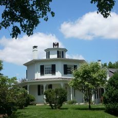
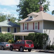
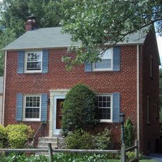
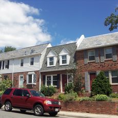
Bluemont Junction Trail is a walking path spanning about 1.2 miles through residential neighborhoods, connecting two regional trails while passing through Arlington County. The route runs from the Washington and Old Dominion Trail to Fairfax Drive in Ballston, crossing several streets along the way.

History

This route began as a railroad spur in 1912 and operated for freight and passenger traffic for more than 50 years until service ended in 1963. Arlington County later transformed the abandoned rail corridor into a public recreational path during the 1980s.

Culture

The trail displays railroad relics, including a preserved caboose at Bluemont Junction Park that shows how trains shaped local transportation. Visitors can learn about this railway heritage while walking through the neighborhoods.

Practical

Parking is available at Bluemont Junction Park, which serves as a convenient starting point for the walk. The path is easy to navigate on foot and connects to other trails, making it simple to extend your outing if desired.

Did you know?

An unusual feature is a 9-hole disc golf course built into the path itself, inviting visitors to combine recreation with their walk. This combination makes the route stand out as an activity destination in the region.

Location
GPS coordinates
38.87530,-77.12360
Latest update
December 14, 2025 11:22

AroundUs brings together thousands of curated places, local tips, and hidden gems, enriched daily by 60,000 contributors worldwide. Discover all places nearby (Virginia).

Around this place
Arlington Hall
United States of America

Arlington Hall

1.9 km
Columbia Gardens Cemetery
United States of America

Columbia Gardens Cemetery

2.9 km
Westover
United States of America

Westover

1.9 km
Dominion Hills Historic District
United States of America

Dominion Hills Historic District

1.5 km
Unitarian Universalist Church of Arlington
United States of America

Unitarian Universalist Church of Arlington

1.6 km
Arlington Heights Historic District
United States of America

Arlington Heights Historic District

3 km
Benjamin Banneker: SW-9 Intermediate Boundary Stone
United States of America

Benjamin Banneker: SW-9 Intermediate Boundary Stone

3.2 km
Charles Richard Drew House
United States of America

Charles Richard Drew House

3.2 km
Glebe House
United States of America

Glebe House

1.9 km
Lyon Park Historic District
United States of America

Lyon Park Historic District

2.9 km
Arlington Forest Historic District
United States of America

Arlington Forest Historic District

663 m
Glebewood Village Historic District
United States of America

Glebewood Village Historic District

1.4 km
Maywood Historic District
United States of America

Maywood Historic District

3.2 km
Lee Gardens North Historic District
United States of America

Lee Gardens North Historic District

3.4 km
United States of America

Taylor's Tavern

3 km
Virginia Heights Historic District
United States of America

Virginia Heights Historic District

2.9 km
Ball-Sellers House
United States of America

Ball-Sellers House

1.3 km
Cherrydale Historic District
United States of America

Cherrydale Historic District

2.5 km
Monroe Courts Historic District
United States of America

Monroe Courts Historic District

2 km
Buckingham Historic District
United States of America

Buckingham Historic District

1.6 km
United States Post Office (Arlington, Virginia)
United States of America

United States Post Office (Arlington, Virginia)

2.7 km
Westover Historic District
United States of America

Westover Historic District

1.4 km
Highland Park-Overlee Knolls
United States of America

Highland Park-Overlee Knolls

2.4 km
Waverly Hills Historic District
United States of America

Waverly Hills Historic District

1.9 km
First Presbyterian Church
United States of America

First Presbyterian Church

939 m
Earle Micajah Winslow House
United States of America

Earle Micajah Winslow House

3 km
Woodrow Wilson Community Library
United States of America

Woodrow Wilson Community Library

3.1 km
Columbia Pike Library
United States of America

Columbia Pike Library

3.3 km
Show the full map
« Bluemont Junction Trail - Rail trail in Arlington County, Virginia » is provided by Around Us (aroundus.com). Images and texts are derived from Wikimedia project under a Creative Commons license. You are allowed to copy, distribute, and modify copies of this page, under the conditions set by the license, as long as this note is clearly visible.

Discover hidden gems everywhere you go!

From secret cafés to breathtaking viewpoints, skip the crowded tourist spots and find places that match your style. Our app makes it easy with voice search, smart filtering, route optimization, and insider tips from travelers worldwide. Download now for the complete mobile experience.

Around Us App Screenshot

A unique approach to discovering new places

Le Figaro

All the places worth exploring

France Info

A tailor-made excursion in just a few clicks

20 Minutes

Around Us
Travel Guide & Maps
Download

Send to your phone

QR Code
1

Open the camera app on your mobile.

2

Point at the QR code with your camera. A notification will appear.

3

Tap the notification to open the link.