McCormick Wilderness
McCormick Wilderness, Wilderness area in Baraga County, Michigan, US.
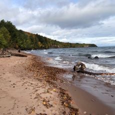
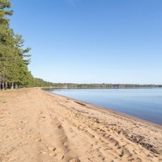
McCormick Wilderness is a protected forest area in Michigan covering about 16,850 acres shaped by lakes and diverse tree growth. Eighteen small lakes dot the landscape alongside northern hardwood forests, lowland conifers, and white pine stands scattered across the rolling terrain.
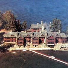
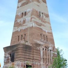
The land belonged to the McCormick family for three generations, descended from Cyrus McCormick who invented the reaping machine. Gordon McCormick eventually transferred the property to the Forest Service, converting it into a protected refuge.
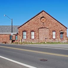
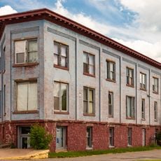
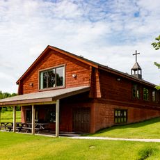
The land takes its name from the McCormick family, who maintained a private estate here that now exists only as ruins visible to visitors. The area reflects how people historically lived and worked within this remote forest landscape.
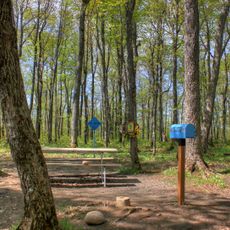
Trails throughout the area receive little maintenance and require solid navigation skills and reliable maps or digital tools to stay on course. Taking time to learn the terrain before attempting longer routes helps ensure a safer, more comfortable experience.
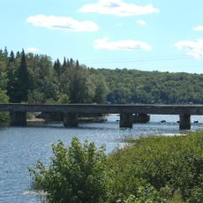
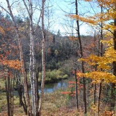
The Yellow Dog River flows through the area creating several waterfalls that make certain sections impossible to navigate by water. These cascading falls shape dramatic sections of the landscape and naturally limit how visitors can explore this waterway.
Location: Michigan
Operator: United States Forest Service
Website: https://fs.usda.gov/recarea/ottawa/recarea/?recid=12361
GPS coordinates: 46.68440,-88.00220
Latest update: December 14, 2025 11:05
Mount Arvon
14.2 km
Granot Loma
34.7 km
National Ski Hall of Fame
32.7 km
Big Bay Point Light
30 km
Cliffs Shaft Mine Museum
33 km
Mather Inn
33.4 km
Baraga State Park
39.1 km
Trunk Line Bridge No. 1
17.4 km
Huron Island Light
31 km
Sam Cohodas Lodge
17.7 km
Hebard – Ford Summer House
35.9 km
Vista Theater
24 km
Canyon Falls Bridge
36.4 km
Carp River Forge
38 km
Zeba Indian United Methodist Church
34.7 km
Sundberg Block
36.2 km
Arvon Township Hall
27.1 km
Old US 41–Backwater Creek Bridge
38.4 km
Ishpeming Municipal Building
33.6 km
Cleveland Mine Engine House Number 3
34.1 km
Ishpeming Main Street Historic District
33.5 km
Reine utsiktspunkt
28 km
Negaunee State Bank Building
36.4 km
Mino-kwe jiigibiik
27.2 km
Ishpeming Carnegie Public Library
33.3 km
Second Sand Beach
34.2 km
Huron National Wildlife Refuge
29.9 km
Most Holy Name of Jesus--Saint Blessed Kateri Tekakwitha Catholic Church
38.7 kmVisited this place? Tap the stars to rate it and share your experience / photos with the community! Try now! You can cancel it anytime.
Discover hidden gems everywhere you go!
From secret cafés to breathtaking viewpoints, skip the crowded tourist spots and find places that match your style. Our app makes it easy with voice search, smart filtering, route optimization, and insider tips from travelers worldwide. Download now for the complete mobile experience.
A unique approach to discovering new places❞
— Le Figaro
All the places worth exploring❞
— France Info
A tailor-made excursion in just a few clicks❞
— 20 Minutes