Walker's Point Historic District

Log in to your account

AroundUs is a community-driven map of interesting places, built by curious explorers like you. It grows with every review, story, and photo you share.
Connect to save your favorite spots, contribute locations, and create personalized routes.
Continue with Google
Continue with Apple
Continue with X
Continue with Facebook
Continue with email
By continuing, you accept our Terms and Conditions and our Privacy Policy
Create an account
Add to collection
Map
Suggest a change
Share

Walker's Point Historic District, Historic district in Walker's Point, Milwaukee, United States.

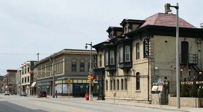
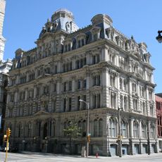
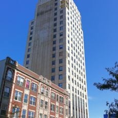
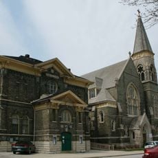
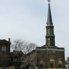
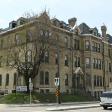
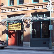
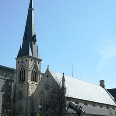
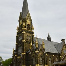
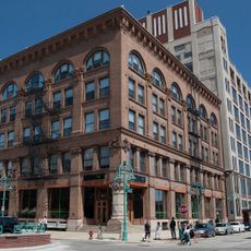
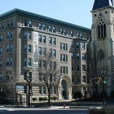
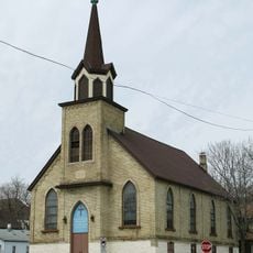
Walker's Point Historic District is a neighborhood in Milwaukee with residential and industrial buildings dating from 1849 onward. The streets show a mix of former factories, breweries, tanneries, churches, and worker cottages that tell the story of life during the industrial era.

George Walker established a trading post on this land in 1833, creating one of the three original settlements that would eventually form Milwaukee. The area then grew into an industrial center during the 1800s, attracting workers and immigrant families who built the neighborhood.

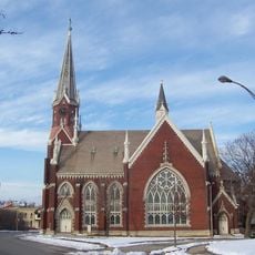
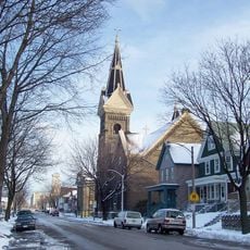
You can see how German, Scandinavian, Irish, and Polish families shaped the buildings around you: sturdy brick churches, small wooden houses, and social halls line the streets. These communities left their mark not just in what they built, but in how they used the neighborhood as their own gathering place.

The district is located between the freeway, the Menomonee Canal, and several main streets, making it easy to reach by car or public transit. Walking through the neighborhoods allows you to move between different streets and buildings at your own pace.

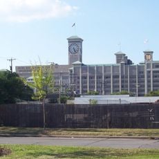
The Philip Best Brewery, which became Pabst, and the Pfister and Vogel Tannery operated here as major industrial employers that shaped the neighborhood's economy. You can still walk past the buildings where these operations once thrived, seeing how their scale dominated the area.

Location: Milwaukee

GPS coordinates: 43.02417,-87.91667

Latest update: December 14, 2025 13:03

Photos
Around this place
Hoan Bridge
United States of America

Hoan Bridge

1.5 km
Harley-Davidson Museum
United States of America

Harley-Davidson Museum

800 m
Rockwell Automation Headquarters
United States of America

Rockwell Automation Headquarters

688 m
Milwaukee Public Market
United States of America

Milwaukee Public Market

1.4 km
Marcus Amphitheater
United States of America

Marcus Amphitheater

1.6 km
Henry Maier Festival Park
United States of America

Henry Maier Festival Park

1.5 km
Mitchell Building
United States of America

Mitchell Building

1.6 km
Chase Tower
United States of America

Chase Tower

1.7 km
National Bobblehead Hall of Fame and Museum
United States of America

National Bobblehead Hall of Fame and Museum

789 m
Patrick and Beatrice Haggerty Museum of Art
United States of America

Patrick and Beatrice Haggerty Museum of Art

1.7 km
Wisconsin Tower
United States of America

Wisconsin Tower

1.7 km
St. Patrick's Roman Catholic Church
United States of America

St. Patrick's Roman Catholic Church

547 m
Holy Trinity Roman Catholic Church
United States of America

Holy Trinity Roman Catholic Church

125 m
Rainbow Machine
United States of America

Rainbow Machine

1.7 km
Oops, Missed
United States of America

Oops, Missed

1.4 km
Saint Vincent's Infant Asylum
United States of America

Saint Vincent's Infant Asylum

882 m
William F. Eisner Museum of Advertising & Design
United States of America

William F. Eisner Museum of Advertising & Design

1.2 km
Saint Stephen Evangelical Lutheran Church of Milwaukee
United States of America

Saint Stephen Evangelical Lutheran Church of Milwaukee

542 m
Angel in a Cage
United States of America

Angel in a Cage

1.4 km
St. Peter's Evangelical Lutheran Church
United States of America

St. Peter's Evangelical Lutheran Church

705 m
St. James Episcopal Church
United States of America

St. James Episcopal Church

1.7 km
St. Martini Evangelical Lutheran Church
United States of America

St. Martini Evangelical Lutheran Church

1.6 km
Erie Street Plaza
United States of America

Erie Street Plaza

1.2 km
R.D. Whitehead Monument
United States of America

R.D. Whitehead Monument

1.7 km
Baumbach Building
United States of America

Baumbach Building

1.4 km
Saint James Court Apartments
United States of America

Saint James Court Apartments

1.7 km
Salem Evangelical Church
United States of America

Salem Evangelical Church

839 m
Gimbels Parking Pavilion
United States of America

Gimbels Parking Pavilion

1.5 km
Show the full map
Reviews

Visited this place? Tap the stars to rate it and share your experience / photos with the community! Try now! You can cancel it anytime.

« Walker's Point Historic District - Historic district in Walker's Point, Milwaukee, United States » is provided by Around Us (aroundus.com). Images and texts are derived from Wikimedia project under a Creative Commons license. You are allowed to copy, distribute, and modify copies of this page, under the conditions set by the license, as long as this note is clearly visible.

Discover hidden gems everywhere you go!

From secret cafés to breathtaking viewpoints, skip the crowded tourist spots and find places that match your style. Our app makes it easy with voice search, smart filtering, route optimization, and insider tips from travelers worldwide. Download now for the complete mobile experience.

Around Us App Screenshot

A unique approach to discovering new places

Le Figaro

All the places worth exploring

France Info

A tailor-made excursion in just a few clicks

20 Minutes