Enable Location

We need your location to show you interesting places around you

Discover nearby places

Find interesting locations and hidden gems around you

Precise directions

Get accurate directions and distances to places

Your location is never shared with other users. It's only used when you tap the location button.

St. Mary's Academy Historic District

Log in to your account

Start exploring — it's free

Trusted by 62,393 travelers worldwide

Continue with Google
Continue with Apple
or

We will send you a code to connect

By continuing, you accept our Terms and Conditions and our Privacy Policy

Check your inbox

We've sent a pincode in your inbox. Please enter the code below.

St. Mary's Academy Historic District, Educational complex in Monroe, United States.

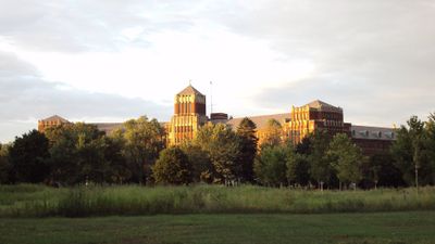
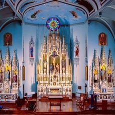
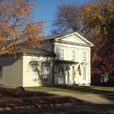
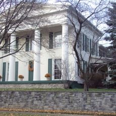
St. Mary's Academy Historic District is an educational complex in Monroe featuring multiple buildings spread across 69 acres with Gothic architectural elements and a central tower flanked by five-story wings. The structures reflect different construction periods and show how the campus expanded over time.

The academy was founded in 1846 as a boarding school for girls and received major additions in 1881 and 1932 to accommodate growing enrollment. These expansion periods shaped the layout and architectural character visible today.

The Sisters, Servants of the Immaculate Heart of Mary created this institution to advance education for girls across the region. You can see how the spaces were designed to serve both spiritual and academic purposes.

The district is located at the intersection of Elm Avenue and North Monroe Street for easy access. Plan time to walk around and explore the various buildings and the open grounds surrounding them.

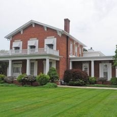
The 1932 building designed by D.A. Bohlen & Son blends Art Deco, Tudor Revival, and Gothic styles through variegated brick and stone trim. This unusual mix of architectural styles makes the newest section of the campus visually distinctive.

The community of curious travelers

AroundUs brings together thousands of curated places, local tips, and hidden gems, enriched daily by 60,000 contributors worldwide.

Start exploring
Location
GPS coordinates
41.92083,-83.38833
Latest update
December 14, 2025 13:08
Around this place
Maumee Bay State Park
United States of America

Maumee Bay State Park

26.4 km
Sterling State Park
United States of America

Sterling State Park

4.6 km
George Armstrong Custer Equestrian Monument
United States of America

George Armstrong Custer Equestrian Monument

753 m
Pointe Mouillee State Game Area
United States of America

Pointe Mouillee State Game Area

18.6 km
United States of America

Flat Rock Speedway

19.1 km
Toledo Harbor Light
United States of America

Toledo Harbor Light

18.4 km
Lake Erie Metropark
United States of America

Lake Erie Metropark

22.2 km
Detroit River Light
United States of America

Detroit River Light

22.3 km
Willow Metropark
United States of America

Willow Metropark

24.2 km
Old Village Historic District
United States of America

Old Village Historic District

1.3 km
Sawyer House
United States of America

Sawyer House

796 m
St. Mary's Church Complex Historic District
United States of America

St. Mary's Church Complex Historic District

723 m
Turtle Island Light
United States of America

Turtle Island Light

18.7 km
Huron High School
United States of America

Huron High School

22.9 km
Edward Loranger House
United States of America

Edward Loranger House

1.8 km
Old Mill Museum
United States of America

Old Mill Museum

22.8 km
Saint Michael the Archangel Church
United States of America

Saint Michael the Archangel Church

1.4 km
Governor Robert McClelland House
United States of America

Governor Robert McClelland House

610 m
Jefferson Avenue–Huron River and Harbin Drive–Silver Creek Canal Bridges
United States of America

Jefferson Avenue–Huron River and Harbin Drive–Silver Creek Canal Bridges

19.7 km
East Elm-North Macomb Street Historic District
United States of America

East Elm-North Macomb Street Historic District

424 m
Rudolph Nims House
United States of America

Rudolph Nims House

5.9 km
Gibraltar Road–Waterway Canal Bridge
United States of America

Gibraltar Road–Waterway Canal Bridge

25.4 km
Dundee Historic District
United States of America

Dundee Historic District

22.9 km
Wing–Allore House
United States of America

Wing–Allore House

539 m
Bridge School
United States of America

Bridge School

14 km
St. John's Lutheran Church and School
United States of America

St. John's Lutheran Church and School

19.7 km
North Maumee Bay Archeological District
United States of America

North Maumee Bay Archeological District

19.7 km
Navarre-Anderson Trading Post
United States of America

Navarre-Anderson Trading Post

6.1 km
Show the full map
« St. Mary's Academy Historic District - Educational complex in Monroe, United States » is provided by Around Us (aroundus.com). Images and texts are derived from Wikimedia project under a Creative Commons license. You are allowed to copy, distribute, and modify copies of this page, under the conditions set by the license, as long as this note is clearly visible.

Discover hidden gems everywhere you go!

From secret cafés to breathtaking viewpoints, skip the crowded tourist spots and find places that match your style. Our app makes it easy with voice search, smart filtering, route optimization, and insider tips from travelers worldwide. Download now for the complete mobile experience.

Around Us App Screenshot

A unique approach to discovering new places

Le Figaro

All the places worth exploring

France Info

A tailor-made excursion in just a few clicks

20 Minutes

Around Us
Travel Guide & Maps
Download

Send to your phone

QR Code
1

Open the camera app on your mobile.

2

Point at the QR code with your camera. A notification will appear.

3

Tap the notification to open the link.